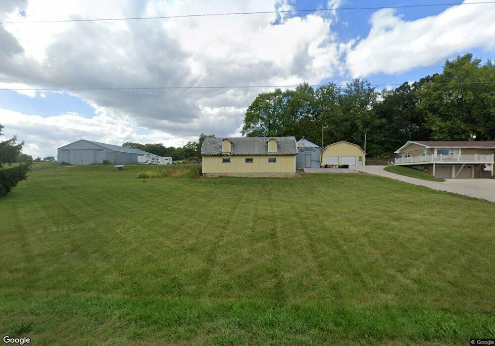
1161 Flint Rd Stoughton, WI 53589
Estimated Value: $502,861 - $593,000
Studio
--
Bath
--
Sq Ft
236,095
Sq Ft Lot
About This Home
This home is located at 1161 Flint Rd, Stoughton, WI 53589 and is currently estimated at $560,954. 1161 Flint Rd is a home with nearby schools including Fox Prairie Elementary School, River Bluff Middle School, and Stoughton High School.
Ownership History
Date
Name
Owned For
Owner Type
Purchase Details
Closed on
Sep 4, 2020
Sold by
Klahn Phillip A and Tews Allison T
Bought by
Klhan Phillip A and Tews Allison L
Current Estimated Value
Home Financials for this Owner
Home Financials are based on the most recent Mortgage that was taken out on this home.
Original Mortgage
$215,000
Interest Rate
2.8%
Mortgage Type
New Conventional
Purchase Details
Closed on
Jun 7, 2018
Sold by
Klondike Farms Llc
Bought by
Klahn Phillip A
Home Financials for this Owner
Home Financials are based on the most recent Mortgage that was taken out on this home.
Original Mortgage
$190,000
Interest Rate
4.5%
Mortgage Type
New Conventional
Create a Home Valuation Report for This Property
The Home Valuation Report is an in-depth analysis detailing your home's value as well as a comparison with similar homes in the area
Purchase History
| Date | Buyer | Sale Price | Title Company |
|---|---|---|---|
| Klhan Phillip A | -- | Nations Title | |
| Klahn Phillip A | $125,000 | None Available |
Source: Public Records
Mortgage History
| Date | Status | Borrower | Loan Amount |
|---|---|---|---|
| Previous Owner | Klhan Phillip A | $215,000 | |
| Previous Owner | Klahn Phillip A | $190,000 |
Source: Public Records
Tax History
| Year | Tax Paid | Tax Assessment Tax Assessment Total Assessment is a certain percentage of the fair market value that is determined by local assessors to be the total taxable value of land and additions on the property. | Land | Improvement |
|---|---|---|---|---|
| 2025 | $4,868 | $368,700 | $200,000 | $168,700 |
| 2024 | $4,498 | $368,700 | $200,000 | $168,700 |
| 2023 | $3,888 | $368,700 | $200,000 | $168,700 |
| 2022 | $4,348 | $368,700 | $200,000 | $168,700 |
| 2021 | $4,130 | $227,500 | $117,500 | $110,000 |
| 2020 | $3,988 | $227,500 | $117,500 | $110,000 |
| 2019 | $3,955 | $227,500 | $117,500 | $110,000 |
| 2018 | $0 | $0 | $0 | $0 |
Source: Public Records
Map
Nearby Homes
- L1 Flint Rd
- 4285 Rutland Dunn Townline Rd
- 1651-1653 Hook Island Rd
- 4631 County Road A
- 558 Lexington Dr Unit 18
- 1686 Sand Hill Rd
- 938 Johnson Ave
- 908 Harding St
- +/-230 Ac Old Stone Rd
- 308 Concord Dr Unit 8
- 1044 Autumn Blaze Ct
- 178 Elliott Ln
- 859 Park St Unit 102
- 859 Park St Unit 101
- 1063 Autumn Blaze Ct
- 1085 Autumn Blaze Ct
- 495 Foxfield Rd
- 477 Foxfield Rd
- 445 Foxfield Rd
- 655 Ridge View Ln
- 1189 Flint Rd
- 1191 Flint Rd
- 1210 Sunrise Rd
- 1123 Flint Rd
- 1107 Flint Rd
- 1208 Sunrise Rd
- 1190 Sunrise Rd
- 1216 Sunrise Rd
- 1157 Sunrise Rd
- 1222 Sunrise Rd
- 1201 Sunrise Rd
- 4230 Sunny Ridge Rd
- 4252 Sunny Ridge Rd
- 1031 Flint Rd
- 1263 Sunrise Rd
- 4262 Sunny Ridge Rd
- 1249 Sunrise Rd
- 4161 State Road 138
- 0 Sunrise Rd Unit 1750712
- 0 Sunrise Rd Unit 1744940
Your Personal Tour Guide
Ask me questions while you tour the home.