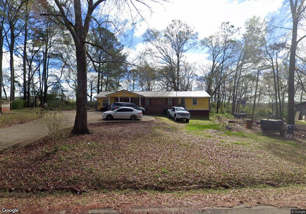
1161 Hensley Rd Greensboro, GA 30642
Estimated Value: $209,000 - $345,000
3
Beds
2
Baths
1,875
Sq Ft
$144/Sq Ft
Est. Value
About This Home
This home is located at 1161 Hensley Rd, Greensboro, GA 30642 and is currently estimated at $269,856, approximately $143 per square foot. 1161 Hensley Rd is a home located in Greene County with nearby schools including Greene County High School.
Ownership History
Date
Name
Owned For
Owner Type
Purchase Details
Closed on
Jan 29, 2004
Sold by
Wright & Wright Rentals Inc
Bought by
Monford Rodricus D and Monford Aimee C
Current Estimated Value
Purchase Details
Closed on
Sep 5, 2003
Sold by
Wingfield Brenda and Wingfield Walker
Bought by
Wright & Wright Rentals Inc
Purchase Details
Closed on
Jan 1, 1985
Sold by
Fha
Bought by
Wingfield Brenda and Wingfield Walker
Purchase Details
Closed on
Jan 1, 1984
Sold by
Harris Dorothy L
Bought by
Fha
Purchase Details
Closed on
Jan 1, 1979
Sold by
Harris Harris L and Harris Dorothy L
Bought by
Harris Dorothy L
Purchase Details
Closed on
Jan 1, 1972
Bought by
Harris Harris L and Harris Dorothy L
Create a Home Valuation Report for This Property
The Home Valuation Report is an in-depth analysis detailing your home's value as well as a comparison with similar homes in the area
Home Values in the Area
Average Home Value in this Area
Purchase History
| Date | Buyer | Sale Price | Title Company |
|---|---|---|---|
| Monford Rodricus D | $82,500 | -- | |
| Wright & Wright Rentals Inc | -- | -- | |
| Wingfield Brenda | -- | -- | |
| Fha | -- | -- | |
| Harris Dorothy L | -- | -- | |
| Harris Harris L | -- | -- |
Source: Public Records
Tax History Compared to Growth
Tax History
| Year | Tax Paid | Tax Assessment Tax Assessment Total Assessment is a certain percentage of the fair market value that is determined by local assessors to be the total taxable value of land and additions on the property. | Land | Improvement |
|---|---|---|---|---|
| 2024 | $572 | $52,400 | $4,240 | $48,160 |
| 2023 | $295 | $50,480 | $3,520 | $46,960 |
| 2022 | $536 | $30,824 | $2,720 | $28,104 |
| 2021 | $554 | $27,584 | $2,720 | $24,864 |
| 2020 | $565 | $21,760 | $1,800 | $19,960 |
| 2019 | $576 | $21,760 | $1,800 | $19,960 |
| 2018 | $554 | $21,760 | $1,800 | $19,960 |
| 2017 | $526 | $21,793 | $1,825 | $19,968 |
| 2016 | $527 | $22,292 | $1,825 | $20,467 |
| 2015 | $502 | $22,292 | $1,825 | $20,467 |
| 2014 | $414 | $16,675 | $1,825 | $14,850 |
Source: Public Records
Map
Nearby Homes
- 3021 Penfield Rd
- 0 Cunningham Rd
- 2260 Cunningham Rd
- 1141 Planing Mill Rd
- 1131 Planing Mill Rd
- 0 Union Point Hwy Unit 69532
- 0 Union Point Hwy Unit 7607786
- 0 Union Point Hwy Unit 10555176
- 0 Shady Side Ln
- 0 Railroad St Unit 218854
- 0 Railroad St Unit 10578007
- 0 Railroad St Unit 531919
- 1020 Horton Dr
- 1531 E Broad St
- 0 Old Union Point Rd Unit 1 10557753
- 301 N East St
- 0 Maple Cir
- 15 South St Unit Siloam Road
- 1251 Brickhouse Rd
- 1251 Brick House Rd
- 1151 Hensley Rd
- 1211 Hensley Rd
- 2701 Penfield Rd
- 1051 Hensley Rd
- 2861 Penfield Rd
- 2700 Penfield Rd
- 19 Penfield Rd SW
- 2650 Penfield Rd
- 2931 Penfield Rd
- 3001 Penfield Rd
- 2930 Penfield Rd
- 1420 Hensley Rd
- 2331 Penfield Rd
- 3030 Penfield Rd
- 2410 Penfield Rd
- 2411 Penfield Rd
- 2360 Penfield Rd
- 3120 Penfield Rd
- 3650 Lick Skillet Rd
- 3161 Penfield Rd