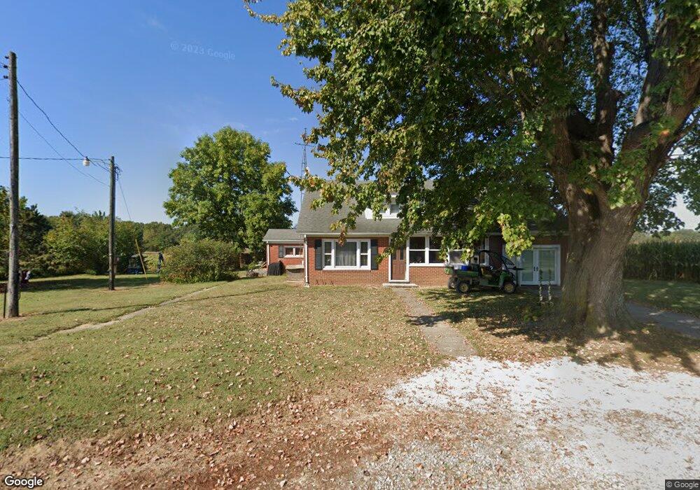
1161 Sam Simpson Rd Sebree, KY 42455
Estimated Value: $737,726
2
Beds
1
Bath
1,300
Sq Ft
$567/Sq Ft
Est. Value
About This Home
This home is located at 1161 Sam Simpson Rd, Sebree, KY 42455 and is currently estimated at $737,726, approximately $567 per square foot. 1161 Sam Simpson Rd is a home located in Webster County with nearby schools including Webster County High School.
Ownership History
Date
Name
Owned For
Owner Type
Purchase Details
Closed on
Feb 2, 2022
Sold by
Walker Suzanne L
Bought by
Cottingham Timothy L and Cottingham Karen M
Current Estimated Value
Home Financials for this Owner
Home Financials are based on the most recent Mortgage that was taken out on this home.
Original Mortgage
$1,670,335
Outstanding Balance
$1,490,584
Interest Rate
3.45%
Mortgage Type
New Conventional
Estimated Equity
-$752,858
Purchase Details
Closed on
Sep 10, 2015
Sold by
Cottingham Timothy L and Cottingham Karen M
Bought by
Cottingham Timothy L and Cottingham Karen M
Purchase Details
Closed on
May 29, 2008
Sold by
Summers Morrisa W and Summers Michael W
Bought by
Cottingham Timothy Lee and Cottingham Karen Marie
Create a Home Valuation Report for This Property
The Home Valuation Report is an in-depth analysis detailing your home's value as well as a comparison with similar homes in the area
Purchase History
| Date | Buyer | Sale Price | Title Company |
|---|---|---|---|
| Cottingham Timothy L | $1,665,000 | None Listed On Document | |
| Cottingham Timothy L | -- | None Available | |
| Cottingham Timothy Lee | $380,000 | -- |
Source: Public Records
Mortgage History
| Date | Status | Borrower | Loan Amount |
|---|---|---|---|
| Open | Cottingham Timothy L | $1,670,335 |
Source: Public Records
Tax History
| Year | Tax Paid | Tax Assessment Tax Assessment Total Assessment is a certain percentage of the fair market value that is determined by local assessors to be the total taxable value of land and additions on the property. | Land | Improvement |
|---|---|---|---|---|
| 2025 | $1,666 | $770,700 | $0 | $0 |
| 2024 | $1,667 | $770,700 | $0 | $0 |
| 2023 | $1,676 | $770,700 | $0 | $0 |
| 2022 | $1,535 | $593,200 | $0 | $0 |
| 2021 | $1,559 | $593,200 | $0 | $0 |
| 2020 | $1,583 | $593,200 | $0 | $0 |
| 2019 | $1,545 | $593,200 | $0 | $0 |
| 2018 | $1,416 | $124,450 | $0 | $0 |
| 2017 | $1,378 | $124,450 | $0 | $0 |
| 2016 | $1,320 | $124,450 | $0 | $0 |
| 2015 | -- | $124,450 | $0 | $0 |
| 2012 | -- | $110,850 | $0 | $0 |
Source: Public Records
Map
Nearby Homes
- 1003 Old Royster Rd
- 8788 John Steele Rd
- 9691 U S 41 Alternate
- 172 Troy Dr
- 150 W Webster St
- 151 W Webster St
- 412 Starl Shelton Rd
- 5299 U S 41 Alternate
- 1321 1st St
- 2078 State Route 56 W
- 2052 Busby Denton Rd
- 7120 Hwy
- 9049 & 9055 Easy Street South Loop
- 7085 Wheeler Rd Unit (Henderson Co. KY 5.
- 2238 Collins Rd
- 3218 State Route 138
- 13885 U S 41
- 5716 Cairo-Hickory Grove Rd
- 6355 Kentucky 1299
- 0 Hwy 41 South (Adj To 14501)
- 2634 Kentucky 56
- 2634 State Route 56 E
- 2428 State Route 56 E
- 2599 State Route 56 E
- 2543 State Route 56 E
- 2735 State Route 56 E
- 2751 Shady Grove Knoblick Rd
- 2879 State Route 56 E
- 2237 State Route 56 E
- 3041 State Route 56 E
- 4843 State Route 283
- 4301 State Route 283
- 3182 Shady Grove Knoblick Rd
- 3248 Shady Grove Knoblick Rd
- 6284 Kentucky 283
- 2090 State Route 56 E
- 5001 State Route 283
- 3405 Countryside Dr
- 9703 Us Highway 41a N
- 331 Williams Rd
Your Personal Tour Guide
Ask me questions while you tour the home.