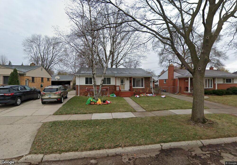
1161 Shenandoah Dr Clawson, MI 48017
Estimated Value: $303,446 - $351,000
3
Beds
2
Baths
1,084
Sq Ft
$306/Sq Ft
Est. Value
About This Home
This home is located at 1161 Shenandoah Dr, Clawson, MI 48017 and is currently estimated at $331,362, approximately $305 per square foot. 1161 Shenandoah Dr is a home located in Oakland County with nearby schools including Clawson High School, Japhet School, and Guardian Angels School.
Ownership History
Date
Name
Owned For
Owner Type
Purchase Details
Closed on
Feb 23, 2007
Sold by
Pandzich Marian and Sargent Mary
Bought by
Pandzich Luke and Pandzich Marian
Current Estimated Value
Home Financials for this Owner
Home Financials are based on the most recent Mortgage that was taken out on this home.
Original Mortgage
$128,250
Interest Rate
6.27%
Mortgage Type
New Conventional
Purchase Details
Closed on
Apr 21, 2003
Sold by
Sargent Jerome and Adler Mary
Bought by
Pandzich Marian and Sargent Mary
Create a Home Valuation Report for This Property
The Home Valuation Report is an in-depth analysis detailing your home's value as well as a comparison with similar homes in the area
Home Values in the Area
Average Home Value in this Area
Purchase History
| Date | Buyer | Sale Price | Title Company |
|---|---|---|---|
| Pandzich Luke | -- | Old Republic Title | |
| Pandzich Marian | -- | -- |
Source: Public Records
Mortgage History
| Date | Status | Borrower | Loan Amount |
|---|---|---|---|
| Closed | Pandzich Luke | $128,250 |
Source: Public Records
Tax History Compared to Growth
Tax History
| Year | Tax Paid | Tax Assessment Tax Assessment Total Assessment is a certain percentage of the fair market value that is determined by local assessors to be the total taxable value of land and additions on the property. | Land | Improvement |
|---|---|---|---|---|
| 2024 | $3,024 | $126,520 | $0 | $0 |
| 2023 | $2,899 | $114,390 | $0 | $0 |
| 2022 | $2,922 | $106,040 | $0 | $0 |
| 2021 | $2,862 | $99,180 | $0 | $0 |
| 2020 | $2,774 | $92,040 | $0 | $0 |
| 2019 | $2,866 | $87,650 | $0 | $0 |
| 2018 | $2,846 | $82,670 | $0 | $0 |
| 2017 | $2,829 | $79,800 | $0 | $0 |
| 2016 | $2,867 | $74,870 | $0 | $0 |
| 2015 | -- | $68,420 | $0 | $0 |
| 2014 | -- | $59,490 | $0 | $0 |
| 2011 | -- | $54,970 | $0 | $0 |
Source: Public Records
Map
Nearby Homes
- 1092 Shenandoah Dr
- 1226 Shenandoah Dr
- Fairfax Plan at The Village at Clawson Park
- Penrose Plan at The Village at Clawson Park
- 908 W Elmwood Ave
- 1341 Oakley Rd
- 659 W Maple Rd
- 846 Phillips Ave
- 275 Council Ave
- 4909 Coventry St Unit 287
- 1806 Torquay Ave
- 1936 Torquay Ave Unit 205
- 351 W Baker Ave
- 609 John M Ave
- 4921 N Crooks Rd Unit N-10
- 4952 Coventry St Unit 315
- 4909 Crooks Rd Unit C7
- 4909 Crooks Rd Unit 4
- 4921 Crooks Rd Unit M-10
- 71 Cloveridge Dr
- 1181 Shenandoah Dr
- 1143 Shenandoah Dr
- 1131 Shenandoah Dr
- 1168 Wright Dr
- 1140 Wright Dr
- 1186 Wright Dr
- 1115 Shenandoah Dr
- 1213 Shenandoah Dr
- 1118 Wright Dr
- 1162 Shenandoah Dr
- 1208 Wright Dr
- 1142 Shenandoah Dr
- 1178 Shenandoah Dr
- 1126 Shenandoah Dr
- 1192 Shenandoah Dr
- 1231 Shenandoah Dr
- 1222 Wright Dr
- 1090 Wright Dr
- 1089 Shenandoah Dr
- 1050 W Stephen Ave