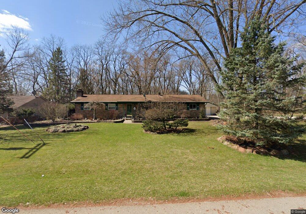
11612 Crooked Ln South Lyon, MI 48178
Estimated Value: $357,000 - $385,591
--
Bed
--
Bath
1,091
Sq Ft
$340/Sq Ft
Est. Value
About This Home
This home is located at 11612 Crooked Ln, South Lyon, MI 48178 and is currently estimated at $371,398, approximately $340 per square foot. 11612 Crooked Ln is a home located in Livingston County with nearby schools including William A. Brummer Elementary School, Centennial Middle School, and South Lyon High School.
Ownership History
Date
Name
Owned For
Owner Type
Purchase Details
Closed on
Sep 24, 2004
Sold by
Messer Timothy G and Messer Deborah J
Bought by
Messer Timothy G and Messer Deborah J
Current Estimated Value
Home Financials for this Owner
Home Financials are based on the most recent Mortgage that was taken out on this home.
Original Mortgage
$10,800
Interest Rate
5.93%
Mortgage Type
Credit Line Revolving
Purchase Details
Closed on
Feb 4, 2004
Sold by
Messer Timothy G and Messer Deborah J
Bought by
Messer Timothy G and Messer Deborah J
Create a Home Valuation Report for This Property
The Home Valuation Report is an in-depth analysis detailing your home's value as well as a comparison with similar homes in the area
Home Values in the Area
Average Home Value in this Area
Purchase History
| Date | Buyer | Sale Price | Title Company |
|---|---|---|---|
| Messer Timothy G | -- | Title Source Inc | |
| Messer Timothy G | -- | Title Source Inc | |
| Messer Timothy G | -- | -- |
Source: Public Records
Mortgage History
| Date | Status | Borrower | Loan Amount |
|---|---|---|---|
| Closed | Messer Timothy G | $10,800 |
Source: Public Records
Tax History Compared to Growth
Tax History
| Year | Tax Paid | Tax Assessment Tax Assessment Total Assessment is a certain percentage of the fair market value that is determined by local assessors to be the total taxable value of land and additions on the property. | Land | Improvement |
|---|---|---|---|---|
| 2025 | $4,539 | $183,700 | $0 | $0 |
| 2024 | $2,342 | $210,200 | $0 | $0 |
| 2023 | $2,234 | $167,600 | $0 | $0 |
| 2022 | $3,964 | $110,100 | $0 | $0 |
| 2021 | $3,964 | $141,100 | $0 | $0 |
| 2020 | $3,787 | $137,200 | $0 | $0 |
| 2019 | $2,852 | $110,100 | $0 | $0 |
| 2018 | $2,813 | $113,000 | $0 | $0 |
| 2017 | $2,858 | $113,200 | $0 | $0 |
| 2016 | $2,899 | $114,800 | $0 | $0 |
| 2014 | $2,935 | $92,300 | $0 | $0 |
| 2012 | $2,935 | $85,700 | $0 | $0 |
Source: Public Records
Map
Nearby Homes
- 11390 Ridge Rd
- 11860 Crooked Ln
- 11904 Moose Ridge Dr
- 12192 Doane Rd
- 11889 Shenandoah Dr Unit 3
- 11734 Shenandoah Dr Unit 3
- 11755 Shenandoah Dr Unit 159-4
- 9870 Cambridge Ct Unit 2
- 9044 Kemper Dr
- 9920 Cambridge Ct
- 0 Hillview Dr Unit 25052269
- 11055 Silver View Ct
- 11047 Silver View Ct
- 11108 Silver Lake Rd
- 51 Deanna Kay Ct Unit 51
- 50 Deanna Kay Ct Unit 50
- 37 Janes Landing Unit 37
- 28 Loretta Ln Unit 28
- 47 Loretta Ln Unit 47
- 64 Loretta Ln Unit 64
- 11624 Crooked Ln
- 0 Sumpter
- 11658 Shorecrest Ct
- 11629 Shorecrest Ct
- 11621 Crooked Ln
- 11636 Crooked Ln
- 11637 Crooked Ln
- 11590 Sumpter Rd
- 11615 Sumpter Rd
- 11644 Sumpter Rd
- 11545 Sumpter Rd
- 11655 Shorecrest Ct
- 9584 Lakeshore Ct
- 11648 Crooked Ln
- 11678 Doane Rd
- 11570 Sumpter Rd
- 11546 Sumpter Rd
- 9319 Silverside
- 11661 Crooked Ln
- 11707 Shorecrest Ct