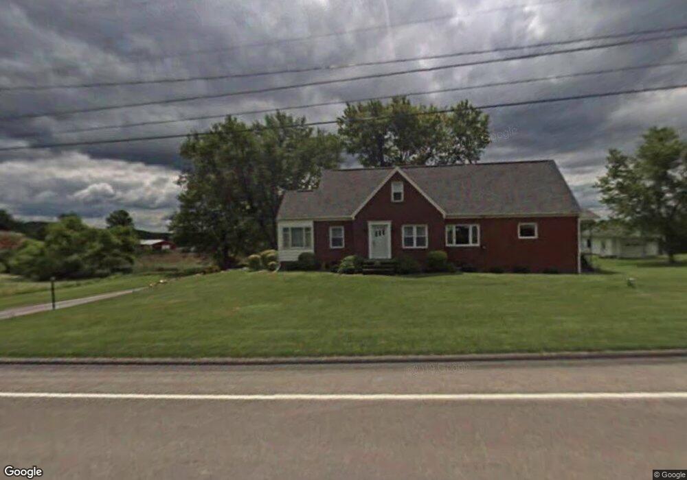
11612 Route 28 Brockway, PA 15824
Estimated Value: $160,167 - $235,000
--
Bed
--
Bath
1,355
Sq Ft
$154/Sq Ft
Est. Value
About This Home
This home is located at 11612 Route 28, Brockway, PA 15824 and is currently estimated at $208,792, approximately $154 per square foot. 11612 Route 28 is a home located in Jefferson County with nearby schools including Brockway Area Elementary School, Brockway Area Junior/Senior High School, and EAGLES NEST AMISH SCHOOL.
Ownership History
Date
Name
Owned For
Owner Type
Purchase Details
Closed on
Apr 23, 2019
Sold by
Shuttleworth John L and Shuttleworth Milly E
Bought by
Shuttleworth Marsha E
Current Estimated Value
Home Financials for this Owner
Home Financials are based on the most recent Mortgage that was taken out on this home.
Original Mortgage
$125,000
Outstanding Balance
$109,448
Interest Rate
4.1%
Mortgage Type
New Conventional
Estimated Equity
$99,344
Purchase Details
Closed on
Dec 29, 2015
Sold by
Karimushan Darla Lou and Britton Debra Sue
Bought by
Shuttleworth John L and Shuttleworth Milly E
Home Financials for this Owner
Home Financials are based on the most recent Mortgage that was taken out on this home.
Original Mortgage
$150,000
Interest Rate
3.96%
Mortgage Type
Purchase Money Mortgage
Purchase Details
Closed on
Oct 4, 2006
Sold by
Bovaird Wayne and Bovaird Ilene
Bought by
Department Of Transportation
Create a Home Valuation Report for This Property
The Home Valuation Report is an in-depth analysis detailing your home's value as well as a comparison with similar homes in the area
Home Values in the Area
Average Home Value in this Area
Purchase History
| Date | Buyer | Sale Price | Title Company |
|---|---|---|---|
| Shuttleworth Marsha E | $14,500 | None Available | |
| Shuttleworth John L | $150,000 | None Available | |
| Department Of Transportation | -- | None Available |
Source: Public Records
Mortgage History
| Date | Status | Borrower | Loan Amount |
|---|---|---|---|
| Open | Shuttleworth Marsha E | $125,000 | |
| Previous Owner | Shuttleworth John L | $150,000 |
Source: Public Records
Tax History Compared to Growth
Tax History
| Year | Tax Paid | Tax Assessment Tax Assessment Total Assessment is a certain percentage of the fair market value that is determined by local assessors to be the total taxable value of land and additions on the property. | Land | Improvement |
|---|---|---|---|---|
| 2025 | $2,238 | $57,720 | $4,220 | $53,500 |
| 2024 | $2,624 | $57,720 | $4,220 | $53,500 |
| 2023 | $2,181 | $57,720 | $4,220 | $53,500 |
| 2022 | $2,181 | $57,720 | $4,220 | $53,500 |
| 2021 | $2,181 | $57,720 | $4,220 | $53,500 |
| 2020 | $2,181 | $57,720 | $4,220 | $53,500 |
| 2019 | $2,086 | $57,720 | $4,220 | $53,500 |
| 2018 | $2,032 | $57,720 | $4,220 | $53,500 |
| 2017 | $2,000 | $57,720 | $4,220 | $53,500 |
| 2016 | $1,821 | $57,720 | $4,220 | $53,500 |
| 2015 | -- | $57,720 | $4,220 | $53,500 |
| 2012 | -- | $57,720 | $4,220 | $53,500 |
Source: Public Records
Map
Nearby Homes
- 0 Coal Glen Rd
- 19 Salandra Ln
- 5546 Stevenson Hill Rd
- 725 Russel Rd
- 10217 Pennsylvania 28
- 00 Pennsylvania 830
- 1074 10th Ave
- 970 Baghdad Rd
- 0 U S 219
- 1549 Main St
- 924 Elm St
- 3539 Stevenson Hill Rd
- 3243 Stevenson Hill Rd
- 7956 U S 219
- 559 Buskirk Rd
- 1144 Shaffer Rd
- 23682 Pennsylvania 949
- 1032 Beechtree Rd
- 4908 Pennsylvania 28
- 5850 U S 219
- 11595 Pennsylvania 28
- 11595 Route 28
- 11712 Route 28
- 11509 Route 28
- 11746 Route 28
- 1971 Sugar Hill Rd
- 11737 Route 28
- 11764 Route 28
- 1980 Sugar Hill Rd
- 1950 Sugar Hill Rd
- 11874 Route 28
- 11777 Route 28
- 82 Weisner Dr
- 140 Weisner Dr
- 25 Weisner Dr
- 1894 Sugar Hill Rd
- 11875 Route 28
- 80407 Alexander H Lindsay Memorial Hwy
- 11938 Route 28
- 11921 Route 28