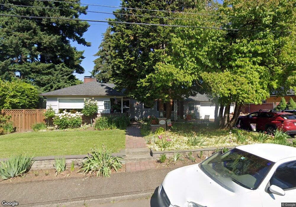
11614 SE 33rd Ave Milwaukie, OR 97222
Lake Road NeighborhoodEstimated Value: $491,000 - $587,000
3
Beds
2
Baths
1,868
Sq Ft
$294/Sq Ft
Est. Value
About This Home
This home is located at 11614 SE 33rd Ave, Milwaukie, OR 97222 and is currently estimated at $550,086, approximately $294 per square foot. 11614 SE 33rd Ave is a home located in Clackamas County with nearby schools including Milwaukie Elementary School, Rowe Middle School, and Milwaukie High School.
Ownership History
Date
Name
Owned For
Owner Type
Purchase Details
Closed on
Mar 28, 2019
Sold by
Olson Paul E and Egloff Olson Joan
Bought by
Olson Paul E and Egloff Olson Joan
Current Estimated Value
Purchase Details
Closed on
Nov 9, 2016
Sold by
Gipson Michael E and Tuomi Jean
Bought by
Olson Paul E and Egloff Olson Joan
Home Financials for this Owner
Home Financials are based on the most recent Mortgage that was taken out on this home.
Original Mortgage
$284,000
Interest Rate
3.42%
Mortgage Type
New Conventional
Create a Home Valuation Report for This Property
The Home Valuation Report is an in-depth analysis detailing your home's value as well as a comparison with similar homes in the area
Home Values in the Area
Average Home Value in this Area
Purchase History
| Date | Buyer | Sale Price | Title Company |
|---|---|---|---|
| Olson Paul E | -- | None Available | |
| Olson Paul E | $355,000 | Fidelity Natl Title Of Or |
Source: Public Records
Mortgage History
| Date | Status | Borrower | Loan Amount |
|---|---|---|---|
| Previous Owner | Olson Paul E | $284,000 |
Source: Public Records
Tax History Compared to Growth
Tax History
| Year | Tax Paid | Tax Assessment Tax Assessment Total Assessment is a certain percentage of the fair market value that is determined by local assessors to be the total taxable value of land and additions on the property. | Land | Improvement |
|---|---|---|---|---|
| 2025 | $5,235 | $237,922 | -- | -- |
| 2024 | $5,056 | $230,993 | -- | -- |
| 2023 | $5,056 | $224,266 | $0 | $0 |
| 2022 | $4,669 | $217,734 | $0 | $0 |
| 2021 | $4,505 | $211,393 | $0 | $0 |
| 2020 | $4,366 | $205,236 | $0 | $0 |
| 2019 | $4,164 | $192,963 | $0 | $0 |
| 2018 | $3,703 | $187,343 | $0 | $0 |
| 2017 | $3,597 | $181,886 | $0 | $0 |
| 2016 | $3,477 | $176,588 | $0 | $0 |
| 2015 | $3,310 | $171,445 | $0 | $0 |
| 2014 | $3,140 | $166,451 | $0 | $0 |
Source: Public Records
Map
Nearby Homes
- 11332 SE 31st Ave
- 11265 SE 30th Ave
- 10845 SE Myrtle St
- 10801 SE Myrtle St
- 10638 SE 34th Ave
- 4134 SE Washington St
- 4119 SE Northridge Dr
- 12632 SE 39th Ct
- 10475 SE 37th Ave
- 12425 SE 27th Ave
- 10429 SE 36th Ave
- 12712 SE 31st Ave
- 4025 SE Llewellyn St
- 4657 SE Franklin St
- 0 SE Sparrow St
- 12815 SE 31st Ave
- 12437 SE 24th Ave
- 12600 SE Freeman Way
- 4512 SE Garrett Cir
- 12735 SE 26th Ave
- 11562 SE 33rd Ave
- 11611 SE 34th Ave
- 11646 SE 33rd Ave
- 11637 SE 34th Ave
- 11577 SE 34th Ave
- 11540 SE 33rd Ave
- 11653 SE 34th Ave
- 11611 SE 33rd Ave
- 11555 SE 34th Ave
- 11607 SE 33rd Ave
- 11565 SE 33rd Ave
- 11528 SE 33rd Ave
- 3305 SE Wister St
- 3315 SE Wister St
- 11541 SE 33rd Ave
- 3326 SE Sellwood St
- 3325 SE Wister St
- 11501 SE 34th Ave
- 11513 SE 33rd Ave
- 0 SE 32nd Ave Unit 15515703