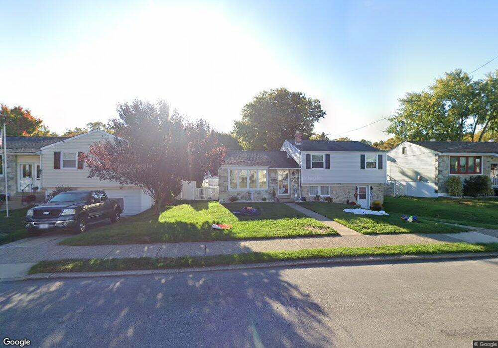
11615 Barlow St Philadelphia, PA 19116
Somerton NeighborhoodEstimated Value: $408,466 - $514,000
3
Beds
2
Baths
1,184
Sq Ft
$399/Sq Ft
Est. Value
About This Home
This home is located at 11615 Barlow St, Philadelphia, PA 19116 and is currently estimated at $472,617, approximately $399 per square foot. 11615 Barlow St is a home located in Philadelphia County with nearby schools including Loesche William H School, CCA Baldi Middle School, and George Washington High School.
Ownership History
Date
Name
Owned For
Owner Type
Purchase Details
Closed on
Apr 20, 2011
Sold by
Athanasopoulos George and Athanasopoulos Theodora
Bought by
Roberto Joseph George and Roberto Christina
Current Estimated Value
Home Financials for this Owner
Home Financials are based on the most recent Mortgage that was taken out on this home.
Original Mortgage
$218,800
Outstanding Balance
$151,093
Interest Rate
4.82%
Mortgage Type
New Conventional
Estimated Equity
$321,524
Purchase Details
Closed on
Jun 15, 2004
Sold by
Benyak Joseph F and Benyak Alma E
Bought by
Athanasopoulos George and Athanasopoulos Theodora
Home Financials for this Owner
Home Financials are based on the most recent Mortgage that was taken out on this home.
Original Mortgage
$162,000
Interest Rate
6.32%
Mortgage Type
Purchase Money Mortgage
Create a Home Valuation Report for This Property
The Home Valuation Report is an in-depth analysis detailing your home's value as well as a comparison with similar homes in the area
Home Values in the Area
Average Home Value in this Area
Purchase History
| Date | Buyer | Sale Price | Title Company |
|---|---|---|---|
| Roberto Joseph George | $273,500 | None Available | |
| Athanasopoulos George | $242,000 | First American Title Ins Co |
Source: Public Records
Mortgage History
| Date | Status | Borrower | Loan Amount |
|---|---|---|---|
| Open | Roberto Joseph George | $218,800 | |
| Previous Owner | Athanasopoulos George | $162,000 |
Source: Public Records
Tax History Compared to Growth
Tax History
| Year | Tax Paid | Tax Assessment Tax Assessment Total Assessment is a certain percentage of the fair market value that is determined by local assessors to be the total taxable value of land and additions on the property. | Land | Improvement |
|---|---|---|---|---|
| 2025 | $4,643 | $413,300 | $82,660 | $330,640 |
| 2024 | $4,643 | $413,300 | $82,660 | $330,640 |
| 2023 | $4,643 | $331,700 | $66,340 | $265,360 |
| 2022 | $2,868 | $286,700 | $66,340 | $220,360 |
| 2021 | $3,498 | $0 | $0 | $0 |
| 2020 | $3,498 | $0 | $0 | $0 |
| 2019 | $3,350 | $0 | $0 | $0 |
| 2018 | $2,969 | $0 | $0 | $0 |
| 2017 | $2,969 | $0 | $0 | $0 |
| 2016 | $2,549 | $0 | $0 | $0 |
| 2015 | $2,440 | $0 | $0 | $0 |
| 2014 | -- | $212,100 | $95,635 | $116,465 |
| 2012 | -- | $31,648 | $10,153 | $21,495 |
Source: Public Records
Map
Nearby Homes
- 825 Delray St
- 818 Burgess St
- 807 Larkspur St
- 808 Densmore Rd
- 813 Piermont St
- 1104 Welton St
- 11003 Stevens Rd
- 11933 Stevens Rd
- 831 Lawler St
- 859 Selmer Rd
- 509 Larkspur St
- 1724 Nathaniel Dr
- 10236 Selmer Terrace
- 11022 Ferndale St
- 10752 Jeanes St
- 770 Selmer Rd
- 11243 Jeanes Place
- 1829 Tomlinson Rd
- 11715 Jeanes St
- 10236 Jeanes St
- 11613 Barlow St
- 11617 Barlow St
- 11614 Stevens Rd
- 11612 Stevens Rd
- 11616 Stevens Rd
- 11619 Barlow St
- 11611 Barlow St
- 11614 Barlow St
- 11610 Stevens Rd
- 11618 Stevens Rd
- 11616 Barlow St
- 11612 Barlow St
- 11609 Barlow St
- 11621 Barlow St
- 11618 Barlow St
- 11610 Barlow St
- 11608 Stevens Rd
- 11620 Stevens Rd
- 11620 Barlow St
- 11607 Barlow St