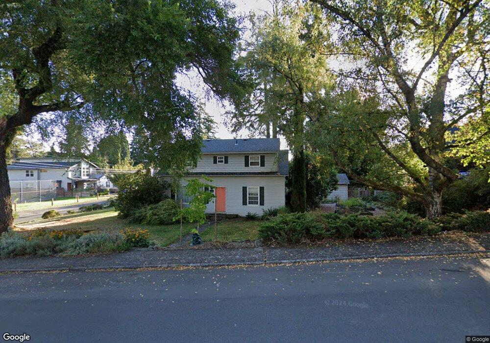
11616 SE 35th Ave Milwaukie, OR 97222
Lake Road NeighborhoodEstimated Value: $599,889 - $718,000
4
Beds
2
Baths
2,828
Sq Ft
$228/Sq Ft
Est. Value
About This Home
This home is located at 11616 SE 35th Ave, Milwaukie, OR 97222 and is currently estimated at $643,472, approximately $227 per square foot. 11616 SE 35th Ave is a home located in Clackamas County with nearby schools including Milwaukie Elementary School, Rowe Middle School, and Milwaukie High School.
Ownership History
Date
Name
Owned For
Owner Type
Purchase Details
Closed on
Jan 26, 2005
Sold by
Bertermann Mark Charles and Bertermann Ethel Louise
Bought by
Hooker Samuel N and Ash Nicola R
Current Estimated Value
Home Financials for this Owner
Home Financials are based on the most recent Mortgage that was taken out on this home.
Original Mortgage
$209,500
Outstanding Balance
$99,784
Interest Rate
5%
Mortgage Type
Purchase Money Mortgage
Estimated Equity
$543,688
Create a Home Valuation Report for This Property
The Home Valuation Report is an in-depth analysis detailing your home's value as well as a comparison with similar homes in the area
Home Values in the Area
Average Home Value in this Area
Purchase History
| Date | Buyer | Sale Price | Title Company |
|---|---|---|---|
| Hooker Samuel N | $261,900 | Chicago Title Insurance Comp |
Source: Public Records
Mortgage History
| Date | Status | Borrower | Loan Amount |
|---|---|---|---|
| Open | Hooker Samuel N | $209,500 |
Source: Public Records
Tax History Compared to Growth
Tax History
| Year | Tax Paid | Tax Assessment Tax Assessment Total Assessment is a certain percentage of the fair market value that is determined by local assessors to be the total taxable value of land and additions on the property. | Land | Improvement |
|---|---|---|---|---|
| 2025 | $5,382 | $244,600 | -- | -- |
| 2024 | $5,198 | $237,476 | -- | -- |
| 2023 | $5,198 | $230,560 | $0 | $0 |
| 2022 | $4,800 | $223,845 | $0 | $0 |
| 2021 | $4,632 | $217,326 | $0 | $0 |
| 2020 | $4,488 | $210,997 | $0 | $0 |
| 2019 | $4,421 | $204,852 | $0 | $0 |
| 2018 | $3,931 | $198,885 | $0 | $0 |
| 2017 | $3,819 | $193,092 | $0 | $0 |
| 2016 | $3,691 | $187,468 | $0 | $0 |
| 2015 | $3,514 | $182,008 | $0 | $0 |
| 2014 | $3,333 | $176,707 | $0 | $0 |
Source: Public Records
Map
Nearby Homes
- 11332 SE 31st Ave
- 11265 SE 30th Ave
- 4134 SE Washington St
- 10845 SE Myrtle St
- 10801 SE Myrtle St
- 4119 SE Northridge Dr
- 10638 SE 34th Ave
- 12632 SE 39th Ct
- 4657 SE Franklin St
- 10475 SE 37th Ave
- 12600 SE Freeman Way
- 10429 SE 36th Ave
- 12712 SE 31st Ave
- 4512 SE Garrett Cir
- 4025 SE Llewellyn St
- 12425 SE 27th Ave
- 11508 SE 48th Ave
- 4805 SE Park St
- 12815 SE 31st Ave
- 12437 SE 24th Ave
- 11658 SE 35th Ave
- 3506 SE Edison St
- 3521 SE Wister St
- 11615 SE 35th Ave
- 3513 SE Edison St
- 3526 SE Edison St
- 11647 SE 35th Ave
- 3517 SE Edison St
- 11581 SE 35th Ave
- 11679 SE 35th Ave
- 11500 SE 35th Ave
- 3525 SE Edison St
- 11708 SE 35th Ave
- 3435 SE Wister St
- 3605 SE Wister St
- 11602 SE 34th Ave
- 11529 SE 35th Ave
- 3526 SE Sellwood St
- 3535 SE Edison St
- 11634 SE 34th Ave