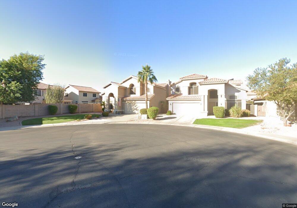
1162 N Woodside Ct Chandler, AZ 85224
Central Ridge NeighborhoodEstimated Value: $498,505 - $613,000
--
Bed
4
Baths
2,267
Sq Ft
$250/Sq Ft
Est. Value
About This Home
This home is located at 1162 N Woodside Ct, Chandler, AZ 85224 and is currently estimated at $567,376, approximately $250 per square foot. 1162 N Woodside Ct is a home located in Maricopa County with nearby schools including Chandler Traditional Academy - Goodman, Andersen Junior High School, and Chandler High School.
Ownership History
Date
Name
Owned For
Owner Type
Purchase Details
Closed on
Nov 25, 2012
Sold by
Snyder Jeffrey A and Cox Wendy M
Bought by
Snyder Jeffrey A and Synder Wendy M
Current Estimated Value
Home Financials for this Owner
Home Financials are based on the most recent Mortgage that was taken out on this home.
Original Mortgage
$95,000
Outstanding Balance
$17,438
Interest Rate
3.33%
Mortgage Type
New Conventional
Estimated Equity
$549,938
Purchase Details
Closed on
Aug 1, 1994
Sold by
Beazer Homes Sales Arizona Inc
Bought by
Snyder Jeffrey A and Cox Wendy M
Home Financials for this Owner
Home Financials are based on the most recent Mortgage that was taken out on this home.
Original Mortgage
$124,350
Interest Rate
8.65%
Mortgage Type
New Conventional
Create a Home Valuation Report for This Property
The Home Valuation Report is an in-depth analysis detailing your home's value as well as a comparison with similar homes in the area
Home Values in the Area
Average Home Value in this Area
Purchase History
| Date | Buyer | Sale Price | Title Company |
|---|---|---|---|
| Snyder Jeffrey A | -- | Security Title Agency | |
| Snyder Jeffrey A | $131,029 | Lawyers Title | |
| Beazer Homes Sales Arizona Inc | -- | Lawyers Title |
Source: Public Records
Mortgage History
| Date | Status | Borrower | Loan Amount |
|---|---|---|---|
| Open | Snyder Jeffrey A | $95,000 | |
| Closed | Snyder Jeffrey A | $124,350 |
Source: Public Records
Tax History Compared to Growth
Tax History
| Year | Tax Paid | Tax Assessment Tax Assessment Total Assessment is a certain percentage of the fair market value that is determined by local assessors to be the total taxable value of land and additions on the property. | Land | Improvement |
|---|---|---|---|---|
| 2025 | $2,088 | $26,810 | -- | -- |
| 2024 | $2,017 | $25,533 | -- | -- |
| 2023 | $2,017 | $42,020 | $8,400 | $33,620 |
| 2022 | $1,946 | $31,770 | $6,350 | $25,420 |
| 2021 | $2,040 | $29,480 | $5,890 | $23,590 |
| 2020 | $2,031 | $28,500 | $5,700 | $22,800 |
| 2019 | $1,953 | $27,030 | $5,400 | $21,630 |
| 2018 | $1,891 | $25,160 | $5,030 | $20,130 |
| 2017 | $1,763 | $23,670 | $4,730 | $18,940 |
| 2016 | $1,698 | $24,180 | $4,830 | $19,350 |
| 2015 | $1,645 | $22,160 | $4,430 | $17,730 |
Source: Public Records
Map
Nearby Homes
- 2571 W Park Ave
- 2541 W Park Ave
- 3111 W Baylor Ln
- 3165 W Golden Ln
- 2580 W Shannon Ct
- 2609 W Upland Dr
- 2173 E La Vieve Ln
- 2623 W Ivanhoe St
- 2875 W Highland St Unit 1102
- 2875 W Highland St Unit 1190
- 2875 W Highland St Unit 1112
- 2455 W Shannon St
- 991 N Florence Dr
- 2784 W Del Rio Place
- 2323 W Harrison St
- 2663 W Estrella Dr
- 1367 N Los Altos Dr
- 1962 N Blackstone Dr
- 810 N Los Altos Dr
- 2221 W Rockwell Dr
- 1172 N Woodside Ct
- 2842 W Gail Dr
- 2832 W Gail Dr
- 1182 N Woodside Ct
- 1171 N Spire Dr
- 2812 W Gail Dr
- 2862 W Gail Dr
- 1181 N Spire Dr
- 1191 N Spire Dr
- 2772 W Gail Dr
- 2831 W Gail Dr
- 2841 W Gail Dr
- 2821 W Gail Dr
- 2882 W Gail Dr
- 2851 W Gail Dr
- 2811 W Gail Dr
- 2861 W Gail Dr
- 1180 N Spire Dr
- 2801 W Gail Dr
- 1190 N Spire Dr