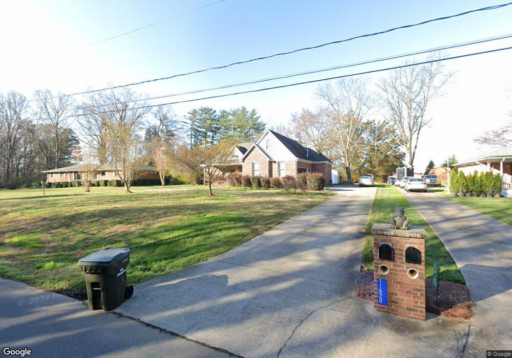
11620 Cresthill Dr Mint Hill, NC 28227
Estimated Value: $445,000 - $566,000
3
Beds
3
Baths
2,037
Sq Ft
$242/Sq Ft
Est. Value
About This Home
This home is located at 11620 Cresthill Dr, Mint Hill, NC 28227 and is currently estimated at $493,633, approximately $242 per square foot. 11620 Cresthill Dr is a home located in Mecklenburg County with nearby schools including Bain Elementary, Mint Hill Middle School, and Independence High.
Ownership History
Date
Name
Owned For
Owner Type
Purchase Details
Closed on
Jul 24, 2000
Sold by
Hunt Debra L and Hunt Gary E
Bought by
Simpson Thomas George
Current Estimated Value
Home Financials for this Owner
Home Financials are based on the most recent Mortgage that was taken out on this home.
Original Mortgage
$20,400
Interest Rate
8.23%
Mortgage Type
Purchase Money Mortgage
Create a Home Valuation Report for This Property
The Home Valuation Report is an in-depth analysis detailing your home's value as well as a comparison with similar homes in the area
Home Values in the Area
Average Home Value in this Area
Purchase History
| Date | Buyer | Sale Price | Title Company |
|---|---|---|---|
| Simpson Thomas George | $8,500 | -- | |
| Simpson Thomas George | $17,000 | -- |
Source: Public Records
Mortgage History
| Date | Status | Borrower | Loan Amount |
|---|---|---|---|
| Closed | Simpson Thomas George | $20,400 |
Source: Public Records
Tax History Compared to Growth
Tax History
| Year | Tax Paid | Tax Assessment Tax Assessment Total Assessment is a certain percentage of the fair market value that is determined by local assessors to be the total taxable value of land and additions on the property. | Land | Improvement |
|---|---|---|---|---|
| 2025 | $2,764 | $383,400 | $80,000 | $303,400 |
| 2024 | $2,764 | $383,400 | $80,000 | $303,400 |
| 2023 | $2,721 | $383,400 | $80,000 | $303,400 |
| 2022 | $2,000 | $224,800 | $34,900 | $189,900 |
| 2021 | $2,000 | $224,800 | $34,900 | $189,900 |
| 2020 | $2,000 | $224,800 | $34,900 | $189,900 |
| 2019 | $1,994 | $224,800 | $34,900 | $189,900 |
| 2018 | $2,074 | $187,200 | $23,000 | $164,200 |
| 2017 | $2,056 | $187,200 | $23,000 | $164,200 |
| 2016 | $2,053 | $187,200 | $23,000 | $164,200 |
| 2015 | $2,049 | $187,200 | $23,000 | $164,200 |
| 2014 | $2,047 | $187,200 | $23,000 | $164,200 |
Source: Public Records
Map
Nearby Homes
- 12017 Mariner Dr
- 13216 Lawyers Rd
- 17049 Malone Ln
- Newell Plan at Whitley Preserve - Enclave Collection
- Lemley Plan at Whitley Preserve - Park Collection
- Wyngate Plan at Whitley Preserve - Park Collection
- 12025 Mariner Dr
- Trailwind Plan at Whitley Preserve - Enclave Collection
- Goldrush Plan at Whitley Preserve - Park Collection
- Teasdale Plan at Whitley Preserve - Park Collection
- Whitetail Plan at Whitley Preserve - Enclave Collection
- 18209 Middle Springs Ln
- 18217 Middle Springs Ln
- 11917 Shady Oak Ct
- 7701 Matthews-Mint Hill Rd
- 3215 Lisburn St
- 5926 Long Stirrup Ln
- 11903 Canter Dr
- 15018 Camus Ct
- 4246 Piaffe Ave
- 11610 Cresthill Dr
- 11632 Cresthill Dr
- 11600 Cresthill Dr
- 11611 Cresthill Dr
- 11621 Cresthill Dr
- 11627 Cresthill Dr
- 11530 Cresthill Dr
- 11520 Cresthill Dr
- 11529 Lawyers Rd
- 11519 Cresthill Dr
- 11631 Lawyers Rd
- 11510 Cresthill Dr
- 11511 Cresthill Dr
- none Lawyers Rd
- 11500 Cresthill Dr
- 11500 Cresthill Dr Unit 6
- 8344 Bretton Woods Dr Unit 38
- 8340 Bretton Woods Dr Unit 39
- 8340 Bretton Woods Dr
- 8336 Bretton Woods Dr Unit 40