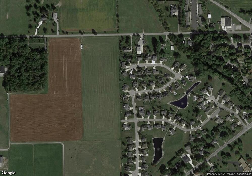
11627 Buckboard Ln Harlan, IN 46743
Estimated Value: $285,000 - $327,000
3
Beds
3
Baths
1,895
Sq Ft
$165/Sq Ft
Est. Value
About This Home
This home is located at 11627 Buckboard Ln, Harlan, IN 46743 and is currently estimated at $313,422, approximately $165 per square foot. 11627 Buckboard Ln is a home located in Allen County with nearby schools including Woodlan Junior/Senior High School, Rupert Ridge School, and Maumee Valley School.
Ownership History
Date
Name
Owned For
Owner Type
Purchase Details
Closed on
May 1, 2021
Sold by
Boes Greta A and Hoeppner Nicole A
Bought by
Bassett Danny L
Current Estimated Value
Home Financials for this Owner
Home Financials are based on the most recent Mortgage that was taken out on this home.
Original Mortgage
$125,000
Outstanding Balance
$112,798
Interest Rate
3.1%
Mortgage Type
Purchase Money Mortgage
Estimated Equity
$200,624
Purchase Details
Closed on
May 24, 2010
Sold by
Delagrange Eldon D and Delagrange Sharon R
Bought by
Harris Joan P and Bassett Danny L
Purchase Details
Closed on
Sep 12, 2001
Sold by
Quality Crafted Homes Inc
Bought by
Delagrance Eldon D and Delagrance Sharon R
Create a Home Valuation Report for This Property
The Home Valuation Report is an in-depth analysis detailing your home's value as well as a comparison with similar homes in the area
Purchase History
| Date | Buyer | Sale Price | Title Company |
|---|---|---|---|
| Bassett Danny L | $125,000 | None Available | |
| Harris Joan P | -- | Commonwealth-Dreibelbiss Tit | |
| Delagrance Eldon D | -- | Columbia Land Title Co Inc |
Source: Public Records
Mortgage History
| Date | Status | Borrower | Loan Amount |
|---|---|---|---|
| Open | Bassett Danny L | $125,000 |
Source: Public Records
Tax History Compared to Growth
Tax History
| Year | Tax Paid | Tax Assessment Tax Assessment Total Assessment is a certain percentage of the fair market value that is determined by local assessors to be the total taxable value of land and additions on the property. | Land | Improvement |
|---|---|---|---|---|
| 2025 | $2,702 | $328,400 | $29,300 | $299,100 |
| 2024 | $2,090 | $314,100 | $29,300 | $284,800 |
| 2022 | $1,858 | $245,000 | $29,300 | $215,700 |
| 2021 | $1,664 | $213,200 | $29,300 | $183,900 |
| 2020 | $1,588 | $200,200 | $29,300 | $170,900 |
| 2019 | $1,344 | $190,800 | $29,300 | $161,500 |
| 2018 | $1,216 | $170,900 | $29,300 | $141,600 |
| 2017 | $1,230 | $165,400 | $29,300 | $136,100 |
| 2016 | $1,237 | $164,200 | $29,300 | $134,900 |
| 2014 | $1,150 | $154,900 | $29,300 | $125,600 |
| 2013 | $1,077 | $147,800 | $29,300 | $118,500 |
Source: Public Records
Map
Nearby Homes
- 16308 Hawk Ridge Ct
- TBD Sunset Pass
- 16410 Sunset Pass
- 12109 Water St
- 0 Sunset Pass Lot B Pass
- 16729 Darling Rd
- 14611 Spencerville Rd
- 12720 Indiana St
- 13226 Indiana St
- 13537 West St
- 12925 Country Shoal Ln
- 13555 Illinois St
- 13618 Walker Mill Ct
- 15720 Roth Rd
- 11934 Grabill Rd
- 11731 Butternut Cove
- 11309 Grabill Rd
- 20201 Old 24 Rd E
- 20728 Old 24
- 11168 Oaklynn Reserve Blvd
- 16301 Wagon Trail
- 11621 Buckboard Ln
- 16308 Hawk Ridge Unit 47
- 16308 Hawk Ridge Unit 47
- 16304 Hawk Ridge
- 16307 Wagon Trail
- 16302 Wagon Trail
- 11615 Buckboard Ln
- 16312 Hawk Ridge Ct
- 16312 Hawk Ridge
- 16303 Hawk Ridge
- 16306 Wagon Trail
- 16316 Hawk Ridge
- 16231 Sunset Pass
- 16316 Hawk Ridge Ct
- 16313 Wagon Trail
- 16307 Hawk Ridge
- 16303 Sunset Pass
- 16310 Wagon Trail
- 16311 Hawk Ridge Unit 43
