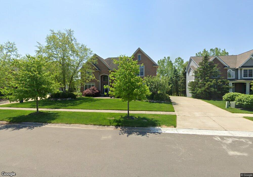
1163 Innsbrook Ct Ann Arbor, MI 48108
Estimated Value: $1,048,000 - $1,107,992
6
Beds
4
Baths
4,887
Sq Ft
$222/Sq Ft
Est. Value
About This Home
This home is located at 1163 Innsbrook Ct, Ann Arbor, MI 48108 and is currently estimated at $1,086,248, approximately $222 per square foot. 1163 Innsbrook Ct is a home located in Washtenaw County with nearby schools including Harvest Elementary School, Heritage School, and Saline Middle School.
Ownership History
Date
Name
Owned For
Owner Type
Purchase Details
Closed on
Aug 6, 2010
Sold by
Haertel Dean A and Haertel Kerry C
Bought by
Wagner Jeffrey J and Wagner Sarah G
Current Estimated Value
Home Financials for this Owner
Home Financials are based on the most recent Mortgage that was taken out on this home.
Original Mortgage
$420,000
Outstanding Balance
$279,898
Interest Rate
4.7%
Mortgage Type
Future Advance Clause Open End Mortgage
Estimated Equity
$806,350
Create a Home Valuation Report for This Property
The Home Valuation Report is an in-depth analysis detailing your home's value as well as a comparison with similar homes in the area
Home Values in the Area
Average Home Value in this Area
Purchase History
| Date | Buyer | Sale Price | Title Company |
|---|---|---|---|
| Wagner Jeffrey J | $607,500 | Sur |
Source: Public Records
Mortgage History
| Date | Status | Borrower | Loan Amount |
|---|---|---|---|
| Open | Wagner Jeffrey J | $420,000 |
Source: Public Records
Tax History Compared to Growth
Tax History
| Year | Tax Paid | Tax Assessment Tax Assessment Total Assessment is a certain percentage of the fair market value that is determined by local assessors to be the total taxable value of land and additions on the property. | Land | Improvement |
|---|---|---|---|---|
| 2025 | $14,089 | $519,234 | $0 | $0 |
| 2024 | $10,599 | $492,579 | $0 | $0 |
| 2023 | $10,113 | $458,700 | $0 | $0 |
| 2022 | $13,816 | $406,400 | $0 | $0 |
| 2021 | $13,426 | $409,000 | $0 | $0 |
| 2020 | $12,879 | $406,400 | $0 | $0 |
| 2019 | $12,551 | $396,000 | $396,000 | $0 |
| 2018 | $12,302 | $387,700 | $0 | $0 |
| 2017 | $11,834 | $385,600 | $0 | $0 |
| 2016 | $8,763 | $307,084 | $0 | $0 |
| 2015 | -- | $306,166 | $0 | $0 |
| 2014 | -- | $296,600 | $0 | $0 |
| 2013 | -- | $296,600 | $0 | $0 |
Source: Public Records
Map
Nearby Homes
- 1241 Bicentennial Pkwy
- 1466 Bicentennial Pkwy
- 6956 Suncrest Dr Unit 31
- 7085 Suncrest Dr
- 28 Black Cherry Ln
- 7106 Black Cherry Ln
- 1273 Gallery Pointe Dr Unit 39
- 862 Kelpie Dr
- 864 Kelpie Dr
- 1294 Gallery Pointe Dr
- 7142 Black Cherry Ln
- 7124 Black Cherry Ln
- 1303 Gallery Pointe Dr
- 7052 Black Cherry Ln
- 870 Kelpie Dr
- 1321 Gallery Pointe Dr
- 833 Kelpie Dr
- 825 Kelpie Dr
- 823 Kelpie Dr
- 7016 Black Cherry Ln
- 1171 Innsbrook Ct
- 1155 Innsbrook Ct
- 1179 Innsbrook Ct
- 6449 Edgewood Dr
- 1170 Innsbrook Ct
- 1187 Innsbrook Ct
- 1178 Innsbrook Ct
- 1133 Innsbrook Ct
- 1142 Innsbrook Ct
- 6433 Edgewood Dr
- 1186 Innsbrook Ct
- 1212 Innsbrook Ct
- 0 Community Dr
- 6491 Community Dr
- 6452 Community Dr
- 1211 Innsbrook Ct
- 6401 Edgewood Dr
- 1249 Bicentennial Pkwy
- 1220 Innsbrook Ct
- 0 Edgewood Dr