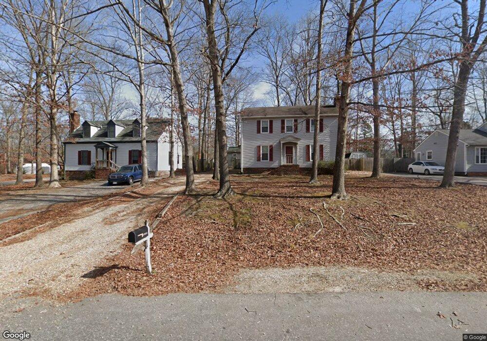
11631 Chester Station Dr Chester, VA 23831
Estimated Value: $289,000 - $352,000
3
Beds
2
Baths
1,632
Sq Ft
$195/Sq Ft
Est. Value
About This Home
This home is located at 11631 Chester Station Dr, Chester, VA 23831 and is currently estimated at $317,572, approximately $194 per square foot. 11631 Chester Station Dr is a home located in Chesterfield County with nearby schools including C E Curtis Elementary School, Bellwood Elementary School, and Elizabeth Davis Middle School.
Ownership History
Date
Name
Owned For
Owner Type
Purchase Details
Closed on
Sep 20, 1996
Sold by
Elbaum Adam
Bought by
Parlow James J and Parlow Lois G
Current Estimated Value
Home Financials for this Owner
Home Financials are based on the most recent Mortgage that was taken out on this home.
Original Mortgage
$84,867
Outstanding Balance
$7,088
Interest Rate
7.89%
Mortgage Type
FHA
Estimated Equity
$310,484
Create a Home Valuation Report for This Property
The Home Valuation Report is an in-depth analysis detailing your home's value as well as a comparison with similar homes in the area
Home Values in the Area
Average Home Value in this Area
Purchase History
| Date | Buyer | Sale Price | Title Company |
|---|---|---|---|
| Parlow James J | $85,000 | -- |
Source: Public Records
Mortgage History
| Date | Status | Borrower | Loan Amount |
|---|---|---|---|
| Open | Parlow James J | $84,867 |
Source: Public Records
Tax History Compared to Growth
Tax History
| Year | Tax Paid | Tax Assessment Tax Assessment Total Assessment is a certain percentage of the fair market value that is determined by local assessors to be the total taxable value of land and additions on the property. | Land | Improvement |
|---|---|---|---|---|
| 2025 | $2,402 | $267,100 | $59,000 | $208,100 |
| 2024 | $2,402 | $252,800 | $57,000 | $195,800 |
| 2023 | $2,128 | $233,900 | $52,000 | $181,900 |
| 2022 | $2,104 | $226,000 | $48,000 | $178,000 |
| 2021 | $1,828 | $189,800 | $43,000 | $146,800 |
| 2020 | $1,802 | $187,000 | $43,000 | $144,000 |
| 2019 | $1,653 | $174,000 | $43,000 | $131,000 |
| 2018 | $1,636 | $170,300 | $43,000 | $127,300 |
| 2017 | $1,628 | $167,000 | $43,000 | $124,000 |
| 2016 | $1,524 | $158,700 | $43,000 | $115,700 |
| 2015 | $1,452 | $151,300 | $43,000 | $108,300 |
| 2014 | $1,452 | $151,300 | $43,000 | $108,300 |
Source: Public Records
Map
Nearby Homes
- 4301 Village Creek Dr
- 11433 Chester Rd
- 3831 Wood Dale Rd
- 3913 Terjo Ln
- 4401 Village Garden Cir
- 11713 Village Garden Ct
- 11219 Chester Rd
- 11206 Heathstead Rd
- 11508 Womack Rd
- 11219 Sparwood Rd
- 4831 Empire Pkwy
- 5013 Stavely Rd
- 5019 Stavely Rd
- Azalea Ranch Plan at Womack Green
- 5001 Stavely Rd
- Millcreek at Womack Green Plan at Womack Green
- Magnolia Plan at Womack Green
- 11325 Vulcan Ln
- 5119 Vulcan Ct
- 5130 Vulcan Ct
- 11625 Chester Station Dr
- 11637 Chester Station Dr
- 4107 Railgate Terrace
- 11643 Chester Station Dr
- 11630 Chester Station Dr
- 4105 Railgate Terrace
- 11624 Chester Station Dr
- 11636 Chester Station Dr
- 4108 Railgate Terrace
- 11649 Chester Station Dr
- 11740 Chester Rd
- 4106 Railgate Terrace
- 11618 Chester Station Dr
- 11642 Chester Station Dr
- 4104 Railgate Terrace
- 4103 Railgate Terrace
- 11612 Chester Station Dr
- 4100 Railgate Terrace
- 11648 Chester Station Dr
- 4102 Railgate Terrace