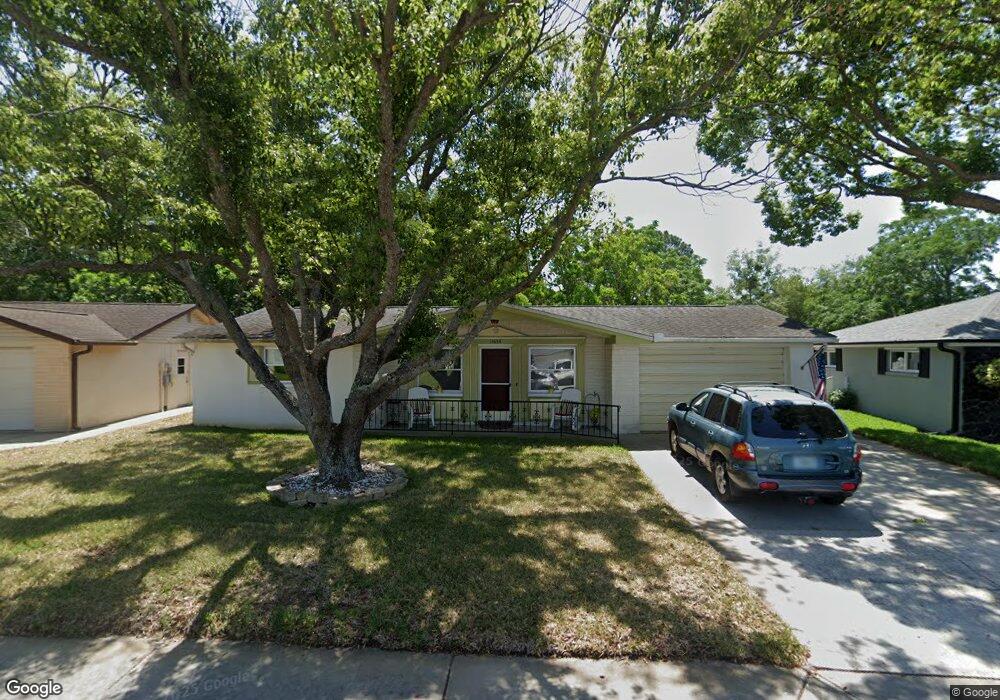
11636 Oceanside Dr Port Richey, FL 34668
Estimated Value: $198,825 - $208,000
2
Beds
2
Baths
1,122
Sq Ft
$182/Sq Ft
Est. Value
About This Home
This home is located at 11636 Oceanside Dr, Port Richey, FL 34668 and is currently estimated at $203,956, approximately $181 per square foot. 11636 Oceanside Dr is a home located in Pasco County with nearby schools including Gulf Highlands Elementary School, Bayonet Point Middle School, and Fivay High School.
Ownership History
Date
Name
Owned For
Owner Type
Purchase Details
Closed on
Feb 7, 2025
Sold by
Balog Loretta A and Balog Steven F
Bought by
Balog Loretta A and Balog Steven F
Current Estimated Value
Purchase Details
Closed on
Feb 6, 2006
Sold by
Balog Loretta A
Bought by
Balog Loretta A and Balog Steven F
Purchase Details
Closed on
Jun 24, 1997
Sold by
Balog Steven F
Bought by
Balog Steven F
Home Financials for this Owner
Home Financials are based on the most recent Mortgage that was taken out on this home.
Original Mortgage
$46,500
Interest Rate
7.97%
Mortgage Type
New Conventional
Purchase Details
Closed on
Oct 2, 1996
Sold by
Budlong Marion
Bought by
Mann Angela
Home Financials for this Owner
Home Financials are based on the most recent Mortgage that was taken out on this home.
Original Mortgage
$41,000
Interest Rate
7.87%
Mortgage Type
New Conventional
Create a Home Valuation Report for This Property
The Home Valuation Report is an in-depth analysis detailing your home's value as well as a comparison with similar homes in the area
Home Values in the Area
Average Home Value in this Area
Purchase History
| Date | Buyer | Sale Price | Title Company |
|---|---|---|---|
| Balog Loretta A | $100 | None Listed On Document | |
| Balog Loretta A | $100 | None Listed On Document | |
| Balog Loretta A | -- | Attorney | |
| Balog Steven F | $46,500 | -- | |
| Mann Angela | $44,000 | -- |
Source: Public Records
Mortgage History
| Date | Status | Borrower | Loan Amount |
|---|---|---|---|
| Previous Owner | Mann Angela | $46,500 | |
| Previous Owner | Mann Angela | $41,000 |
Source: Public Records
Tax History Compared to Growth
Tax History
| Year | Tax Paid | Tax Assessment Tax Assessment Total Assessment is a certain percentage of the fair market value that is determined by local assessors to be the total taxable value of land and additions on the property. | Land | Improvement |
|---|---|---|---|---|
| 2025 | $585 | $46,320 | -- | -- |
| 2024 | $585 | $45,020 | -- | -- |
| 2023 | $554 | $43,710 | $0 | $0 |
| 2022 | $505 | $42,440 | $0 | $0 |
| 2021 | $483 | $41,210 | $17,553 | $23,657 |
| 2020 | $467 | $40,650 | $8,235 | $32,415 |
| 2019 | $448 | $39,740 | $0 | $0 |
| 2018 | $430 | $39,003 | $0 | $0 |
| 2017 | $422 | $39,003 | $0 | $0 |
| 2016 | $393 | $38,747 | $0 | $0 |
| 2015 | $393 | $38,478 | $0 | $0 |
| 2014 | $374 | $40,943 | $8,235 | $32,708 |
Source: Public Records
Map
Nearby Homes
- 11615 Meadow Dr
- 7726 Gulf Highlands Dr
- 7901 Marlboro Dr
- 7739 Salt Ln
- 7911 Bell Dr
- 7719 Salt Ln
- 11828 Bingham Dr
- 7614 Karen Dr
- 11608 Zimmerman Rd
- 11414 Stansberry Dr
- 7535 Christina Ln
- 7519 Kensico Dr
- 7436 Gulf Highlands Dr
- 11404 Stansberry Dr
- 11326 Yellowwood Ln
- 0 Zimmerman Rd
- 7815 Foxbloom Dr
- 7421 Ashwood Dr
- 7923 Foxbloom Dr
- 7415 Neva Ln
- 11640 Oceanside Dr
- 11632 Oceanside Dr
- 11704 Oceanside Dr
- 7744 Seashore Dr
- 11635 Oceanside Dr
- 11703 Oceanside Dr
- 11625 Meadow Dr
- 11631 Meadow Dr
- 11708 Oceanside Dr
- 11621 Meadow Dr
- 7740 Seashore Dr
- 11709 Oceanside Dr
- 11635 Meadow Dr
- 7731 Seashore Dr
- 7733 Dale Dr
- 11641 Meadow Dr
- 11712 Oceanside Dr
- 7746 Candle Dr
- 11705 Meadow Dr Unit 6
- 7732 Dale Dr