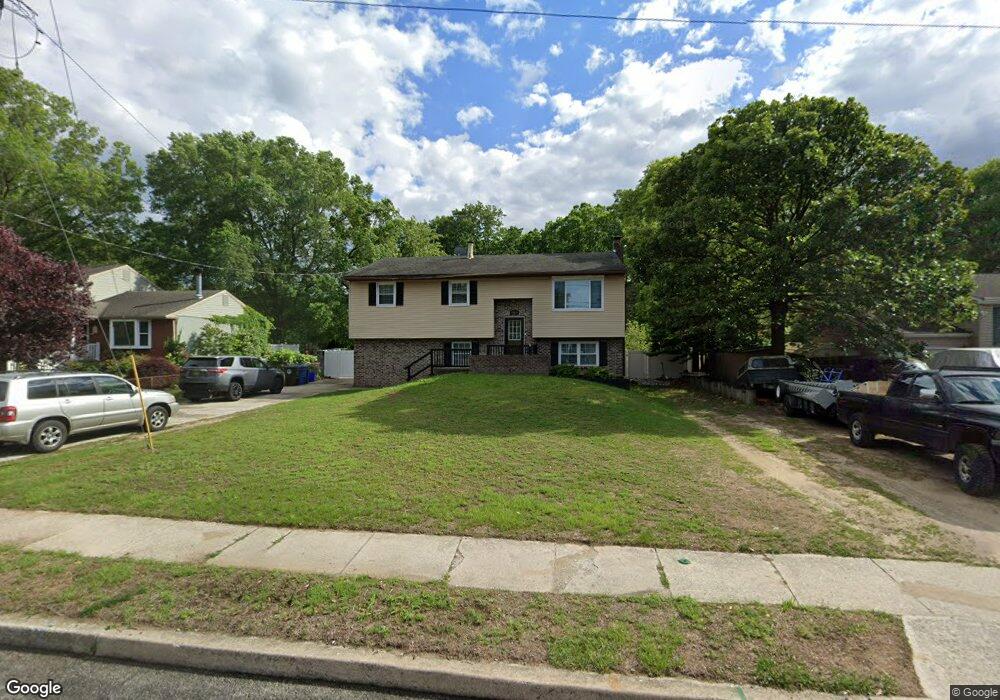
1164 Hessian Ave West Deptford, NJ 08093
West Deptford Township NeighborhoodEstimated Value: $374,000
4
Beds
2
Baths
2,568
Sq Ft
$146/Sq Ft
Est. Value
About This Home
This home is located at 1164 Hessian Ave, West Deptford, NJ 08093 and is currently estimated at $374,000, approximately $145 per square foot. 1164 Hessian Ave is a home located in Gloucester County with nearby schools including Red Bank Elementary School, Oakview Elementary School, and Green-Fields Elementary School.
Ownership History
Date
Name
Owned For
Owner Type
Purchase Details
Closed on
Jan 22, 2010
Sold by
Putorti Giovanni and Putorti Frances
Current Estimated Value
Home Financials for this Owner
Home Financials are based on the most recent Mortgage that was taken out on this home.
Original Mortgage
$220,924
Outstanding Balance
$147,241
Interest Rate
5.25%
Mortgage Type
FHA
Estimated Equity
$209,759
Create a Home Valuation Report for This Property
The Home Valuation Report is an in-depth analysis detailing your home's value as well as a comparison with similar homes in the area
Home Values in the Area
Average Home Value in this Area
Purchase History
| Date | Buyer | Sale Price | Title Company |
|---|---|---|---|
| -- | $225,000 | Group 21 Title Agency |
Source: Public Records
Mortgage History
| Date | Status | Borrower | Loan Amount |
|---|---|---|---|
| Open | -- | $220,924 |
Source: Public Records
Tax History Compared to Growth
Tax History
| Year | Tax Paid | Tax Assessment Tax Assessment Total Assessment is a certain percentage of the fair market value that is determined by local assessors to be the total taxable value of land and additions on the property. | Land | Improvement |
|---|---|---|---|---|
| 2025 | $7,483 | $223,600 | $53,800 | $169,800 |
| 2024 | $7,387 | $214,300 | $53,800 | $160,500 |
| 2023 | $7,387 | $214,300 | $53,800 | $160,500 |
| 2022 | $7,353 | $214,300 | $53,800 | $160,500 |
| 2021 | $7,327 | $214,300 | $53,800 | $160,500 |
| 2020 | $7,310 | $214,300 | $53,800 | $160,500 |
| 2019 | $7,106 | $214,300 | $53,800 | $160,500 |
| 2018 | $6,913 | $214,300 | $53,800 | $160,500 |
| 2017 | $6,753 | $214,300 | $53,800 | $160,500 |
| 2016 | $6,564 | $214,300 | $53,800 | $160,500 |
| 2015 | $6,455 | $221,200 | $60,700 | $160,500 |
| 2014 | $6,134 | $221,200 | $60,700 | $160,500 |
Source: Public Records
Map
Nearby Homes
- 1156 Hessian Ave
- 1448 Victory Ave
- 1134 Brewer Ave
- 1009 Hessian Ave
- 1676 Miller Ave
- 1678 Miller Ave
- 1372 Riley Ave
- 0 S Jefferson Ave Unit NJGL2053472
- 1113 Hessian Ave
- 176 Columbia Ave
- 1346 Verga Ave
- 106 N Lincoln Ave
- 1174 Harker Ave
- 904 Princeton Ave
- 815 Harker Ave
- 814 Hessian Ave
- 541 Elberne Ave
- 210 Lawnton Ave
- 704 Wesley Ave
- 2 Victorian Way
- 1160 Hessian Ave
- 1170 Hessian Ave
- 1402 Saint Mathews Dr
- 1400 Saint Mathews Dr
- 1175 Hessian Ave
- 1167 Hessian Ave
- 1404 Saint Mathews Dr
- 1179 Hessian Ave
- 1152 Hessian Ave
- 1185 Hessian Ave
- 1189 Hessian Ave
- 1406 Saint Mathews Dr
- 1157 Hessian Ave
- 1452 Spiegle Ave
- 1401 Saint Mathews Dr
- 1148 Hessian Ave
- 1406 Saint Matthew Dr
- 1460 Spiegle Ave
- 1414 Storrie Ave
- 1403 Saint Mathews Dr