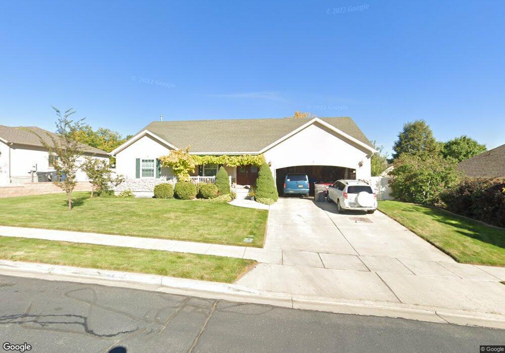
1164 N 560 W American Fork, UT 84003
Estimated Value: $653,000 - $709,000
4
Beds
3
Baths
1,840
Sq Ft
$373/Sq Ft
Est. Value
About This Home
This home is located at 1164 N 560 W, American Fork, UT 84003 and is currently estimated at $685,973, approximately $372 per square foot. 1164 N 560 W is a home located in Utah County with nearby schools including Legacy Elementary School, American Fork Junior High School, and American Fork High School.
Ownership History
Date
Name
Owned For
Owner Type
Purchase Details
Closed on
Jun 11, 2025
Sold by
Sumsion Kenneth W and Sumsion Lisa D
Bought by
Kenneth And Lisa Sumsion Living Trust and Sumsion
Current Estimated Value
Purchase Details
Closed on
Apr 24, 2025
Sold by
Sumsion Kenneth Wayne and Sumsion Lisa Dawn
Bought by
Kenneth And Lisa Sumsion Living Trust and Sumsion
Purchase Details
Closed on
Mar 8, 2002
Sold by
Carson Davis Investments Lc
Bought by
Sumsion Kenneth W and Sumsion Lisa D
Home Financials for this Owner
Home Financials are based on the most recent Mortgage that was taken out on this home.
Original Mortgage
$214,000
Interest Rate
6.94%
Mortgage Type
Construction
Create a Home Valuation Report for This Property
The Home Valuation Report is an in-depth analysis detailing your home's value as well as a comparison with similar homes in the area
Home Values in the Area
Average Home Value in this Area
Purchase History
| Date | Buyer | Sale Price | Title Company |
|---|---|---|---|
| Kenneth And Lisa Sumsion Living Trust | -- | None Listed On Document | |
| Kenneth And Lisa Sumsion Living Trust | -- | None Listed On Document | |
| Sumsion Kenneth W | -- | Provo Land Title Company |
Source: Public Records
Mortgage History
| Date | Status | Borrower | Loan Amount |
|---|---|---|---|
| Previous Owner | Sumsion Kenneth W | $214,000 |
Source: Public Records
Tax History Compared to Growth
Tax History
| Year | Tax Paid | Tax Assessment Tax Assessment Total Assessment is a certain percentage of the fair market value that is determined by local assessors to be the total taxable value of land and additions on the property. | Land | Improvement |
|---|---|---|---|---|
| 2025 | $2,945 | $362,615 | $229,700 | $429,600 |
| 2024 | $2,945 | $327,195 | $0 | $0 |
| 2023 | $2,752 | $324,170 | $0 | $0 |
| 2022 | $3,062 | $356,015 | $0 | $0 |
| 2021 | $2,468 | $448,200 | $130,700 | $317,500 |
| 2020 | $2,372 | $417,700 | $121,000 | $296,700 |
| 2019 | $2,273 | $414,100 | $121,000 | $293,100 |
| 2018 | $2,269 | $395,200 | $117,400 | $277,800 |
| 2017 | $2,009 | $188,815 | $0 | $0 |
| 2016 | $2,112 | $184,470 | $0 | $0 |
| 2015 | $2,150 | $178,145 | $0 | $0 |
| 2014 | $2,179 | $178,145 | $0 | $0 |
Source: Public Records
Map
Nearby Homes
- 471 W 1040 N
- 425 W 1120 N
- 987 N 410 W
- 344 W 1080 N
- 602 W 860 N
- 356 W 1300 N
- 3935 W 1000 N Unit 438
- 3983 W 1000 N Unit 442
- 4007 W 1000 N
- 3947 W 1000 N Unit 439
- 3959 W 1000 N
- 3889 W 950 Cir N Unit 366
- 914 N 400 W Unit A
- 9435 N Aspen Hollow Cir
- 1438 N 400 W
- 287 W 1360 N
- 984 N 300 W
- 822 N 860 W Unit 317
- 822 W 800 St N Unit LOT319
- 179 W 1290 N