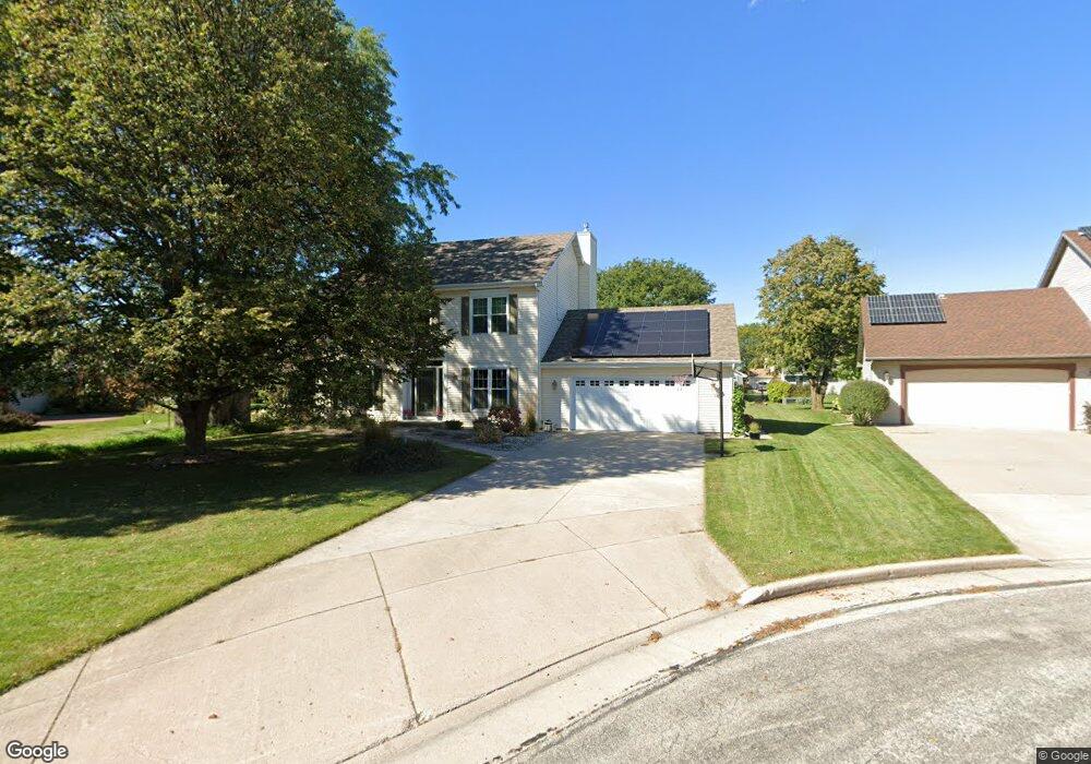
1164 Westwind Dr Neenah, WI 54956
Estimated Value: $383,000 - $404,000
4
Beds
3
Baths
2,266
Sq Ft
$174/Sq Ft
Est. Value
About This Home
This home is located at 1164 Westwind Dr, Neenah, WI 54956 and is currently estimated at $394,462, approximately $174 per square foot. 1164 Westwind Dr is a home located in Winnebago County with nearby schools including Tullar Elementary School, Horace Mann Middle School, and Neenah Middle School.
Ownership History
Date
Name
Owned For
Owner Type
Purchase Details
Closed on
Aug 25, 2017
Sold by
Jones James and Jones Elizabeth
Bought by
Jones James C and Jones Elizabeth M
Current Estimated Value
Purchase Details
Closed on
Jul 30, 2008
Sold by
Schuster Mark A and Schuster Kathleen M
Bought by
Jones James and Jones Elizabeth
Home Financials for this Owner
Home Financials are based on the most recent Mortgage that was taken out on this home.
Original Mortgage
$225,161
Outstanding Balance
$148,214
Interest Rate
6.39%
Mortgage Type
FHA
Estimated Equity
$246,248
Create a Home Valuation Report for This Property
The Home Valuation Report is an in-depth analysis detailing your home's value as well as a comparison with similar homes in the area
Home Values in the Area
Average Home Value in this Area
Purchase History
| Date | Buyer | Sale Price | Title Company |
|---|---|---|---|
| Jones James C | -- | None Available | |
| Jones James | $228,700 | None Available |
Source: Public Records
Mortgage History
| Date | Status | Borrower | Loan Amount |
|---|---|---|---|
| Open | Jones James | $225,161 |
Source: Public Records
Tax History Compared to Growth
Tax History
| Year | Tax Paid | Tax Assessment Tax Assessment Total Assessment is a certain percentage of the fair market value that is determined by local assessors to be the total taxable value of land and additions on the property. | Land | Improvement |
|---|---|---|---|---|
| 2024 | $5,167 | $337,000 | $37,000 | $300,000 |
| 2023 | $5,167 | $337,000 | $37,000 | $300,000 |
| 2022 | $4,669 | $232,500 | $36,000 | $196,500 |
| 2021 | $4,737 | $232,500 | $36,000 | $196,500 |
| 2020 | $4,813 | $232,500 | $36,000 | $196,500 |
| 2019 | $4,506 | $232,500 | $36,000 | $196,500 |
| 2018 | $4,248 | $188,100 | $35,700 | $152,400 |
| 2017 | $4,228 | $188,100 | $35,700 | $152,400 |
| 2016 | $4,205 | $188,100 | $35,700 | $152,400 |
| 2015 | $4,234 | $188,100 | $35,700 | $152,400 |
| 2014 | $4,276 | $188,100 | $35,700 | $152,400 |
| 2013 | $4,486 | $188,100 | $35,700 | $152,400 |
Source: Public Records
Map
Nearby Homes
- 1160 Westwind Dr
- 985 Babcock St
- 1160 Brittany Ct Unit 94
- 940 Babcock St Unit 96
- 970 Manor Dr Unit 72
- 970 Manor Dr Unit 74
- 1016 Gregory St
- 1201 Green Acres Ln
- 1500 Hidden Acres Ln
- 668 Dartmouth Dr
- 8404 Clayton Ave
- 1316 Wedgewood Ln
- 1095 Dogwood Trail
- 1341 Alpine Ln
- 929 Gay Dr Unit 931
- 1133 Primrose Ct Unit 1135
- 1372 Baytree Ln
- 1373 Wedgewood Ln
- 0 Vassar Ln
- 1241 Cameron Cir
- 1168 Westwind Dr
- 1058 Patrick Ct
- 1172 Westwind Dr
- 1055 Patrick Ct
- 1156 Westwind Dr
- 1165 Westwind Dr
- 1025 Stuart Dr
- 1062 Patrick Ct
- 1024 Stuart Dr
- 1176 Westwind Dr
- 1169 Westwind Dr
- 1173 Westwind Dr
- 1061 Patrick Ct
- 1055 Stuart Dr
- 1061 Stuart Dr
- 1015 Stuart Dr
- 1180 Westwind Dr
- 1177 Westwind Dr
- 1067 Patrick Ct
- 1152 Westwind Ct