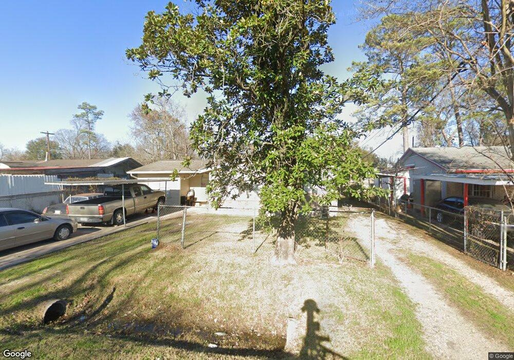
11642 Innsbury Dr Houston, TX 77093
East Aldine NeighborhoodEstimated Value: $177,506 - $204,000
3
Beds
1
Bath
1,304
Sq Ft
$142/Sq Ft
Est. Value
About This Home
This home is located at 11642 Innsbury Dr, Houston, TX 77093 and is currently estimated at $185,377, approximately $142 per square foot. 11642 Innsbury Dr is a home located in Harris County with nearby schools including Vardeman EC/PK/K, Worsham Elementary School, and Macarthur Ninth Grade School.
Ownership History
Date
Name
Owned For
Owner Type
Purchase Details
Closed on
Mar 30, 2005
Sold by
Danna Joseph Mario
Bought by
Nino Ralph and Castro Rachel
Current Estimated Value
Home Financials for this Owner
Home Financials are based on the most recent Mortgage that was taken out on this home.
Original Mortgage
$64,800
Outstanding Balance
$33,374
Interest Rate
5.75%
Mortgage Type
Purchase Money Mortgage
Estimated Equity
$152,003
Purchase Details
Closed on
Aug 6, 1998
Sold by
Mattern Marjorie J and Danna Marjorie J
Bought by
Danna Joseph Mario
Create a Home Valuation Report for This Property
The Home Valuation Report is an in-depth analysis detailing your home's value as well as a comparison with similar homes in the area
Home Values in the Area
Average Home Value in this Area
Purchase History
| Date | Buyer | Sale Price | Title Company |
|---|---|---|---|
| Nino Ralph | -- | First Southwestern Title Co | |
| Danna Joseph Mario | -- | -- |
Source: Public Records
Mortgage History
| Date | Status | Borrower | Loan Amount |
|---|---|---|---|
| Open | Nino Ralph | $64,800 | |
| Closed | Nino Ralph | $16,200 |
Source: Public Records
Tax History Compared to Growth
Tax History
| Year | Tax Paid | Tax Assessment Tax Assessment Total Assessment is a certain percentage of the fair market value that is determined by local assessors to be the total taxable value of land and additions on the property. | Land | Improvement |
|---|---|---|---|---|
| 2025 | $1,466 | $168,935 | $43,955 | $124,980 |
| 2024 | $1,466 | $169,338 | $43,955 | $125,383 |
| 2023 | $1,466 | $182,488 | $30,738 | $151,750 |
| 2022 | $2,355 | $144,977 | $30,738 | $114,239 |
| 2021 | $2,244 | $115,665 | $30,738 | $84,927 |
| 2020 | $2,150 | $103,709 | $30,738 | $72,971 |
| 2019 | $2,047 | $96,763 | $30,738 | $66,025 |
| 2018 | $764 | $78,213 | $14,754 | $63,459 |
| 2017 | $1,773 | $78,213 | $14,754 | $63,459 |
| 2016 | $1,671 | $78,213 | $14,754 | $63,459 |
| 2015 | $1,083 | $76,848 | $14,754 | $62,094 |
| 2014 | $1,083 | $60,950 | $14,754 | $46,196 |
Source: Public Records
Map
Nearby Homes
- 11716 Innsbury Dr
- 11746 Somerset Ln
- 2326 Sunny Dr
- 2311 Warwick Rd
- 2306 Wardmont St
- 2723 Castledale Dr
- 2237 Cromwell St
- 2915 Brea Crest St
- 2817 Cromwell St
- 2410 Mierianne St
- 2629 Kowis St
- 2131 Cromwell St Unit D
- 3111 Hartwick Rd
- 2152 William Tell St
- 2131 Warwick Rd
- 2123 Warwick Rd
- 3214 Brea Crest St
- 1925 Sunny Dr
- 2122 Kowis St
- 2636 Lone Oak Rd
- 11638 Innsbury Dr
- 11646 Innsbury Dr
- 2614 Brea Crest St
- 11634 Innsbury Dr
- 2618 Brea Crest St
- 11643 Innsbury Dr
- 2607 Mooney Rd
- 11639 Innsbury Dr
- 11647 Innsbury Dr
- 2622 Brea Crest St
- 11702 Innsbury Dr
- 11635 Innsbury Dr
- 2607 Brea Crest St
- 2615 Brea Crest St
- 2611 Mooney Rd
- 2626 Brea Crest St
- 11631 Innsbury Dr
- 11703 Innsbury Dr
- 2619 Brea Crest St
- 11710 Innsbury Dr