Estimated Value: $219,000 - $341,000
Studio
--
Bath
1,128
Sq Ft
$252/Sq Ft
Est. Value
About This Home
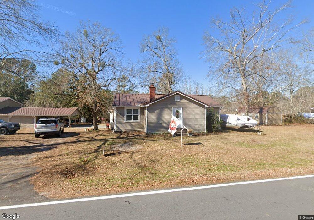
This home is located at 1165 Longpoint Rd, Cross, SC 29436 and is currently estimated at $284,798, approximately $252 per square foot. 1165 Longpoint Rd is a home located in Berkeley County with nearby schools including Cross Elementary School and Cross High School.
Ownership History
Date
Name
Owned For
Owner Type
Purchase Details
Closed on
Mar 14, 2024
Sold by
Weymouth William K
Bought by
Weymouth William K and Weymouth Patricia
Current Estimated Value
Purchase Details
Closed on
Apr 17, 2013
Sold by
Carroll Starling William and Carroll Mary Carol
Bought by
Weymouth William K
Home Financials for this Owner
Home Financials are based on the most recent Mortgage that was taken out on this home.
Original Mortgage
$100,000
Interest Rate
3.55%
Mortgage Type
Future Advance Clause Open End Mortgage
Purchase Details
Closed on
Aug 13, 2009
Sold by
Lybrand Phrona W and Gianatos Mary W
Bought by
Carroll Starling William and Carroll Mary Carol
Purchase Details
Closed on
Jul 2, 2009
Sold by
Estate Of Marvin F Weathers and Gianatos Mary W
Bought by
Lybrand Phrona W and Gianatos Mary W
Create a Home Valuation Report for This Property
The Home Valuation Report is an in-depth analysis detailing your home's value as well as a comparison with similar homes in the area
Home Values in the Area
Average Home Value in this Area
Purchase History
| Date | Buyer | Sale Price | Title Company |
|---|---|---|---|
| Weymouth William K | -- | None Listed On Document | |
| Weymouth William K | $125,000 | -- | |
| Carroll Starling William | $150,000 | -- | |
| Lybrand Phrona W | -- | -- |
Source: Public Records
Mortgage History
| Date | Status | Borrower | Loan Amount |
|---|---|---|---|
| Previous Owner | Weymouth William K | $100,000 |
Source: Public Records
Tax History Compared to Growth
Tax History
| Year | Tax Paid | Tax Assessment Tax Assessment Total Assessment is a certain percentage of the fair market value that is determined by local assessors to be the total taxable value of land and additions on the property. | Land | Improvement |
|---|---|---|---|---|
| 2025 | $590 | $158,568 | $77,730 | $80,838 |
| 2024 | $723 | $6,343 | $3,109 | $3,234 |
| 2023 | $723 | $6,343 | $3,109 | $3,234 |
| 2022 | $726 | $5,515 | $3,446 | $2,069 |
| 2021 | $743 | $5,520 | $3,446 | $2,069 |
| 2020 | $752 | $5,515 | $3,446 | $2,069 |
| 2019 | $747 | $5,515 | $3,446 | $2,069 |
| 2018 | $689 | $4,796 | $2,508 | $2,288 |
| 2017 | $689 | $4,796 | $2,508 | $2,288 |
| 2016 | $704 | $4,800 | $2,510 | $2,290 |
| 2015 | $655 | $4,800 | $2,510 | $2,290 |
| 2014 | $644 | $4,800 | $2,510 | $2,290 |
| 2013 | -- | $4,800 | $2,510 | $2,290 |
Source: Public Records
Map
Nearby Homes
- 0 Bolt Dr
- 184 Burbank Dr
- 0000 Ranger Dr
- 1726 Ranger Dr
- 000 Ranger Dr Unit Lot F
- 000 Ranger Dr Unit Lot E
- 000 Ranger Dr
- 000 Ranger Dr Unit Lot D
- 000 Ranger Dr Unit Lot C
- 000 Ranger Dr Unit Lot B
- 000 Ranger Dr Unit Lot A
- 280 Royalegates Ct
- 00 Saint Julian Dr
- 106 Airborne Way
- 1401 Old Highway 6
- 0 Richardson St Unit 26001891
- 108 Browns Family Place
- 106 Pine Arbor Ln
- 112 Pine Arbor Ln
- 117 Pine Arbor Ln
- 1162 Longpoint Rd
- 1172 Longpoint Rd
- 1173 Longpoint Rd
- 1159 Longpoint Rd
- 1158 Longpoint Rd
- 1184 Longpoint Rd
- 1179 Longpoint Rd
- 1188 Longpoint Rd
- 1148 Longpoint Rd
- 116 Wares Run
- 1191 Longpoint Rd
- 1194 Longpoint Rd
- 112 Wares Run
- 135 Wares Run
- 0 Wares Run Rd
- 111 Stump Hollow Ln
- 1197 Longpoint Rd
- 0 Wares Run
- 1125 Longpoint Rd
- 1204 Longpoint Rd