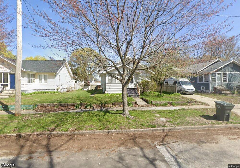
1166 W Dale Ave Muskegon, MI 49441
Nims NeighborhoodEstimated Value: $185,401 - $218,000
3
Beds
1
Bath
1,124
Sq Ft
$177/Sq Ft
Est. Value
About This Home
This home is located at 1166 W Dale Ave, Muskegon, MI 49441 and is currently estimated at $199,350, approximately $177 per square foot. 1166 W Dale Ave is a home located in Muskegon County with nearby schools including Muskegon Catholic Central School and St. Michael Elementary School.
Ownership History
Date
Name
Owned For
Owner Type
Purchase Details
Closed on
Feb 10, 2021
Sold by
Peters Linda
Bought by
Reyes Melissa K
Current Estimated Value
Purchase Details
Closed on
Oct 10, 2011
Sold by
Enriquez Rodolfo
Bought by
Peters Linda and Enriquez Melissa
Purchase Details
Closed on
Oct 7, 2004
Sold by
Ogle Robert D and Willett Ogle Tracy L
Bought by
Peters Linda S and Enriquez Rodolfo
Home Financials for this Owner
Home Financials are based on the most recent Mortgage that was taken out on this home.
Original Mortgage
$82,500
Interest Rate
7.25%
Mortgage Type
Unknown
Create a Home Valuation Report for This Property
The Home Valuation Report is an in-depth analysis detailing your home's value as well as a comparison with similar homes in the area
Home Values in the Area
Average Home Value in this Area
Purchase History
| Date | Buyer | Sale Price | Title Company |
|---|---|---|---|
| Reyes Melissa K | -- | None Available | |
| Peters Linda | -- | Rei | |
| Peters Linda S | -- | -- |
Source: Public Records
Mortgage History
| Date | Status | Borrower | Loan Amount |
|---|---|---|---|
| Previous Owner | Peters Linda S | $82,500 |
Source: Public Records
Tax History Compared to Growth
Tax History
| Year | Tax Paid | Tax Assessment Tax Assessment Total Assessment is a certain percentage of the fair market value that is determined by local assessors to be the total taxable value of land and additions on the property. | Land | Improvement |
|---|---|---|---|---|
| 2025 | $1,351 | $75,300 | $0 | $0 |
| 2024 | $356 | $61,300 | $0 | $0 |
| 2023 | $340 | $53,600 | $0 | $0 |
| 2022 | $1,263 | $44,000 | $0 | $0 |
| 2021 | $1,241 | $38,500 | $0 | $0 |
| 2020 | $1,203 | $33,400 | $0 | $0 |
| 2019 | $1,182 | $29,500 | $0 | $0 |
| 2018 | $1,156 | $28,800 | $0 | $0 |
| 2017 | $1,116 | $27,100 | $0 | $0 |
| 2016 | $290 | $26,000 | $0 | $0 |
| 2015 | -- | $26,100 | $0 | $0 |
| 2014 | $284 | $26,000 | $0 | $0 |
| 2013 | -- | $24,400 | $0 | $0 |
Source: Public Records
Map
Nearby Homes
- 1151 W Dale Ave
- 1135 W Dale Ave
- 952 Boardwalk Cove Dr
- 1636 Franklin St
- 988 W Larch Ave
- 972 W Dale Ave
- 1270 Palmer Ave
- 995 W Southern Ave
- 929 Ireland Ave
- 1465 Barclay St
- 933 W Southern Ave
- 905 W Forest Ave
- 923 W Southern Ave
- VL Washington
- 1776 Division St
- 902 W Southern Ave
- 827 W Larch Ave
- 1497 Division St
- 1886 Crowley St
- 1936 Crowley St
- 1172 W Dale Ave
- 1158 W Dale Ave
- 1182 W Dale Ave
- 1165 W Dale Ave
- 1173 W Dale Ave
- 1157 W Dale Ave
- 1152 W Dale Ave
- 1144 W Dale Ave
- 1190 W Dale Ave
- 1181 W Dale Ave
- 1191 W Dale Ave
- 1181 Ireland Ave
- 1151 Ireland Ave
- 1138 W Dale Ave
- 1169 Ireland Ave
- 1173 Ireland Ave
- 1159 Ireland Ave
- 1145 Ireland Ave
- 1189 Ireland Ave
- 1128 W Dale Ave