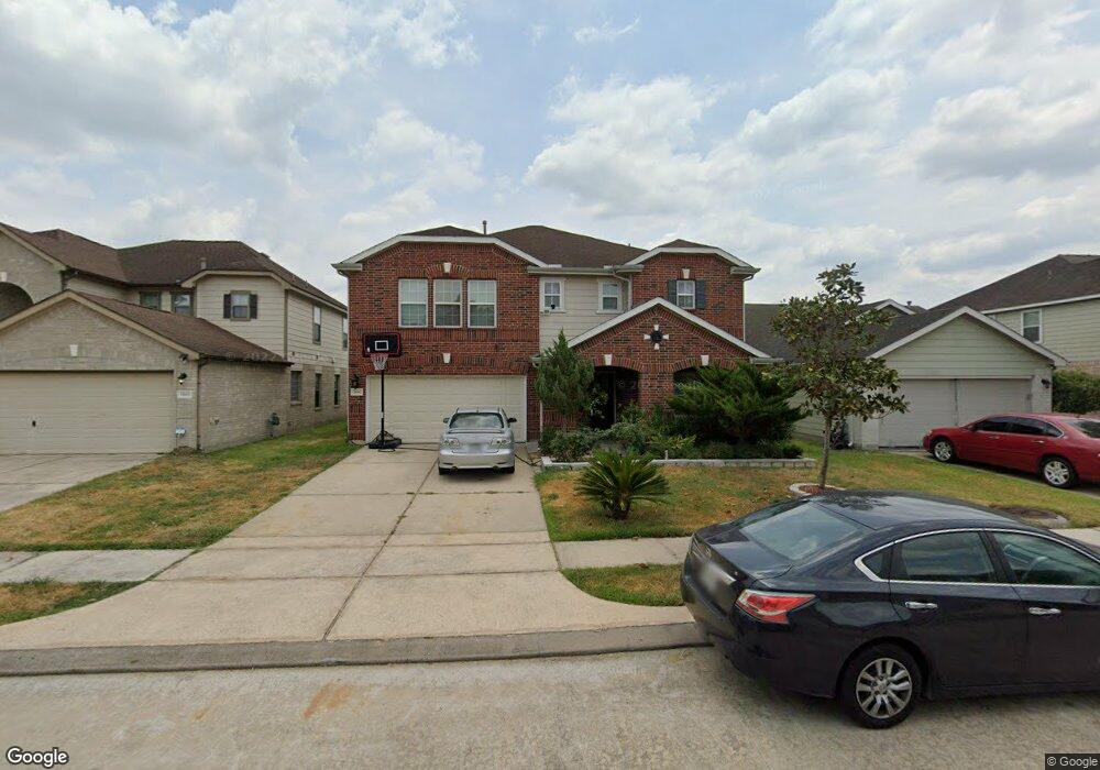
11662 Walnut Dale Ct Houston, TX 77038
North Houston NeighborhoodEstimated Value: $288,000 - $325,000
4
Beds
4
Baths
3,216
Sq Ft
$95/Sq Ft
Est. Value
About This Home
This home is located at 11662 Walnut Dale Ct, Houston, TX 77038 and is currently estimated at $304,637, approximately $94 per square foot. 11662 Walnut Dale Ct is a home located in Harris County with nearby schools including Kujawa EC/Pre-K/K School, Carter Academy, and Shotwell Middle School.
Ownership History
Date
Name
Owned For
Owner Type
Purchase Details
Closed on
Dec 15, 2011
Sold by
Fannie Mae
Bought by
Vu Truongky Pham
Current Estimated Value
Purchase Details
Closed on
Aug 2, 2011
Sold by
Arellano Ali and Bank Of America Na
Bought by
Federal National Mortgage Association and Fannie Mae
Purchase Details
Closed on
Nov 20, 2007
Sold by
Kb Home Lone Star Lp
Bought by
Arellano Ali
Home Financials for this Owner
Home Financials are based on the most recent Mortgage that was taken out on this home.
Original Mortgage
$153,294
Interest Rate
6.43%
Mortgage Type
Purchase Money Mortgage
Create a Home Valuation Report for This Property
The Home Valuation Report is an in-depth analysis detailing your home's value as well as a comparison with similar homes in the area
Home Values in the Area
Average Home Value in this Area
Purchase History
| Date | Buyer | Sale Price | Title Company |
|---|---|---|---|
| Vu Truongky Pham | -- | Texas American Title Company | |
| Vu Truongky Pham | -- | Texas American Title Company | |
| Federal National Mortgage Association | $146,063 | None Available | |
| Arellano Ali | -- | First American Title |
Source: Public Records
Mortgage History
| Date | Status | Borrower | Loan Amount |
|---|---|---|---|
| Previous Owner | Arellano Ali | $153,294 |
Source: Public Records
Tax History Compared to Growth
Tax History
| Year | Tax Paid | Tax Assessment Tax Assessment Total Assessment is a certain percentage of the fair market value that is determined by local assessors to be the total taxable value of land and additions on the property. | Land | Improvement |
|---|---|---|---|---|
| 2025 | $6,694 | $311,467 | $53,781 | $257,686 |
| 2024 | $6,694 | $304,595 | $53,781 | $250,814 |
| 2023 | $6,694 | $339,176 | $53,781 | $285,395 |
| 2022 | $7,302 | $278,611 | $30,030 | $248,581 |
| 2021 | $6,896 | $213,791 | $30,030 | $183,761 |
| 2020 | $6,480 | $201,000 | $30,030 | $170,970 |
| 2019 | $6,068 | $179,692 | $21,840 | $157,852 |
| 2018 | $1,794 | $155,000 | $21,840 | $133,160 |
| 2017 | $4,861 | $155,000 | $21,840 | $133,160 |
| 2016 | $4,419 | $155,000 | $21,840 | $133,160 |
| 2015 | $2,455 | $176,000 | $21,840 | $154,160 |
| 2014 | $2,455 | $133,939 | $21,840 | $112,099 |
Source: Public Records
Map
Nearby Homes
- 11623 Quinn Ridge Way
- 11707 Madison Oak St
- 11638 Township Dale Ct
- 2934 Washington Dr
- 2930 Washington Dr
- 2746 Piney Lake Ct
- 2907 Valiant Scene Ct
- 11618 Wren Crossing Dr
- 11726 Wren Crossing Dr
- 9218 Washington Dr
- 9217 Washington Dr
- 9206 Washington Dr
- 2743 Oriole Wood Ct
- 2934 Valiant Scene Ct
- 11727 State Highway 249
- 2845 Washington Dr
- 12006 Mallard Stream Ct
- 12007 Bach Orchard Trail
- 12015 Audubon Hill Ct
- 2631 Palmetto Valley Dr
- 11658 Walnut Dale Ct
- 11666 Walnut Dale Ct
- 11654 Walnut Dale Ct
- 11670 Walnut Dale Ct
- 11655 Quinn Ridge Way
- 11659 Quinn Ridge Way
- 11651 Quinn Ridge Way
- 11663 Quinn Ridge Way
- 11650 Walnut Dale Ct
- 11647 Quinn Ridge Way
- 11663 Walnut Dale Ct
- 11667 Quinn Ridge Way
- 11655 Walnut Dale Ct
- 11643 Quinn Ridge Way
- 11646 Walnut Dale Ct
- 11651 Walnut Dale Ct
- 11639 Quinn Ridge Way
- 11642 Walnut Dale Ct
- 11647 Walnut Dale Ct
- 11654 Quinn Ridge Way