Estimated Value: $370,851 - $401,000
4
Beds
3
Baths
2,016
Sq Ft
$194/Sq Ft
Est. Value
About This Home
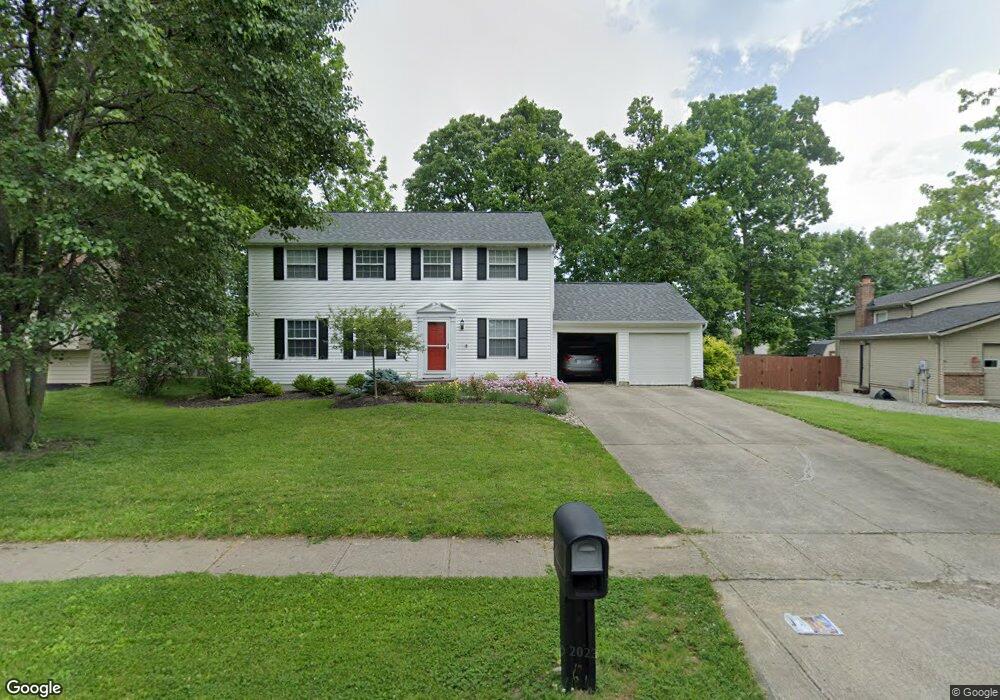
This home is located at 1167 Anthony Ln, Mason, OH 45040 and is currently estimated at $390,963, approximately $193 per square foot. 1167 Anthony Ln is a home located in Warren County with nearby schools including Mason Intermediate Elementary School, Mason Middle School, and William Mason High School.
Ownership History
Date
Name
Owned For
Owner Type
Purchase Details
Closed on
Dec 9, 2010
Sold by
Lawson Douglas Eugene and Lawson Carol L
Bought by
Mann Jennifer G
Current Estimated Value
Home Financials for this Owner
Home Financials are based on the most recent Mortgage that was taken out on this home.
Original Mortgage
$166,250
Outstanding Balance
$109,838
Interest Rate
4.22%
Mortgage Type
New Conventional
Estimated Equity
$281,125
Purchase Details
Closed on
Apr 9, 1981
Sold by
Record Record and Record Daniel L
Purchase Details
Closed on
Jul 3, 1979
Sold by
Ryan Homes Inc
Purchase Details
Closed on
May 9, 1979
Sold by
D J Properties Inc
Create a Home Valuation Report for This Property
The Home Valuation Report is an in-depth analysis detailing your home's value as well as a comparison with similar homes in the area
Home Values in the Area
Average Home Value in this Area
Purchase History
| Date | Buyer | Sale Price | Title Company |
|---|---|---|---|
| Mann Jennifer G | $175,000 | Lawyers Title | |
| -- | $79,500 | -- | |
| -- | $75,300 | -- | |
| -- | $73,500 | -- |
Source: Public Records
Mortgage History
| Date | Status | Borrower | Loan Amount |
|---|---|---|---|
| Open | Mann Jennifer G | $166,250 |
Source: Public Records
Tax History Compared to Growth
Tax History
| Year | Tax Paid | Tax Assessment Tax Assessment Total Assessment is a certain percentage of the fair market value that is determined by local assessors to be the total taxable value of land and additions on the property. | Land | Improvement |
|---|---|---|---|---|
| 2024 | $3,826 | $94,260 | $24,500 | $69,760 |
| 2023 | $3,491 | $72,674 | $10,762 | $61,911 |
| 2022 | $3,446 | $72,674 | $10,763 | $61,912 |
| 2021 | $3,264 | $72,674 | $10,763 | $61,912 |
| 2020 | $3,095 | $59,084 | $8,750 | $50,334 |
| 2019 | $2,846 | $59,084 | $8,750 | $50,334 |
| 2018 | $2,855 | $59,084 | $8,750 | $50,334 |
| 2017 | $2,623 | $50,673 | $8,274 | $42,399 |
| 2016 | $2,702 | $50,673 | $8,274 | $42,399 |
| 2015 | $2,707 | $50,673 | $8,274 | $42,399 |
| 2014 | $2,713 | $47,360 | $7,730 | $39,620 |
| 2013 | $2,719 | $53,600 | $8,750 | $44,850 |
Source: Public Records
Map
Nearby Homes
- 6356 Amber Ct Unit 91
- 6070 Fireside Dr Unit 45
- 6138 Nicholas Way
- 6387 Coverage Ct
- 6369 Coverage Ct
- 6403 Coverage Ct
- 6357 Coverage Ct
- 6383 Coverage Ct
- 6407 Coverage Ct
- 6375 Coverage Ct
- 6365 Coverage Ct
- 6361 Coverage Ct
- 6379 Coverage Ct
- 6411 Coverage Ct
- 6126 Nicholas Way
- 6146 Nicholas Way
- 6150 Nicholas Way
- 6358 Coverage Ct
- 6362 Coverage Ct
- 6134 Nicholas Way
- 1163 Anthony Ln
- 1171 Anthony Ln
- 6307 Fireside Dr
- 1277 Kay Dr
- 1275 Kay Dr
- 500 Charles Ct
- 1170 Anthony Ln
- 1174 Anthony Ln
- 1273 Kay Dr
- 6319 Fireside Dr
- 504 Charles Ct
- 1166 Anthony Ln
- 1178 Anthony Ln
- 6299 Fireside Dr
- 6275 Fireside Dr
- 1258 Laura Ln
- 1271 Kay Dr
- 1285 Kay Dr
- 6331 Fireside Dr
- 1182 Anthony Ln