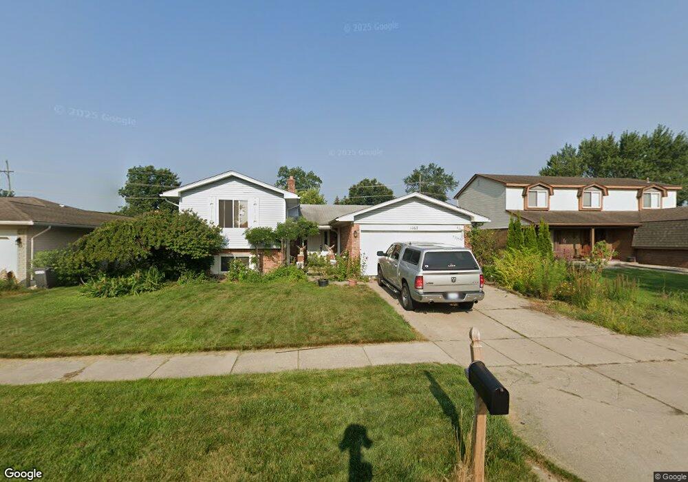
1167 Brookline St Canton, MI 48187
Estimated Value: $402,000 - $422,040
--
Bed
3
Baths
2,104
Sq Ft
$197/Sq Ft
Est. Value
About This Home
This home is located at 1167 Brookline St, Canton, MI 48187 and is currently estimated at $415,010, approximately $197 per square foot. 1167 Brookline St is a home located in Wayne County with nearby schools including Canton High School, Discovery Middle School, and Salem High School.
Ownership History
Date
Name
Owned For
Owner Type
Purchase Details
Closed on
Jan 1, 2015
Sold by
Wenzel Donna L and Wenzel Jerry Lee
Bought by
Watson Andrew G and Watson Melissa M
Current Estimated Value
Home Financials for this Owner
Home Financials are based on the most recent Mortgage that was taken out on this home.
Original Mortgage
$106,500
Interest Rate
4.8%
Mortgage Type
New Conventional
Create a Home Valuation Report for This Property
The Home Valuation Report is an in-depth analysis detailing your home's value as well as a comparison with similar homes in the area
Home Values in the Area
Average Home Value in this Area
Purchase History
| Date | Buyer | Sale Price | Title Company |
|---|---|---|---|
| Watson Andrew G | $120,000 | None Available | |
| Watson Andrew G | -- | None Available |
Source: Public Records
Mortgage History
| Date | Status | Borrower | Loan Amount |
|---|---|---|---|
| Previous Owner | Watson Andrew G | $106,500 |
Source: Public Records
Tax History Compared to Growth
Tax History
| Year | Tax Paid | Tax Assessment Tax Assessment Total Assessment is a certain percentage of the fair market value that is determined by local assessors to be the total taxable value of land and additions on the property. | Land | Improvement |
|---|---|---|---|---|
| 2025 | $2,371 | $189,600 | $0 | $0 |
| 2024 | $2,371 | $173,800 | $0 | $0 |
| 2023 | $2,261 | $150,500 | $0 | $0 |
| 2022 | $4,948 | $133,200 | $0 | $0 |
| 2021 | $4,801 | $130,800 | $0 | $0 |
| 2020 | $4,741 | $126,300 | $0 | $0 |
| 2019 | $4,654 | $115,540 | $0 | $0 |
| 2018 | $1,922 | $109,090 | $0 | $0 |
| 2017 | $4,889 | $108,900 | $0 | $0 |
| 2016 | $4,391 | $111,500 | $0 | $0 |
| 2015 | $8,074 | $101,880 | $0 | $0 |
| 2013 | $7,822 | $81,610 | $0 | $0 |
| 2010 | -- | $83,800 | $38,023 | $45,777 |
Source: Public Records
Map
Nearby Homes
- 44150 Duchess Dr
- 44320 Harsdale Ct
- 44737 Fair Oaks Dr
- 44893 Fair Oaks Dr
- 1322 Saltz Ct
- 1625 Longfellow Dr
- 1822 N Sheldon Rd
- 1710 Longfellow Dr
- 44322 Vassar St
- 227 Edington Cir
- 437 Corinne Blvd
- 1796 Oakview Dr
- 407 N Willard Rd
- 288 Edington Cir Unit 61
- 44497 Savery Dr Unit 103
- 5887 Northford
- 278 Cornell St
- 58560 Stuart Dr
- 1945 W Franklin Dr Unit 13
- 1494 Ranier Blvd
- 1181 Brookline St
- 1153 Brookline St
- 1195 Brookline St
- 1139 Brookline St
- 44299 Franciscan Dr
- 1209 Brookline St
- 1154 Brookline St
- 1125 Brookline St
- 1064 Whittier Dr
- 1032 Whittier Dr
- 1130 Brookline St
- 44285 Franciscan Dr
- 1096 Whittier Dr
- 1000 Whittier Dr
- 1223 Brookline St
- 44300 Duchess Dr
- 1210 Brookline St
- 968 Whittier Dr Unit Bldg-Unit
- 968 Whittier Dr
- 44271 Franciscan Dr