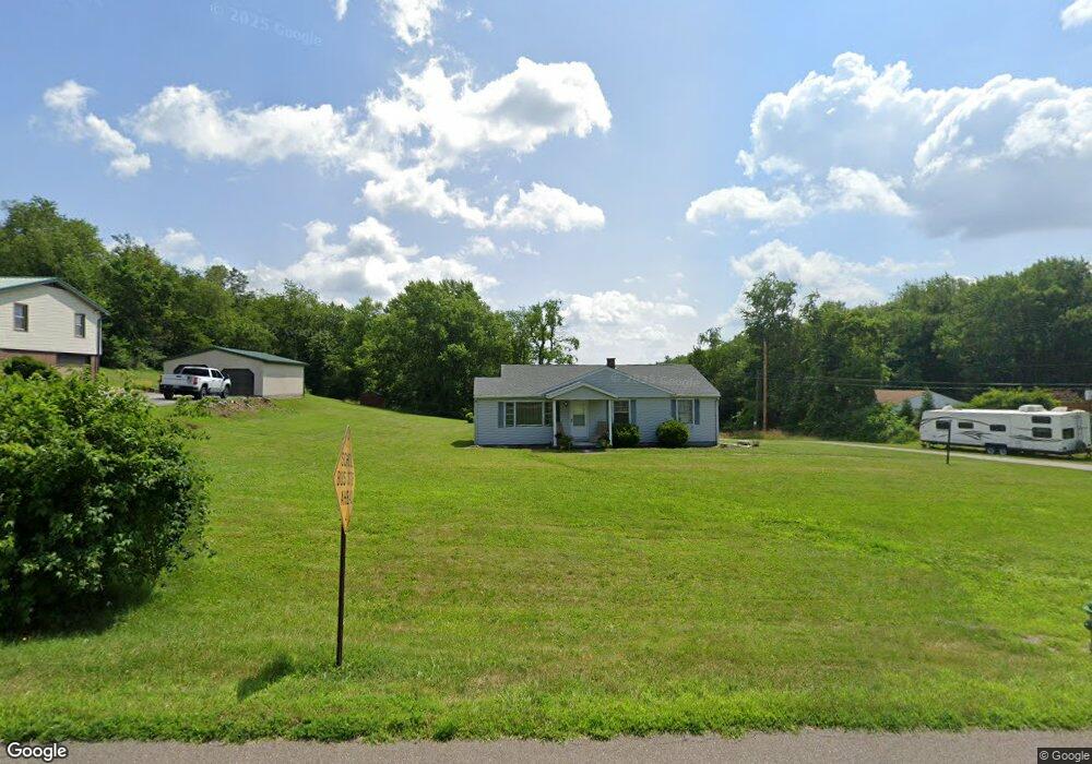
1167 Mick Rd Wellsville, OH 43968
Estimated Value: $97,000 - $151,000
3
Beds
1
Bath
1,218
Sq Ft
$107/Sq Ft
Est. Value
About This Home
This home is located at 1167 Mick Rd, Wellsville, OH 43968 and is currently estimated at $130,608, approximately $107 per square foot. 1167 Mick Rd is a home located in Columbiana County with nearby schools including Garfield Elementary School, Daw Elementary School, and Wellsville Jr./Sr. High School.
Ownership History
Date
Name
Owned For
Owner Type
Purchase Details
Closed on
Sep 1, 2023
Bought by
Eric M Dougherty
Current Estimated Value
Home Financials for this Owner
Home Financials are based on the most recent Mortgage that was taken out on this home.
Interest Rate
7.18%
Purchase Details
Closed on
Nov 23, 2022
Bought by
Coleen Rosenlieb
Home Financials for this Owner
Home Financials are based on the most recent Mortgage that was taken out on this home.
Interest Rate
6.58%
Create a Home Valuation Report for This Property
The Home Valuation Report is an in-depth analysis detailing your home's value as well as a comparison with similar homes in the area
Home Values in the Area
Average Home Value in this Area
Purchase History
| Date | Buyer | Sale Price | Title Company |
|---|---|---|---|
| Eric M Dougherty | $90,000 | -- | |
| Coleen Rosenlieb | -- | -- |
Source: Public Records
Mortgage History
| Date | Status | Borrower | Loan Amount |
|---|---|---|---|
| Closed | Eric M Dougherty | -- | |
| Previous Owner | Eric M Dougherty | -- |
Source: Public Records
Tax History Compared to Growth
Tax History
| Year | Tax Paid | Tax Assessment Tax Assessment Total Assessment is a certain percentage of the fair market value that is determined by local assessors to be the total taxable value of land and additions on the property. | Land | Improvement |
|---|---|---|---|---|
| 2024 | $912 | $27,200 | $4,870 | $22,330 |
| 2023 | $906 | $27,200 | $4,870 | $22,330 |
| 2022 | $598 | $27,200 | $4,870 | $22,330 |
| 2021 | $464 | $22,340 | $4,660 | $17,680 |
| 2020 | $464 | $22,340 | $4,660 | $17,680 |
| 2019 | $481 | $22,340 | $4,660 | $17,680 |
| 2018 | $431 | $20,310 | $4,240 | $16,070 |
| 2017 | $440 | $20,310 | $4,240 | $16,070 |
| 2016 | $440 | $20,060 | $4,100 | $15,960 |
| 2015 | $439 | $20,060 | $4,100 | $15,960 |
| 2014 | $410 | $20,060 | $4,100 | $15,960 |
Source: Public Records
Map
Nearby Homes
- 1087 Hillcrest Rd
- 0 Hibbetts-Mill Rd
- 1370 Hillcrest Rd
- 1010 Hibbetts Mill Rd
- 319 Ridge Ave
- 401 Broadway Ave
- 405 Main St
- 616 Washington Ave
- 609 Broadway Ave
- 1715 Brandon Dr
- 525 Riverside Ave
- 602 Main St
- 923 Wood St
- 17140 Cannons Mill Rd
- 817 Broadway Ave
- 738 Main St
- 928 Main St
- 1019 Commerce St
- 1952 Dunn Rd
- 909 Riverside Ave