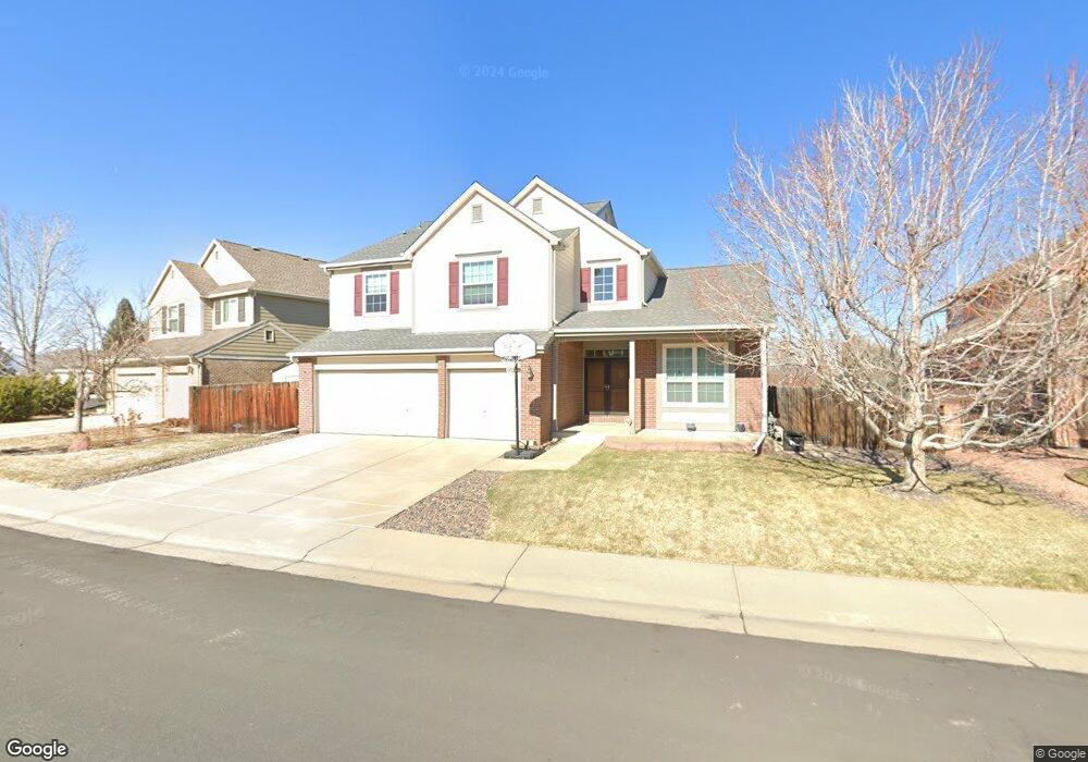
1167 W 126th Ct Denver, CO 80234
Home Farm NeighborhoodEstimated Value: $783,520 - $990,000
4
Beds
4
Baths
2,970
Sq Ft
$289/Sq Ft
Est. Value
About This Home
This home is located at 1167 W 126th Ct, Denver, CO 80234 and is currently estimated at $859,130, approximately $289 per square foot. 1167 W 126th Ct is a home located in Adams County with nearby schools including Arapahoe Ridge Elementary School, Silver Hills Middle School, and Mountain Range High School.
Ownership History
Date
Name
Owned For
Owner Type
Purchase Details
Closed on
Mar 10, 2005
Sold by
Ross Michael R and Ross Cynthia B
Bought by
The Michael R Ross Trust
Current Estimated Value
Purchase Details
Closed on
Jan 29, 1999
Sold by
Smith Diane and Goncalves Greg T
Bought by
Goncalves Diane and Goncalves Greg T
Purchase Details
Closed on
Jul 22, 1998
Sold by
Colorado North Company Llc
Bought by
Ross Michael R and Ross Cynthia B
Home Financials for this Owner
Home Financials are based on the most recent Mortgage that was taken out on this home.
Original Mortgage
$227,150
Outstanding Balance
$41,665
Interest Rate
7.05%
Estimated Equity
$817,465
Create a Home Valuation Report for This Property
The Home Valuation Report is an in-depth analysis detailing your home's value as well as a comparison with similar homes in the area
Home Values in the Area
Average Home Value in this Area
Purchase History
| Date | Buyer | Sale Price | Title Company |
|---|---|---|---|
| The Michael R Ross Trust | -- | -- | |
| Goncalves Diane | -- | -- | |
| Ross Michael R | $312,488 | Land Title |
Source: Public Records
Mortgage History
| Date | Status | Borrower | Loan Amount |
|---|---|---|---|
| Open | Ross Michael R | $227,150 |
Source: Public Records
Tax History
| Year | Tax Paid | Tax Assessment Tax Assessment Total Assessment is a certain percentage of the fair market value that is determined by local assessors to be the total taxable value of land and additions on the property. | Land | Improvement |
|---|---|---|---|---|
| 2025 | $4,775 | $56,230 | $9,790 | $46,440 |
| 2024 | $4,775 | $51,690 | $9,000 | $42,690 |
| 2023 | $4,724 | $58,990 | $9,740 | $49,250 |
| 2022 | $3,667 | $41,840 | $10,010 | $31,830 |
| 2021 | $3,788 | $41,840 | $10,010 | $31,830 |
| 2020 | $4,202 | $39,470 | $10,300 | $29,170 |
| 2019 | $4,210 | $39,470 | $10,300 | $29,170 |
| 2018 | $3,868 | $35,080 | $7,200 | $27,880 |
| 2017 | $3,490 | $35,080 | $7,200 | $27,880 |
| 2016 | $3,513 | $34,240 | $6,770 | $27,470 |
| 2015 | $3,508 | $34,240 | $6,770 | $27,470 |
| 2014 | $3,393 | $32,090 | $5,890 | $26,200 |
Source: Public Records
Map
Nearby Homes
- 1010 Home Farm Cir
- 12705 Kalamath Ct
- 945 W 128th Place
- 931 W 128th Place
- 870 W 128th Place
- 851 W 128th Place
- 811 W 128th Place
- 12880 Inca St
- 807 W 129th Place
- 1942 W 130th Dr
- 860 W 132nd Ave Unit 188
- 860 W 132nd Ave Unit 14
- 860 W 132nd Ave Unit 220
- 860 W 132nd Ave Unit 235
- 860 W 132nd Ave Unit 112
- 12532 Alcott St
- 552 W 128th Place
- 12599 Alcott St
- 860 W 132nd Ave Unit 179
- 860 W 132nd Ave Unit 47
- 1177 W 126th Ct
- 1157 W 126th Ct
- 1147 W 126th Ct
- 1180 W 127th Ct
- 1160 W 127th Ct
- 1187 W 126th Ct
- 1158 W 126th Ct
- 1148 W 126th Ct
- 1168 W 126th Ct
- 1178 W 126th Ct
- 1138 W 126th Ct
- 1197 W 126th Ct
- 1137 W 126th Ct
- 1188 W 126th Ct
- 1190 W 127th Ct
- 1128 W 126th Ct
- 1198 W 126th Ct
- 1075 W 125th Dr
- 1095 W 125th Dr
- 1065 W 125th Dr
Your Personal Tour Guide
Ask me questions while you tour the home.