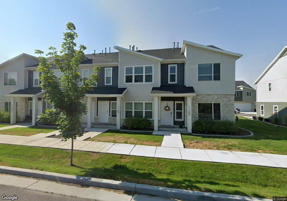
1167 W 1820 S Logan, UT 84321
Woodruff NeighborhoodEstimated Value: $309,000 - $322,000
--
Bed
--
Bath
1,440
Sq Ft
$221/Sq Ft
Est. Value
About This Home
This home is located at 1167 W 1820 S, Logan, UT 84321 and is currently estimated at $317,555, approximately $220 per square foot. 1167 W 1820 S is a home with nearby schools including Woodruff School, Mount Logan Middle School, and Logan High School.
Ownership History
Date
Name
Owned For
Owner Type
Purchase Details
Closed on
Oct 22, 2021
Sold by
Visionary Homes 2020 Llc
Bought by
Tolman Kimberly P and Tolman Christopher H
Current Estimated Value
Home Financials for this Owner
Home Financials are based on the most recent Mortgage that was taken out on this home.
Original Mortgage
$314,105
Interest Rate
2.8%
Mortgage Type
FHA
Purchase Details
Closed on
Oct 9, 2020
Sold by
Land Haven Inc
Bought by
Homes 2020 Llc
Purchase Details
Closed on
Mar 26, 2020
Sold by
Sterling Land Holdings Llc
Bought by
Land Haven Inc
Home Financials for this Owner
Home Financials are based on the most recent Mortgage that was taken out on this home.
Original Mortgage
$738,523
Interest Rate
2.8%
Mortgage Type
Commercial
Create a Home Valuation Report for This Property
The Home Valuation Report is an in-depth analysis detailing your home's value as well as a comparison with similar homes in the area
Home Values in the Area
Average Home Value in this Area
Purchase History
| Date | Buyer | Sale Price | Title Company |
|---|---|---|---|
| Tolman Kimberly P | -- | Cache Title Logan | |
| Homes 2020 Llc | -- | Cache Title Logan | |
| Land Haven Inc | -- | Cache Title Logan |
Source: Public Records
Mortgage History
| Date | Status | Borrower | Loan Amount |
|---|---|---|---|
| Previous Owner | Tolman Kimberly P | $314,105 | |
| Previous Owner | Land Haven Inc | $738,523 |
Source: Public Records
Tax History Compared to Growth
Tax History
| Year | Tax Paid | Tax Assessment Tax Assessment Total Assessment is a certain percentage of the fair market value that is determined by local assessors to be the total taxable value of land and additions on the property. | Land | Improvement |
|---|---|---|---|---|
| 2024 | $1,436 | $179,850 | $0 | $0 |
| 2023 | $1,404 | $167,695 | $0 | $0 |
| 2022 | $1,677 | $186,945 | $0 | $0 |
| 2021 | $406 | $38,500 | $38,500 | $0 |
Source: Public Records
Map
Nearby Homes
- 1183 W 1820 S
- 1230 W 1820 S
- 1221 W 1870 S
- 1220 W 1870 S Unit M111
- 2258 S 1120 W Unit 73
- 2250 S 1120 W Unit 71
- 2254 S 1120 W Unit 72
- 2242 S 1120 W Unit 69
- 2246 S 1120 W Unit 70
- 2238 S 1120 W Unit 68
- 2214 S 1120 W Unit 67
- 2206 S 1120 W Unit 65
- 2202 S 1120 W Unit 64
- 1324 W 1800 S
- 1177 W 1960 S
- 1950 S 1250 W
- 1777 S 1330 W
- 1350 W 1750 S
- 1387 W 1825 S
- 1580 S 1330 W
- 1165 W 1820 S
- 1169 W 1820 S
- 1163 W 1820 S
- 1173 W 1820 S
- 1153 W 1820 S
- 1177 W 1820 S
- 1168 W 1820 S Unit 75
- 1164 W 1820 S
- 1170 W 1820 S Unit 74
- 1162 W 1820 S Unit 77
- 1172 W 1820 S Unit AC 73
- 1149 W 1820 S
- 1160 W 1820 S
- 1174 W 1820 S Unit 72
- 1158 W 1820 S Unit AA79
- 1147 W 1820 S
- 1158 W 1780 S
- 1174 W 1780 S
- 1148 W 1820 S Unit Y80
- 1180 W 1820 S