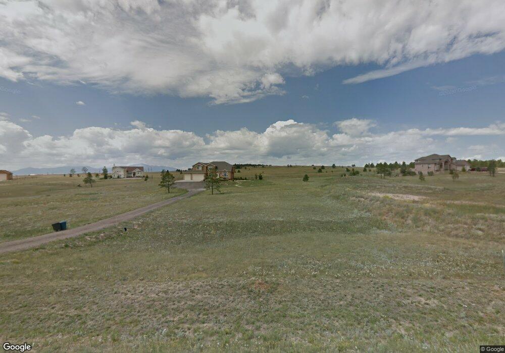
11670 Sir Galahad Dr Colorado Springs, CO 80908
Estimated Value: $1,102,000 - $1,553,000
5
Beds
4
Baths
5,503
Sq Ft
$237/Sq Ft
Est. Value
About This Home
This home is located at 11670 Sir Galahad Dr, Colorado Springs, CO 80908 and is currently estimated at $1,302,032, approximately $236 per square foot. 11670 Sir Galahad Dr is a home located in El Paso County with nearby schools including Bennett Ranch Elementary School, Falcon Middle School, and Falcon High School.
Ownership History
Date
Name
Owned For
Owner Type
Purchase Details
Closed on
May 20, 2015
Sold by
Queen Carole D and Queen Christopher E
Bought by
Nash John David and Nash Amy L
Current Estimated Value
Home Financials for this Owner
Home Financials are based on the most recent Mortgage that was taken out on this home.
Original Mortgage
$417,000
Outstanding Balance
$321,242
Interest Rate
3.68%
Mortgage Type
New Conventional
Estimated Equity
$980,790
Purchase Details
Closed on
Apr 7, 2008
Sold by
Mills Randy P and Mills Jennifer R
Bought by
Queen Carole D and Queen Christopher E
Home Financials for this Owner
Home Financials are based on the most recent Mortgage that was taken out on this home.
Original Mortgage
$408,000
Interest Rate
6.11%
Mortgage Type
Unknown
Purchase Details
Closed on
Mar 31, 2006
Sold by
Transwestern Development Corp
Bought by
Mills Randy P and Mills Jennifer R
Create a Home Valuation Report for This Property
The Home Valuation Report is an in-depth analysis detailing your home's value as well as a comparison with similar homes in the area
Home Values in the Area
Average Home Value in this Area
Purchase History
| Date | Buyer | Sale Price | Title Company |
|---|---|---|---|
| Nash John David | $532,000 | Stewart Title | |
| Queen Carole D | $510,000 | Title America | |
| Mills Randy P | $128,000 | Fahtco |
Source: Public Records
Mortgage History
| Date | Status | Borrower | Loan Amount |
|---|---|---|---|
| Open | Nash John David | $417,000 | |
| Previous Owner | Queen Carole D | $408,000 |
Source: Public Records
Tax History Compared to Growth
Tax History
| Year | Tax Paid | Tax Assessment Tax Assessment Total Assessment is a certain percentage of the fair market value that is determined by local assessors to be the total taxable value of land and additions on the property. | Land | Improvement |
|---|---|---|---|---|
| 2025 | $6,095 | $81,590 | -- | -- |
| 2024 | $5,969 | $88,850 | $14,630 | $74,220 |
| 2022 | $3,914 | $56,370 | $11,330 | $45,040 |
| 2021 | $3,707 | $52,820 | $11,660 | $41,160 |
| 2020 | $3,255 | $46,160 | $10,190 | $35,970 |
| 2019 | $3,225 | $46,160 | $10,190 | $35,970 |
| 2018 | $2,713 | $38,170 | $8,280 | $29,890 |
| 2017 | $2,485 | $38,170 | $8,280 | $29,890 |
| 2016 | $2,425 | $36,760 | $9,160 | $27,600 |
| 2015 | $2,427 | $36,760 | $9,160 | $27,600 |
| 2014 | $2,473 | $36,760 | $9,320 | $27,440 |
Source: Public Records
Map
Nearby Homes
- 12188 Goodson Rd
- 12196 Goodson Rd
- 11824 Black Hills Dr
- 12155 Spine Creek Place
- 0 Goodson Rd
- 12150 Fox Brush Dr
- 12190 Smoke Bluffs Rd
- 11504 Blackcomb Trail
- 10973 Torreys Peak Way
- 10760 Sandlilly Ln
- 12683 Fulford Ct
- 10677 Greenbelt Dr
- 10932 Huron Peak Place
- 10641 Greenbelt Dr
- 10965 Long Summer Ct
- 10530 Pictured Rocks Dr
- 11135 Pemble Ct
- 11134 Lobo Peak Dr
- 10853 Torreys Peak Way
- 10467 Pictured Rocks Dr
- 11630 Sir Galahad Dr
- 11840 Old England Dr
- 11675 Sir Galahad Dr
- 11590 Sir Galahad Dr
- 11550 Sir Galahad Dr
- 11555 Sir Galahad Dr
- 11755 Sir Galahad Dr
- 11875 Old England Dr
- 11795 Sir Galahad Dr
- 11880 Old England Dr
- 11830 Sir Galahad Dr
- 11650 N Meridian Rd
- 11920 Old England Dr
- 11915 Old England Dr
- 11870 Sir Galahad Dr
- 11680 N Meridian Rd
- 11490 Guinevere Ct
- 11410 Guinevere Ct
- 11960 Old England Dr
- 11550 N Meridian Rd