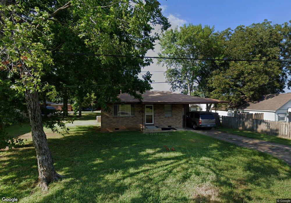
1168 Gist St Conway, AR 72032
Downtown Conway NeighborhoodEstimated Value: $110,000 - $163,000
--
Bed
2
Baths
1,204
Sq Ft
$120/Sq Ft
Est. Value
About This Home
This home is located at 1168 Gist St, Conway, AR 72032 and is currently estimated at $144,126, approximately $119 per square foot. 1168 Gist St is a home located in Faulkner County with nearby schools including Ida Burns Elementary School, Conway Junior High School, and Ruth Doyle Intermediate School.
Ownership History
Date
Name
Owned For
Owner Type
Purchase Details
Closed on
Jan 19, 2015
Bought by
Burnside Bobbie
Current Estimated Value
Purchase Details
Closed on
May 18, 2006
Bought by
Trent Hawk Patton Llc
Purchase Details
Closed on
Jan 11, 2006
Bought by
Rufus Hawk
Purchase Details
Closed on
Dec 1, 2005
Bought by
Trent Hawk Patton Llc
Purchase Details
Closed on
Apr 13, 1995
Bought by
Corrects 586-449
Create a Home Valuation Report for This Property
The Home Valuation Report is an in-depth analysis detailing your home's value as well as a comparison with similar homes in the area
Home Values in the Area
Average Home Value in this Area
Purchase History
| Date | Buyer | Sale Price | Title Company |
|---|---|---|---|
| Burnside Bobbie | $62,000 | -- | |
| Trent Hawk Patton Llc | -- | -- | |
| Rufus Hawk | -- | -- | |
| Trent Hawk Patton Llc | -- | -- | |
| Corrects 586-449 | -- | -- |
Source: Public Records
Tax History Compared to Growth
Tax History
| Year | Tax Paid | Tax Assessment Tax Assessment Total Assessment is a certain percentage of the fair market value that is determined by local assessors to be the total taxable value of land and additions on the property. | Land | Improvement |
|---|---|---|---|---|
| 2025 | $618 | $25,620 | $6,000 | $19,620 |
| 2024 | $618 | $25,620 | $6,000 | $19,620 |
| 2023 | $618 | $18,330 | $6,000 | $12,330 |
| 2022 | $243 | $18,330 | $6,000 | $12,330 |
| 2021 | $243 | $18,330 | $6,000 | $12,330 |
| 2020 | $243 | $12,220 | $2,700 | $9,520 |
| 2019 | $243 | $12,220 | $2,700 | $9,520 |
| 2018 | $268 | $12,220 | $2,700 | $9,520 |
| 2017 | $268 | $12,220 | $2,700 | $9,520 |
| 2016 | $268 | $12,220 | $2,700 | $9,520 |
| 2015 | $618 | $12,220 | $2,700 | $9,520 |
| 2014 | $618 | $12,580 | $2,700 | $9,880 |
Source: Public Records
Map
Nearby Homes
- 1800 Altus St
- 860 Steel Ave
- 1527 Clifton St
- 1813 Tyler St
- 1535 Clifton St
- 2107 West St
- 1311 Clifton St
- 1309 Clifton St
- 1905 Hutto St
- 1906 Hutto St
- 1834 Johnston Ave
- 1220 & 1221 Ash St
- 1522 Mill St
- 2007 Arkansas Ave
- 1150 Clifton St
- 807 Walnut St
- 2010 Hairston St
- 0 Lee Ave
- 1415 Watkins St
- 1000 Grandview Heights Dr
- 1170 Gist St
- 1903 Harkrider St
- 1908 Cleveland St
- 1907 Harkrider St
- 1161 Gist St Unit 1171
- 1813 Harkrider St Unit 1152 Hunter Street
- 1912 Cleveland St
- 1818 Cleveland St Unit 1818 1/2
- 1907 Cleveland St
- 1907 Cleveland St
- 1811 Harkrider St
- 1909 Cleveland St Unit 1907
- 1911 Cleveland St
- 1815 Cleveland St
- 1918 Cleveland St Unit 1920
- 1915 Cleveland St
- 1809 Cleveland St
- 1950 Harkrider St
- 1156 Hunter St
- 1152 Hunter St