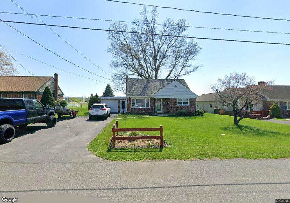
1168 Wea Wit St East Earl, PA 17519
Estimated Value: $286,000 - $357,000
3
Beds
1
Bath
880
Sq Ft
$351/Sq Ft
Est. Value
About This Home
This home is located at 1168 Wea Wit St, East Earl, PA 17519 and is currently estimated at $308,602, approximately $350 per square foot. 1168 Wea Wit St is a home located in Lancaster County with nearby schools including Garden Spot Middle School, Garden Spot Senior High School, and Conestoga Parochial School.
Ownership History
Date
Name
Owned For
Owner Type
Purchase Details
Closed on
Jan 27, 1999
Sold by
Martin Merle K and Martin Donna J
Bought by
Northeimer Linda
Current Estimated Value
Home Financials for this Owner
Home Financials are based on the most recent Mortgage that was taken out on this home.
Original Mortgage
$104,000
Outstanding Balance
$24,468
Interest Rate
6.67%
Estimated Equity
$284,134
Create a Home Valuation Report for This Property
The Home Valuation Report is an in-depth analysis detailing your home's value as well as a comparison with similar homes in the area
Home Values in the Area
Average Home Value in this Area
Purchase History
| Date | Buyer | Sale Price | Title Company |
|---|---|---|---|
| Northeimer Linda | $109,500 | -- |
Source: Public Records
Mortgage History
| Date | Status | Borrower | Loan Amount |
|---|---|---|---|
| Open | Northeimer Linda | $104,000 |
Source: Public Records
Tax History Compared to Growth
Tax History
| Year | Tax Paid | Tax Assessment Tax Assessment Total Assessment is a certain percentage of the fair market value that is determined by local assessors to be the total taxable value of land and additions on the property. | Land | Improvement |
|---|---|---|---|---|
| 2025 | $2,398 | $133,900 | $48,300 | $85,600 |
| 2024 | $2,398 | $133,900 | $48,300 | $85,600 |
| 2023 | $2,363 | $133,900 | $48,300 | $85,600 |
| 2022 | $2,338 | $133,900 | $48,300 | $85,600 |
| 2021 | $2,301 | $133,900 | $48,300 | $85,600 |
| 2020 | $2,301 | $133,900 | $48,300 | $85,600 |
| 2019 | $2,276 | $133,900 | $48,300 | $85,600 |
| 2018 | $3,189 | $133,900 | $48,300 | $85,600 |
| 2017 | $2,578 | $123,800 | $37,000 | $86,800 |
| 2016 | $2,578 | $123,800 | $37,000 | $86,800 |
| 2015 | $716 | $123,800 | $37,000 | $86,800 |
| 2014 | $1,720 | $123,800 | $37,000 | $86,800 |
Source: Public Records
Map
Nearby Homes
- 1276 Martin St
- 1215 Shetland Cir
- 1220 Shetland Cir
- 529 Ranck Rd Unit 6
- 529 Ranck Rd Unit 10
- 529 Ranck Rd Unit 9
- 529 Ranck Rd Unit 8
- 529 Ranck Rd Unit 5
- 529 Ranck Rd Unit 4
- 529 Ranck Rd Unit 3
- 529 Ranck Rd Unit 2
- 529 Ranck Rd Unit 1
- 1145 Brownstone Ridge
- 590 E Jackson St
- 44 Emily Ln
- 13 Amber Cir
- 28 Hearth Dr
- 113 Windsock Way
- 300 Jared Way
- 404 Jared Way
- 1172 Wea Wit St
- 1164 Wea Wit St
- 1176 Wea Wit St
- 1162 Wea Wit St
- 1163 Wea Wit St
- 1167 Wea Wit St
- 1161 Wea Wit St
- 214 Musser Rd
- 1160 Wea Wit St
- 1171 Wea Wit St
- 210 Musser Rd
- 1159 Wea Wit St
- 1175 Wea Wit St
- 1158 Wea Wit St
- 1157 Weawit St
- 1170 Rose Ave
- 1166 Rose Ave
- 1174 Rose Ave
- 1156 Wea Wit St
- 1162 Rose Ave