Estimated Value: $886,000 - $1,209,874
2
Beds
3
Baths
2,064
Sq Ft
$508/Sq Ft
Est. Value
About This Home
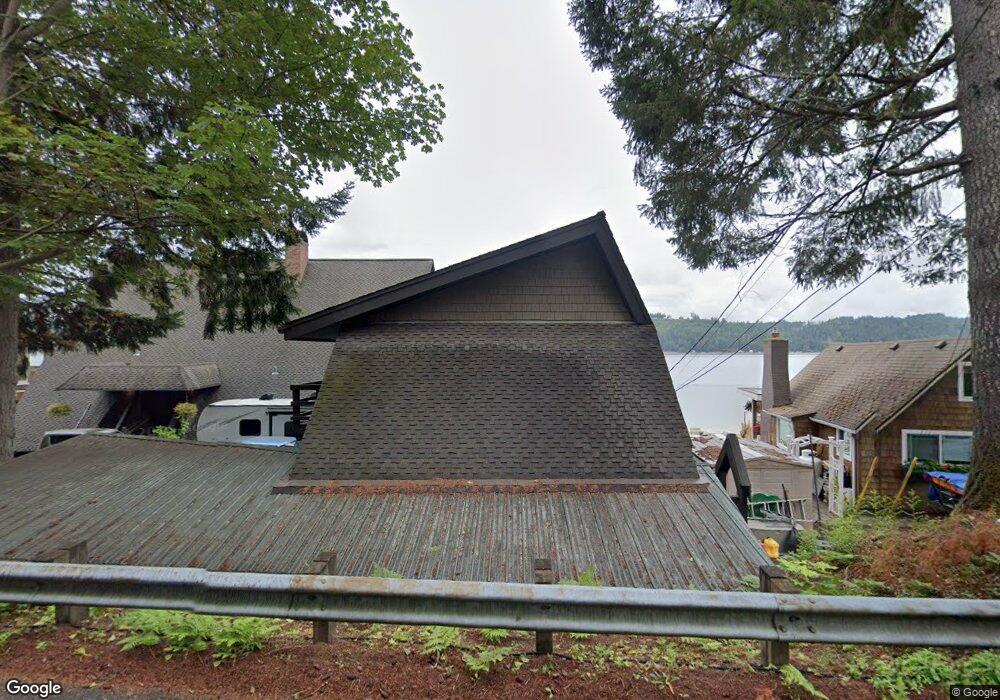
This home is located at 11683 St Rte 106, Union, WA 98592 and is currently estimated at $1,047,937, approximately $507 per square foot. 11683 St Rte 106 is a home located in Mason County.
Ownership History
Date
Name
Owned For
Owner Type
Purchase Details
Closed on
Oct 12, 2016
Sold by
Mccauley Robert L and Mccauley Pamela A
Bought by
Litaker Thomas
Current Estimated Value
Home Financials for this Owner
Home Financials are based on the most recent Mortgage that was taken out on this home.
Original Mortgage
$417,000
Outstanding Balance
$334,304
Interest Rate
3.46%
Mortgage Type
New Conventional
Estimated Equity
$713,633
Purchase Details
Closed on
Sep 22, 2011
Sold by
David Tracy A and Estate Of Barbara F Austin
Bought by
Mccauley Robert L
Home Financials for this Owner
Home Financials are based on the most recent Mortgage that was taken out on this home.
Original Mortgage
$417,000
Interest Rate
4.26%
Mortgage Type
New Conventional
Purchase Details
Closed on
Nov 30, 2005
Sold by
Windward Trust
Bought by
Austin Barbara F
Create a Home Valuation Report for This Property
The Home Valuation Report is an in-depth analysis detailing your home's value as well as a comparison with similar homes in the area
Home Values in the Area
Average Home Value in this Area
Purchase History
| Date | Buyer | Sale Price | Title Company |
|---|---|---|---|
| Litaker Thomas | $625,280 | Land Title Co | |
| Mccauley Robert L | $575,280 | Masaon County Title Ins | |
| Austin Barbara F | -- | None Available |
Source: Public Records
Mortgage History
| Date | Status | Borrower | Loan Amount |
|---|---|---|---|
| Open | Litaker Thomas | $417,000 | |
| Previous Owner | Mccauley Robert L | $417,000 |
Source: Public Records
Tax History Compared to Growth
Tax History
| Year | Tax Paid | Tax Assessment Tax Assessment Total Assessment is a certain percentage of the fair market value that is determined by local assessors to be the total taxable value of land and additions on the property. | Land | Improvement |
|---|---|---|---|---|
| 2025 | $9,072 | $1,127,195 | $214,820 | $912,375 |
| 2024 | $9,072 | $1,254,730 | $214,820 | $1,039,910 |
| 2023 | $8,827 | $1,056,715 | $363,610 | $693,105 |
| 2022 | $9,917 | $1,086,075 | $274,430 | $811,645 |
| 2021 | $7,057 | $1,086,075 | $274,430 | $811,645 |
| 2020 | $8,622 | $788,270 | $261,355 | $526,915 |
| 2018 | $8,250 | $709,665 | $348,470 | $361,195 |
| 2017 | $7,505 | $709,695 | $348,500 | $361,195 |
| 2016 | $7,791 | $660,265 | $331,905 | $328,360 |
| 2015 | $7,889 | $691,060 | $353,775 | $337,285 |
| 2014 | -- | $689,755 | $369,675 | $320,080 |
| 2013 | -- | $667,505 | $357,750 | $309,755 |
Source: Public Records
Map
Nearby Homes
- 10271 NE North Shore Rd
- 40 NE Brook Dr
- 121 E Woods Place
- 61 E Woods Place
- 991 NE Hurd Rd
- 1173 NE Hurd Rd
- 0 NE Hurd Rd Unit NWM2408700
- 62 Southridge Dr
- 110 E Canyon View Rd
- 361 Southridge Dr
- 151 E Hillside Dr
- 0 E Twanoh Heights Rd N Unit NWM2454609
- 40 E Seahawks Way
- 14103 E State Route 106
- 151 E Kingsley Place
- 14160 Washington 106
- 0 E Windstar Rd Unit NWM2436680
- 14341 Washington 106
- 30 NE Lake Place
- 241 NE Lakeshore Dr S
- 11683 E State Route 106
- 11711 E State Route 106
- 11681 E State Route 106
- 11661 E State Route 106
- 11721 E State Route 106
- 11661 Washington 106 Unit F
- 11661 Washington 106 Unit G
- 11731 E State Route 106
- 11751 E State Route 106
- 11730 E State Route 106
- 11734 E State Route 106
- 11771 E State Route 106
- 11631 E State Route 106
- 11791 E State Route 106
- 11621 Washington 106
- 11740 E State Route 106
- 11621 E State Route 106
- 11801 E State Route 106
- 11601 E State Route 106
- 11591 Washington 106