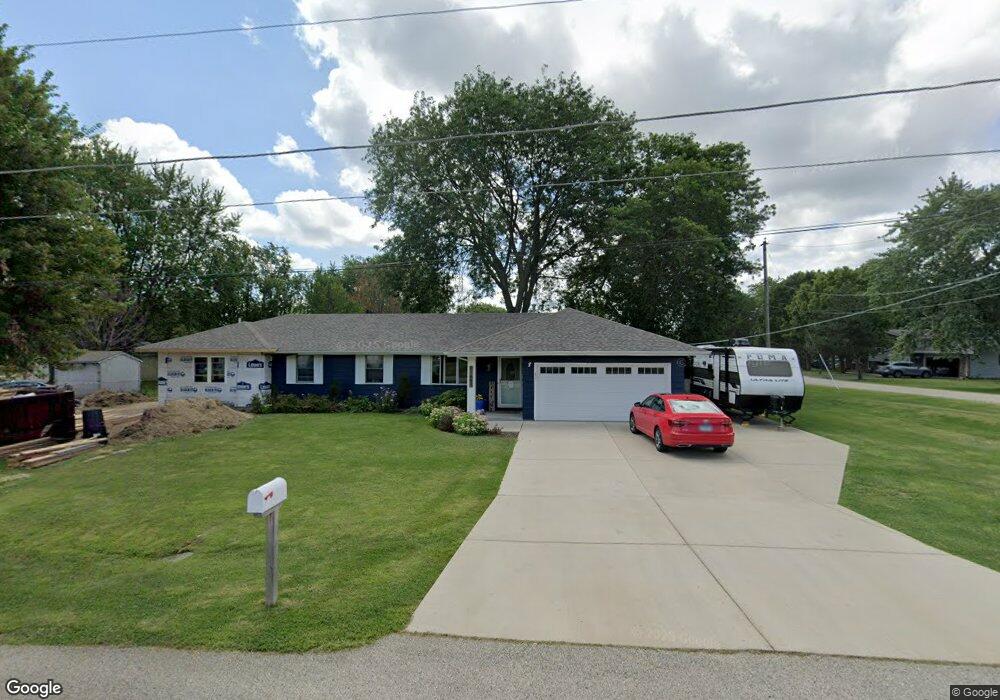
11685 W 11th St Zion, IL 60099
Shore Acres NeighborhoodEstimated Value: $199,000 - $307,000
3
Beds
2
Baths
1,277
Sq Ft
$208/Sq Ft
Est. Value
About This Home
This home is located at 11685 W 11th St, Zion, IL 60099 and is currently estimated at $266,103, approximately $208 per square foot. 11685 W 11th St is a home located in Lake County with nearby schools including Kenneth Murphy School, Beach Park Middle School, and Zion-Benton Township High School.
Ownership History
Date
Name
Owned For
Owner Type
Purchase Details
Closed on
Jun 14, 2001
Sold by
Kennedy William H
Bought by
Braden William L and Braden Katherine A
Current Estimated Value
Home Financials for this Owner
Home Financials are based on the most recent Mortgage that was taken out on this home.
Original Mortgage
$124,440
Outstanding Balance
$47,298
Interest Rate
7.11%
Mortgage Type
VA
Estimated Equity
$218,805
Create a Home Valuation Report for This Property
The Home Valuation Report is an in-depth analysis detailing your home's value as well as a comparison with similar homes in the area
Home Values in the Area
Average Home Value in this Area
Purchase History
| Date | Buyer | Sale Price | Title Company |
|---|---|---|---|
| Braden William L | $122,000 | -- |
Source: Public Records
Mortgage History
| Date | Status | Borrower | Loan Amount |
|---|---|---|---|
| Open | Braden William L | $124,440 |
Source: Public Records
Tax History Compared to Growth
Tax History
| Year | Tax Paid | Tax Assessment Tax Assessment Total Assessment is a certain percentage of the fair market value that is determined by local assessors to be the total taxable value of land and additions on the property. | Land | Improvement |
|---|---|---|---|---|
| 2024 | $4,967 | $67,288 | $9,942 | $57,346 |
| 2023 | $4,798 | $58,672 | $9,597 | $49,075 |
| 2022 | $4,798 | $54,167 | $9,375 | $44,792 |
| 2021 | $4,680 | $50,319 | $9,137 | $41,182 |
| 2020 | $4,564 | $48,019 | $8,719 | $39,300 |
| 2019 | $4,546 | $45,559 | $8,272 | $37,287 |
| 2018 | $5,249 | $50,160 | $10,042 | $40,118 |
| 2017 | $5,201 | $47,187 | $9,447 | $37,740 |
| 2016 | $5,050 | $44,923 | $8,994 | $35,929 |
| 2015 | $4,870 | $41,198 | $8,248 | $32,950 |
| 2014 | $4,225 | $38,545 | $6,867 | $31,678 |
| 2012 | $4,286 | $40,055 | $7,136 | $32,919 |
Source: Public Records
Map
Nearby Homes
- 1304 Pelican Ct
- 1531 Southport Ct
- 1405 Lewis Ave
- 1521 Southport Ct
- 3707 Willow Crest Dr
- 3717 Willow Crest Dr
- 3616 Creekside Ct
- 0 9th St
- 42908 N Lewis Ave
- 4014 Ridge Rd
- 1417 Westside Trail
- 1302 Lorelei Dr
- 1703 Hermon Ave
- 3106 13th St
- 1817 Joppa Ave
- 43100 N Lewis Ave
- 1814 Jethro Ave
- 1807 Horeb Ave
- 1701 Galilee Ave
- 429 Megan Place
- 42215 N Hanks Ave
- 11647 W 11th St
- 42263 N Hanks Ave
- 42238 N Hanks Ave
- 11646 W 11th St
- 42177 N Hanks Ave
- 42216 N Hanks Ave
- 42176 N Fago Ave
- 42281 N Hanks Ave
- 42276 N Hanks Ave
- 42237 N Hayner Ave
- 11623 W 11th St
- 42280 N Fago Ave
- 42215 N Hayner Ave
- 42215 N Fago Ave
- 11622 W 11th St
- 42163 N Hanks Ave
- 11722 W 11th St
- 42162 N Fago Ave
- 42177 N Hayner Ave