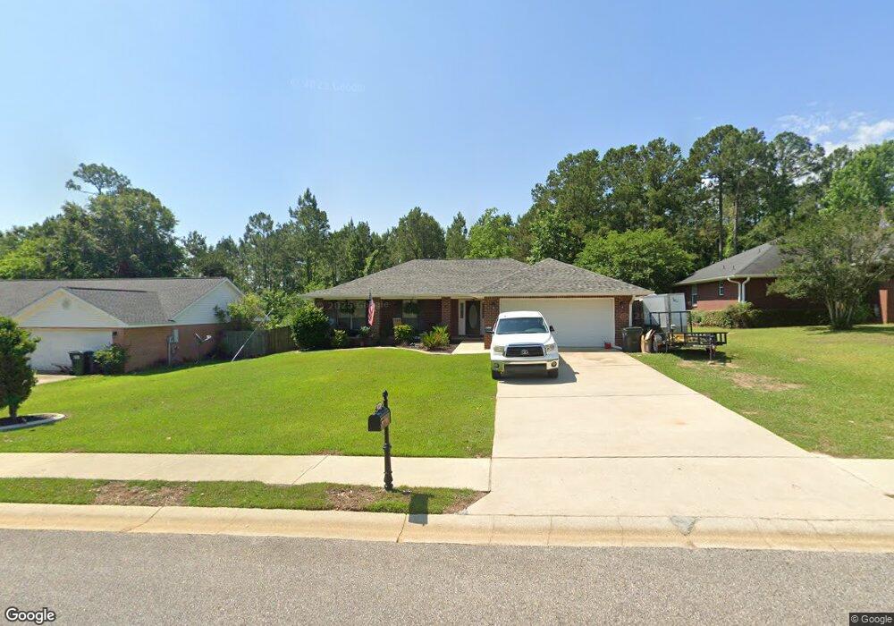
11686 Balsam Ct Spanish Fort, AL 36527
Estimated Value: $297,000 - $329,000
4
Beds
2
Baths
1,760
Sq Ft
$177/Sq Ft
Est. Value
About This Home
This home is located at 11686 Balsam Ct, Spanish Fort, AL 36527 and is currently estimated at $312,158, approximately $177 per square foot. 11686 Balsam Ct is a home located in Baldwin County with nearby schools including Rockwell Elementary School, Spanish Fort Middle School, and Spanish Fort High School.
Ownership History
Date
Name
Owned For
Owner Type
Purchase Details
Closed on
Nov 2, 2023
Sold by
Olson Brian Wayne
Bought by
Brian Wayne Olson Irrevocable Trust and Olson
Current Estimated Value
Purchase Details
Closed on
Sep 16, 2008
Sold by
Foster Joseph P and Foster Anita N
Bought by
Olson Brian W
Home Financials for this Owner
Home Financials are based on the most recent Mortgage that was taken out on this home.
Original Mortgage
$151,200
Interest Rate
6.49%
Mortgage Type
Purchase Money Mortgage
Purchase Details
Closed on
Jul 30, 2008
Sold by
Boldman Scott K and Boldman Lisa M
Bought by
Foster Joseph P and Foster Anita N
Home Financials for this Owner
Home Financials are based on the most recent Mortgage that was taken out on this home.
Original Mortgage
$151,200
Interest Rate
6.49%
Mortgage Type
Purchase Money Mortgage
Create a Home Valuation Report for This Property
The Home Valuation Report is an in-depth analysis detailing your home's value as well as a comparison with similar homes in the area
Home Values in the Area
Average Home Value in this Area
Purchase History
| Date | Buyer | Sale Price | Title Company |
|---|---|---|---|
| Brian Wayne Olson Irrevocable Trust | -- | None Listed On Document | |
| Olson Brian W | -- | Gtc | |
| Foster Joseph P | -- | Gtc |
Source: Public Records
Mortgage History
| Date | Status | Borrower | Loan Amount |
|---|---|---|---|
| Previous Owner | Olson Brian W | $151,200 | |
| Previous Owner | Foster Joseph P | $114,320 |
Source: Public Records
Tax History Compared to Growth
Tax History
| Year | Tax Paid | Tax Assessment Tax Assessment Total Assessment is a certain percentage of the fair market value that is determined by local assessors to be the total taxable value of land and additions on the property. | Land | Improvement |
|---|---|---|---|---|
| 2024 | $705 | $24,180 | $3,600 | $20,580 |
| 2023 | $680 | $23,380 | $5,880 | $17,500 |
| 2022 | $544 | $19,000 | $0 | $0 |
| 2021 | $489 | $17,140 | $0 | $0 |
| 2020 | $465 | $16,460 | $0 | $0 |
| 2019 | $429 | $16,920 | $0 | $0 |
| 2018 | $401 | $15,940 | $0 | $0 |
| 2017 | $395 | $15,700 | $0 | $0 |
| 2016 | $390 | $15,520 | $0 | $0 |
| 2015 | $392 | $15,620 | $0 | $0 |
| 2014 | $396 | $15,740 | $0 | $0 |
| 2013 | -- | $14,320 | $0 | $0 |
Source: Public Records
Map
Nearby Homes
- 11738 Balsam Ct
- 0 Us Highway 31
- 11546 Whitaker Ave
- 31221 Buckingham Blvd
- 30406 Pinyon Dr
- 30429 Pinyon Dr
- 11548 Forsyth Loop
- Boucher III H Plan at Silver Springs
- Camellia V H Plan at Brentwood
- Raymond IV A Plan at Silver Springs
- Camellia V G Plan at Brentwood
- Irises V H Plan at Brentwood
- Roses V A Plan at Brentwood
- Aubry III A Plan at Silver Springs
- Degas III B Plan at Silver Springs
- Ionia III H Plan at Brentwood
- Comstock III H Plan at Brentwood
- Trillium IV B Plan at Silver Springs
- Nolana IV A Plan at Silver Springs
- Dogwood IV H Plan at Silver Springs
- 11668 Balsam Ct
- 11708 Balsam Ct
- 11656 Balsam Ct
- 11716 Balsam Ct
- 11685 Balsam Ct
- 11707 Balsam Ct
- 11727 Balsam Ct
- 11657 Balsam Ct
- 11723 Madrone Ln
- 11699 Madrone Ln
- 11762 Balsam Ct
- 30738 Pinyon Dr
- 11739 Madrone Ln
- 30752 Pinyon Dr
- 30766 Pinyon Dr
- 11643 Balsam Ct
- 11737 Balsam Ct
- 11693 Madrone Ln
- 11753 Madrone Ln
- 30714 Pinyon Dr