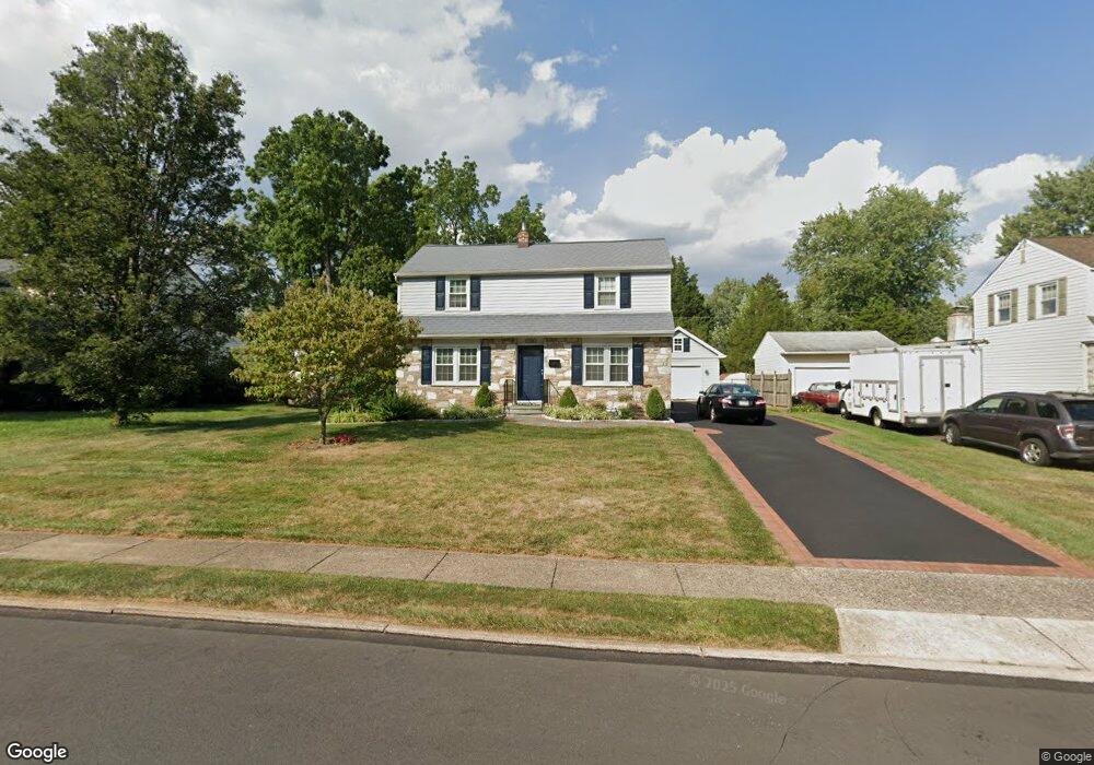
1169 Cambridge Rd Warminster, PA 18974
Estimated Value: $424,000 - $464,000
3
Beds
1
Bath
1,506
Sq Ft
$295/Sq Ft
Est. Value
About This Home
This home is located at 1169 Cambridge Rd, Warminster, PA 18974 and is currently estimated at $444,803, approximately $295 per square foot. 1169 Cambridge Rd is a home located in Bucks County with nearby schools including Willow Dale El School, Log College Middle School, and William Tennent High School.
Ownership History
Date
Name
Owned For
Owner Type
Purchase Details
Closed on
May 22, 1998
Sold by
Depree Cynthia J and Dye Jane H
Bought by
Melnikas Rimas J and Melnikas Elizabeth
Current Estimated Value
Home Financials for this Owner
Home Financials are based on the most recent Mortgage that was taken out on this home.
Original Mortgage
$102,400
Interest Rate
6.99%
Purchase Details
Closed on
Jul 29, 1955
Bought by
Dye Frederick E and Dye Jane H
Create a Home Valuation Report for This Property
The Home Valuation Report is an in-depth analysis detailing your home's value as well as a comparison with similar homes in the area
Home Values in the Area
Average Home Value in this Area
Purchase History
| Date | Buyer | Sale Price | Title Company |
|---|---|---|---|
| Melnikas Rimas J | $128,000 | -- | |
| Dye Frederick E | -- | -- |
Source: Public Records
Mortgage History
| Date | Status | Borrower | Loan Amount |
|---|---|---|---|
| Previous Owner | Melnikas Rimas J | $102,400 |
Source: Public Records
Tax History Compared to Growth
Tax History
| Year | Tax Paid | Tax Assessment Tax Assessment Total Assessment is a certain percentage of the fair market value that is determined by local assessors to be the total taxable value of land and additions on the property. | Land | Improvement |
|---|---|---|---|---|
| 2025 | $5,287 | $25,050 | $4,560 | $20,490 |
| 2024 | $5,287 | $25,050 | $4,560 | $20,490 |
| 2023 | $5,124 | $25,050 | $4,560 | $20,490 |
| 2022 | $5,015 | $25,050 | $4,560 | $20,490 |
| 2021 | $4,898 | $25,050 | $4,560 | $20,490 |
| 2020 | $4,829 | $25,050 | $4,560 | $20,490 |
| 2019 | $4,573 | $25,050 | $4,560 | $20,490 |
| 2018 | $4,463 | $25,050 | $4,560 | $20,490 |
| 2017 | $4,333 | $25,050 | $4,560 | $20,490 |
| 2016 | $4,333 | $25,050 | $4,560 | $20,490 |
| 2015 | $4,254 | $25,050 | $4,560 | $20,490 |
| 2014 | $4,254 | $25,050 | $4,560 | $20,490 |
Source: Public Records
Map
Nearby Homes
- 1130 Victoria Rd
- 1277 Beverly Rd
- 1274 Beverly Rd
- 1309 Clyde Rd
- 1002 Windsor Rd
- 159 Villa Dr Unit 91
- 64 Villa Dr Unit 206
- 100 Villa Dr Unit 224
- 416 Aspen Ln
- 990 Meadow Glen Rd
- 898 Walnut Rd
- Faraday Plan at Liberty Ridge
- Westmont Plan at Liberty Ridge
- Northbrook Plan at Liberty Ridge
- 603 Liberty Ridge Rd
- 605 Liberty Ridge Rd
- 604 Liberty Ridge Rd
- 607 Liberty Ridge Rd
- 611 Liberty Ridge Rd
- 616 Liberty Ridge Rd
- 1175 Cambridge Rd
- 1161 Cambridge Rd
- 1183 Cambridge Rd
- 132 Belair Rd
- 1168 Victoria Rd
- 1160 Victoria Rd
- 1176 Victoria Rd
- 1168 Cambridge Rd
- 1160 Cambridge Rd
- 1176 Cambridge Rd
- 148 Belair Rd
- 1184 Victoria Rd
- 1191 Cambridge Rd
- 108 Belair Rd
- 1184 Cambridge Rd
- 1190 Victoria Rd
- 1190 Cambridge Rd
- 1199 Cambridge Rd
- 145 Belair Rd
- 96 Belair Rd