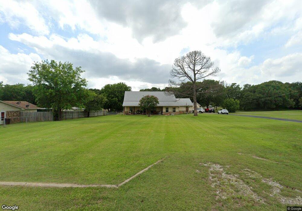
1169 Desvoignes 1 Acre Rd Denison, TX 75021
Estimated Value: $425,904 - $549,000
3
Beds
3
Baths
2,198
Sq Ft
$222/Sq Ft
Est. Value
About This Home
This home is located at 1169 Desvoignes 1 Acre Rd, Denison, TX 75021 and is currently estimated at $487,452, approximately $221 per square foot. 1169 Desvoignes 1 Acre Rd is a home located in Grayson County with nearby schools including Lamar Elementary School, Scott Middle School, and Denison High School.
Ownership History
Date
Name
Owned For
Owner Type
Purchase Details
Closed on
Sep 30, 2024
Sold by
Wade Megan Ann and Sandmann Dustin Wanye
Bought by
Warren Sarah and Warren Michael
Current Estimated Value
Home Financials for this Owner
Home Financials are based on the most recent Mortgage that was taken out on this home.
Original Mortgage
$517,750
Outstanding Balance
$512,450
Interest Rate
6.49%
Mortgage Type
New Conventional
Estimated Equity
-$24,998
Purchase Details
Closed on
Oct 7, 2015
Sold by
Menta William Pio and Stone Patricia Leigh
Bought by
Sandmann Dustin Wayne and Wade Megan Ann
Home Financials for this Owner
Home Financials are based on the most recent Mortgage that was taken out on this home.
Original Mortgage
$190,000
Interest Rate
3.85%
Mortgage Type
New Conventional
Purchase Details
Closed on
Apr 30, 2010
Sold by
Jones Marilyn G and Jones Marilyn Gail
Bought by
Menta William Pio and Stone Patricia Leigh
Create a Home Valuation Report for This Property
The Home Valuation Report is an in-depth analysis detailing your home's value as well as a comparison with similar homes in the area
Home Values in the Area
Average Home Value in this Area
Purchase History
| Date | Buyer | Sale Price | Title Company |
|---|---|---|---|
| Warren Sarah | -- | None Listed On Document | |
| Sandmann Dustin Wayne | -- | None Available | |
| Menta William Pio | -- | Chapin Title Co Inc |
Source: Public Records
Mortgage History
| Date | Status | Borrower | Loan Amount |
|---|---|---|---|
| Open | Warren Sarah | $517,750 | |
| Previous Owner | Sandmann Dustin Wayne | $190,000 |
Source: Public Records
Tax History Compared to Growth
Tax History
| Year | Tax Paid | Tax Assessment Tax Assessment Total Assessment is a certain percentage of the fair market value that is determined by local assessors to be the total taxable value of land and additions on the property. | Land | Improvement |
|---|---|---|---|---|
| 2025 | $4,528 | $389,760 | $56,675 | $333,085 |
| 2024 | $5,912 | $366,056 | $48,850 | $317,206 |
| 2023 | $4,228 | $347,944 | $0 | $0 |
| 2022 | $5,466 | $316,313 | $0 | $0 |
| 2021 | $5,391 | $295,643 | $25,338 | $270,305 |
| 2020 | $5,204 | $261,415 | $13,238 | $248,177 |
| 2019 | $5,501 | $259,035 | $13,238 | $245,797 |
| 2018 | $5,083 | $236,777 | $13,238 | $223,539 |
| 2017 | $4,807 | $235,573 | $16,000 | $219,573 |
| 2016 | $4,370 | $202,264 | $14,500 | $187,764 |
| 2015 | $4,157 | $190,882 | $14,500 | $176,382 |
| 2014 | $4,299 | $197,382 | $21,000 | $176,382 |
Source: Public Records
Map
Nearby Homes
- 1513 Desvoignes Rd
- 248 Karen Dr
- 413 Rolling Acres Rd
- 1651 Desvoignes Rd
- 1747 Desvoignes Rd
- TBD N Highway 69
- 21 Chaparral Estates Dr
- 515 Joy Ln
- 153 Circle Dr
- 601 Dubois St
- 227 Sheryl Ln
- 1905 S Lamar Ave
- 66 Shady Woods Ln
- 1903 S Lamar Ave
- 732 E Bullock St
- 1901 S Lamar Ave
- 430 W Coffin St
- 721 E Bullock St
- 608 W Baker St
- 607 W Baker St
- 1169 Desvoignes Rd
- 1187 Desvoignes Rd
- 1127 Desvoignes Rd
- 1217 Desvoignes Rd
- 1147 Desvoignes Rd
- 1170 Desvoignes Rd
- 1087 Desvoignes Rd
- 1246 Desvoignes Rd
- 1214 Desvoignes Rd
- 105 Rolling Acres Rd
- 1266 Desvoignes Rd
- TBD 2 Karen
- 1065 Desvoignes Rd
- 1029 Desvoignes Rd
- 94 Victoria Ln
- Lt 7 Meadows Estate Ct
- 50 Karen Dr
- TBD 3 Karen
- 134 Rolling Acres Rd
- 1073 Desvoignes Rd