Estimated Value: $286,253 - $592,000
Studio
--
Bath
--
Sq Ft
5,009
Sq Ft
About This Home
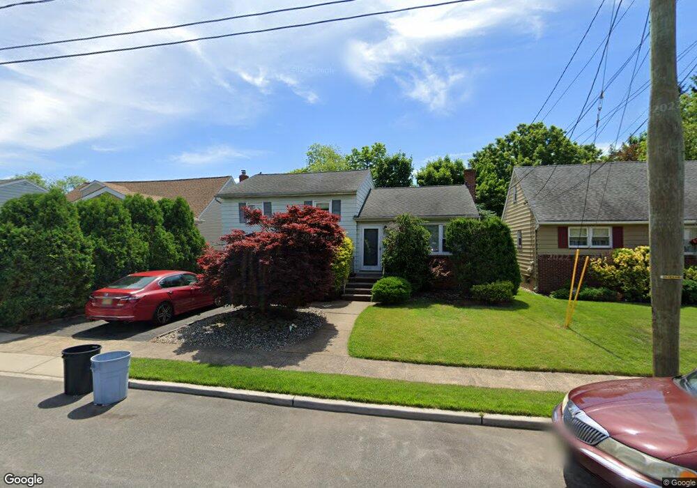
This home is located at 1169 Harmony Rd, Union, NJ 07083 and is currently estimated at $491,063. 1169 Harmony Rd is a home located in Union County with nearby schools including Livingston Elementary School, Union High School, and St Michael Parish School.
Ownership History
Date
Name
Owned For
Owner Type
Purchase Details
Closed on
May 29, 1998
Sold by
Capasso Gerard A and Capasso Deborah A
Bought by
Destefano Anthony L and Destefano Carol Ann Trimblet
Current Estimated Value
Home Financials for this Owner
Home Financials are based on the most recent Mortgage that was taken out on this home.
Original Mortgage
$110,000
Outstanding Balance
$22,006
Interest Rate
7.05%
Estimated Equity
$469,057
Create a Home Valuation Report for This Property
The Home Valuation Report is an in-depth analysis detailing your home's value as well as a comparison with similar homes in the area
Home Values in the Area
Average Home Value in this Area
Purchase History
| Date | Buyer | Sale Price | Title Company |
|---|---|---|---|
| Destefano Anthony L | $163,250 | -- |
Source: Public Records
Mortgage History
| Date | Status | Borrower | Loan Amount |
|---|---|---|---|
| Open | Destefano Anthony L | $110,000 |
Source: Public Records
Tax History
| Year | Tax Paid | Tax Assessment Tax Assessment Total Assessment is a certain percentage of the fair market value that is determined by local assessors to be the total taxable value of land and additions on the property. | Land | Improvement |
|---|---|---|---|---|
| 2025 | $10,863 | $49,400 | $20,000 | $29,400 |
| 2024 | $10,531 | $48,600 | $20,000 | $28,600 |
| 2023 | $10,531 | $48,600 | $20,000 | $28,600 |
| 2022 | $10,165 | $48,600 | $20,000 | $28,600 |
| 2021 | $9,919 | $48,600 | $20,000 | $28,600 |
| 2020 | $9,721 | $48,600 | $20,000 | $28,600 |
| 2019 | $9,590 | $48,600 | $20,000 | $28,600 |
| 2018 | $9,427 | $48,600 | $20,000 | $28,600 |
| 2017 | $9,287 | $48,600 | $20,000 | $28,600 |
| 2016 | $9,061 | $48,600 | $20,000 | $28,600 |
| 2015 | $8,911 | $48,600 | $20,000 | $28,600 |
| 2014 | $8,711 | $48,600 | $20,000 | $28,600 |
Source: Public Records
Map
Nearby Homes
- 1250 Erhardt St
- 1611 N Sunset Place
- 1453 Morris Ave
- 1393 Cornell Place
- 564 Chapman St
- 1218 Schmidt Ave
- 552 Paul St Unit 8
- 542 Leo St
- 537 Us Highway 22
- 950 Carteret Ave
- 525 Us Highway 22
- 1841 Cider Mill Rd
- 365 Broadwell Ave
- 1801 Quaker Way
- 985 Arnet Ave
- 969 Arnet Ave
- 1779 Oak Hill Dr
- 292 Crann St
- 386 Yale Ave
- 875 Salem Rd
- 1165 Harmony Rd
- 1173 Harmony Rd
- 1177 Harmony Rd
- 1982 Patton Rd
- 1161 Harmony Rd
- 1978 Patton Rd
- 1988 Patton Rd
- 1972 Patton Rd
- 1074 Susan Place
- 1075 Susan Place
- 1063 Reeves Terrace
- 1992 Patton Rd
- 1067 Reeves Terrace
- 1178 Harmony Rd
- 1160 Harmony Rd
- 1552 Vauxhall Rd
- 1185 Harmony Rd
- 1966 Patton Rd
- 1182 Harmony Rd
- 1075 Reeves Terrace
Your Personal Tour Guide
Ask me questions while you tour the home.