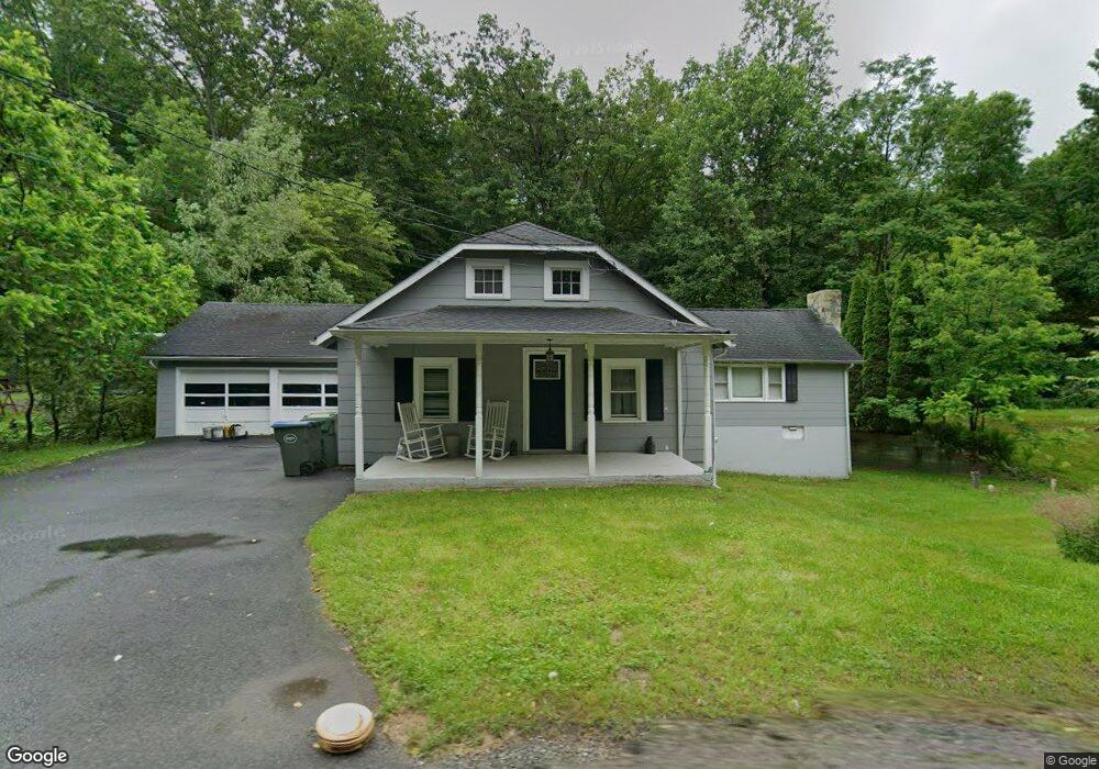
1169 State Route 94 Blairstown, NJ 07825
Estimated Value: $183,000 - $485,000
3
Beds
1
Bath
1,100
Sq Ft
$287/Sq Ft
Est. Value
About This Home
This home is located at 1169 State Route 94, Blairstown, NJ 07825 and is currently estimated at $315,274, approximately $286 per square foot. 1169 State Route 94 is a home located in Warren County with nearby schools including Frelinghuysen Township Elementary School and North Warren Regional School.
Ownership History
Date
Name
Owned For
Owner Type
Purchase Details
Closed on
May 15, 2018
Sold by
Jpmorgan Chase Bank Na
Bought by
Wilson Raymond
Current Estimated Value
Purchase Details
Closed on
Feb 6, 2018
Sold by
Black Kenneth A and Black Donna M
Bought by
Jp Morgan Chase Bank
Purchase Details
Closed on
Dec 9, 2011
Sold by
Housing Resoutions Llc
Bought by
Black Kenneth A and Black Donna M
Home Financials for this Owner
Home Financials are based on the most recent Mortgage that was taken out on this home.
Original Mortgage
$173,469
Interest Rate
4.01%
Mortgage Type
New Conventional
Purchase Details
Closed on
Jun 21, 2010
Sold by
Beron Michael
Bought by
Jodoin Theresa
Purchase Details
Closed on
Oct 19, 2001
Sold by
Manning Audrey
Bought by
Beron Michael
Home Financials for this Owner
Home Financials are based on the most recent Mortgage that was taken out on this home.
Original Mortgage
$103,550
Interest Rate
6.86%
Mortgage Type
Stand Alone First
Create a Home Valuation Report for This Property
The Home Valuation Report is an in-depth analysis detailing your home's value as well as a comparison with similar homes in the area
Home Values in the Area
Average Home Value in this Area
Purchase History
| Date | Buyer | Sale Price | Title Company |
|---|---|---|---|
| Wilson Raymond | $81,500 | None Available | |
| Jp Morgan Chase Bank | -- | None Available | |
| Black Kenneth A | $170,000 | None Available | |
| Jodoin Theresa | $101,200 | 1St Rate Title & Settlement | |
| Beron Michael | $109,000 | Chicago Title Insurance Co |
Source: Public Records
Mortgage History
| Date | Status | Borrower | Loan Amount |
|---|---|---|---|
| Previous Owner | Black Kenneth A | $173,469 | |
| Previous Owner | Beron Michael | $103,550 |
Source: Public Records
Tax History Compared to Growth
Tax History
| Year | Tax Paid | Tax Assessment Tax Assessment Total Assessment is a certain percentage of the fair market value that is determined by local assessors to be the total taxable value of land and additions on the property. | Land | Improvement |
|---|---|---|---|---|
| 2025 | $5,067 | $177,300 | $64,800 | $112,500 |
| 2024 | $4,791 | $177,300 | $64,800 | $112,500 |
| 2023 | $4,342 | $177,300 | $64,800 | $112,500 |
| 2022 | $4,342 | $177,300 | $64,800 | $112,500 |
| 2021 | $4,287 | $177,300 | $64,800 | $112,500 |
| 2020 | $4,436 | $177,300 | $64,800 | $112,500 |
| 2019 | $4,333 | $177,300 | $64,800 | $112,500 |
| 2018 | $4,333 | $177,300 | $64,800 | $112,500 |
| 2017 | $4,282 | $177,300 | $64,800 | $112,500 |
| 2016 | $4,179 | $177,300 | $64,800 | $112,500 |
| 2015 | $4,328 | $177,300 | $64,800 | $112,500 |
| 2014 | $4,234 | $177,300 | $64,800 | $112,500 |
Source: Public Records
Map
Nearby Homes
- 150 Silver Lake Rd
- 18 New Jersey 94
- 1054 Route94
- 82 Spring Valley Rd
- 5 Ward Rd
- 229 Spring Valley Rd
- 39 Stillwater Rd
- 30 Lanning Rd
- 16 Stillwater Rd
- 17 High St
- 42C Spring Valley Rd
- 76 Hope Rd
- 32 High St
- 720 New Jersey 94
- 12 Jones Ln
- 6 Main St
- 49 Spring Valley Rd
- 910 New Jersey 94
- 910 State Route 94
- 873 New Jersey 94
- 1169 New Jersey 94
- 1167 State Route 94
- 1174 State Route 94
- 1166 State Route 94
- 1177 State Route 94
- 1177 New Jersey 94
- 1162 State Route 94
- 1162 New Jersey 94
- 1180 New Jersey 94
- 1180 State Route 94
- 1181 State Route 94
- 1184 State Route 94
- 1184 New Jersey 94
- 1185 State Route 94
- 1182 State Route 94
- 1182 New Jersey 94
- 1188 State Route 94
- 1188 New Jersey 94
- 1192 State Route 94
- 1193 State Route 94