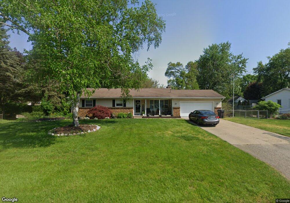
1169 Wrenwood Dr Jenison, MI 49428
Estimated Value: $340,000 - $369,804
3
Beds
2
Baths
2,158
Sq Ft
$164/Sq Ft
Est. Value
About This Home
This home is located at 1169 Wrenwood Dr, Jenison, MI 49428 and is currently estimated at $354,701, approximately $164 per square foot. 1169 Wrenwood Dr is a home located in Ottawa County with nearby schools including Bursley School, Jenison Junior High School, and Jenison High School.
Ownership History
Date
Name
Owned For
Owner Type
Purchase Details
Closed on
Aug 11, 2011
Sold by
Glupker Robert and Glupker Corrie
Bought by
Ickes Ryan J
Current Estimated Value
Home Financials for this Owner
Home Financials are based on the most recent Mortgage that was taken out on this home.
Original Mortgage
$90,900
Outstanding Balance
$63,084
Interest Rate
4.62%
Mortgage Type
FHA
Estimated Equity
$291,617
Purchase Details
Closed on
Mar 3, 2011
Sold by
Glupker Robert and Glupker Corrie D
Bought by
Federal Home Loan Mortgage Corp
Purchase Details
Closed on
Aug 14, 2007
Sold by
Williams Sean and Williams Brenda S
Bought by
Glupker Robert and Glupker Corrie
Home Financials for this Owner
Home Financials are based on the most recent Mortgage that was taken out on this home.
Original Mortgage
$129,200
Interest Rate
6.69%
Mortgage Type
Purchase Money Mortgage
Create a Home Valuation Report for This Property
The Home Valuation Report is an in-depth analysis detailing your home's value as well as a comparison with similar homes in the area
Home Values in the Area
Average Home Value in this Area
Purchase History
| Date | Buyer | Sale Price | Title Company |
|---|---|---|---|
| Ickes Ryan J | $105,000 | None Available | |
| Federal Home Loan Mortgage Corp | $139,316 | None Available | |
| Glupker Robert | $161,500 | Group Title Services |
Source: Public Records
Mortgage History
| Date | Status | Borrower | Loan Amount |
|---|---|---|---|
| Open | Ickes Ryan J | $90,900 | |
| Previous Owner | Glupker Robert | $129,200 |
Source: Public Records
Tax History Compared to Growth
Tax History
| Year | Tax Paid | Tax Assessment Tax Assessment Total Assessment is a certain percentage of the fair market value that is determined by local assessors to be the total taxable value of land and additions on the property. | Land | Improvement |
|---|---|---|---|---|
| 2025 | $2,301 | $167,600 | $0 | $0 |
| 2024 | $1,997 | $147,300 | $0 | $0 |
| 2023 | $1,906 | $127,100 | $0 | $0 |
| 2022 | $2,092 | $107,300 | $0 | $0 |
| 2021 | $2,032 | $99,800 | $0 | $0 |
| 2020 | $2,010 | $96,000 | $0 | $0 |
| 2019 | $1,988 | $89,200 | $0 | $0 |
| 2018 | $1,875 | $88,700 | $0 | $0 |
| 2017 | $1,843 | $84,000 | $0 | $0 |
| 2016 | $1,832 | $79,600 | $0 | $0 |
| 2015 | $1,749 | $72,000 | $0 | $0 |
| 2014 | $1,749 | $72,000 | $0 | $0 |
Source: Public Records
Map
Nearby Homes
- 1241 S Marymark Dr
- 6451 12th Ave
- 1306 Carol Dr
- 1361 Carol Dr
- 1433 Winifred St
- 1355 Bent Tree Dr Unit 12
- 950 Brentwood St
- 6501 Andre's Crossing Unit 14
- 6516 Andre's Crossing
- 1451 Eagle Shore Ct
- 6025 Gleneagle Dr
- 1643 Laramy Ln
- 1496 Eagle Shore Ct Unit 13
- 1519 Eagle Shore Ct Unit Lot 33
- 1481 Eagle Shore Ct Unit 39
- 1040 Castlebay Way Unit 19
- 1038 Castlebay Way Unit 18
- 1036 Castlebay Way Unit 17
- 925 Parsons St SW
- 776 Chancellor Dr SW
- 1153 Wrenwood Dr
- 1168 Port Sheldon St
- 6521 Wrenwood Dr
- 1186 Port Sheldon St
- 1154 Port Sheldon St
- 1160 Wrenwood Dr
- 1137 Wrenwood Dr
- 1198 Port Sheldon St
- 6505 Wrenwood Dr
- 1130 Wrenwood Dr
- 1130 Port Sheldon St
- 6570 12th Ave
- 6560 12th Ave
- 6492 Wrenwood Dr
- 1121 Wrenwood Dr
- 6530 12th Ave
- 1208 Port Sheldon St
- 0 12th Ave Unit O-418
- 6489 Wrenwood Dr
- 6514 12th Ave