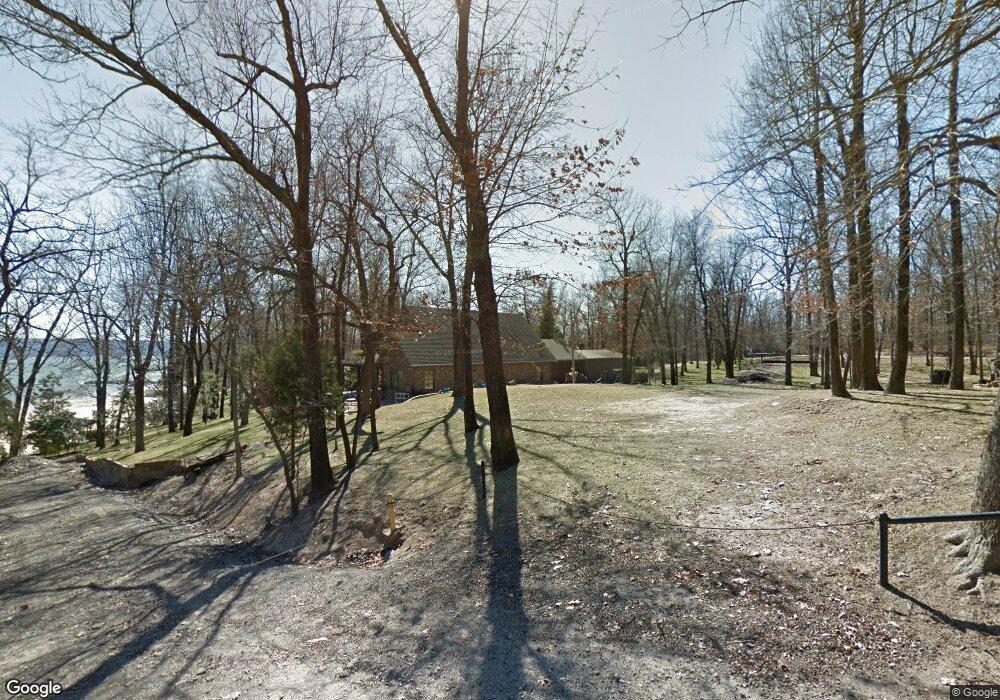
116921 S 4249 Rd Eufaula, OK 74432
Estimated Value: $443,409 - $494,000
3
Beds
2
Baths
1,610
Sq Ft
$290/Sq Ft
Est. Value
About This Home
This home is located at 116921 S 4249 Rd, Eufaula, OK 74432 and is currently estimated at $467,602, approximately $290 per square foot. 116921 S 4249 Rd is a home with nearby schools including Eufaula Elementary School, Eufaula Middle School, and Eufaula High School.
Ownership History
Date
Name
Owned For
Owner Type
Purchase Details
Closed on
Feb 6, 2018
Sold by
Mcpherson Dan T and Mcpherson Marinelle
Bought by
The Mcpherson Family Trust
Current Estimated Value
Purchase Details
Closed on
Apr 5, 2013
Sold by
Nail Earl Wayne and Nail Kathryn Anne
Bought by
Mcpherson Dan T and Mcpherson Marinelle
Home Financials for this Owner
Home Financials are based on the most recent Mortgage that was taken out on this home.
Original Mortgage
$188,500
Outstanding Balance
$133,596
Interest Rate
3.56%
Mortgage Type
New Conventional
Estimated Equity
$334,006
Purchase Details
Closed on
May 25, 2001
Sold by
Abercrombie
Bought by
Nail
Purchase Details
Closed on
Oct 14, 1997
Sold by
Hickle
Bought by
Abercrombie
Create a Home Valuation Report for This Property
The Home Valuation Report is an in-depth analysis detailing your home's value as well as a comparison with similar homes in the area
Home Values in the Area
Average Home Value in this Area
Purchase History
| Date | Buyer | Sale Price | Title Company |
|---|---|---|---|
| The Mcpherson Family Trust | -- | None Available | |
| Mcpherson Dan T | $285,000 | None Available | |
| Nail | $50,000 | -- | |
| Abercrombie | $32,500 | -- |
Source: Public Records
Mortgage History
| Date | Status | Borrower | Loan Amount |
|---|---|---|---|
| Open | Mcpherson Dan T | $188,500 |
Source: Public Records
Tax History Compared to Growth
Tax History
| Year | Tax Paid | Tax Assessment Tax Assessment Total Assessment is a certain percentage of the fair market value that is determined by local assessors to be the total taxable value of land and additions on the property. | Land | Improvement |
|---|---|---|---|---|
| 2024 | $2,487 | $30,351 | $7,865 | $22,486 |
| 2023 | $2,487 | $28,609 | $7,865 | $20,744 |
| 2022 | $2,221 | $27,775 | $7,865 | $19,910 |
| 2021 | $2,525 | $31,086 | $7,865 | $23,221 |
| 2020 | $2,526 | $31,086 | $7,865 | $23,221 |
| 2019 | $2,548 | $31,086 | $7,865 | $23,221 |
| 2018 | $2,505 | $31,087 | $7,865 | $23,222 |
| 2017 | $2,507 | $31,087 | $7,865 | $23,222 |
| 2016 | $2,530 | $31,229 | $7,865 | $23,364 |
| 2015 | $2,507 | $31,354 | $7,865 | $23,489 |
| 2014 | $2,572 | $31,354 | $7,865 | $23,489 |
Source: Public Records
Map
Nearby Homes
- 421232 E 1168 Rd
- 116527 S 4250 Dr
- 116873 S 4253 Rd
- 425 E 1168 Rd
- 3 E 1168 Rd
- 426779 E 1166 Rd
- 424826 E 1165th Rd
- 424826 E 1165 Rd Unit 16&17
- 116500 S 4249 Rd
- 425183 E 1168 Rd
- 116942 S 4244 Rd
- 0 1 3 Acres E 1168 Rd
- E 1168 Rd
- 0 55 Acres Peaceful Acres II Unit 1164857
- n 4256 Northwest 1st St
- 4 S 4256 Rd
- 1 S 4256 Rd
- 59 Edge Water
- 4 N 4256 Rd
- 116645 S 4256 Rd
- 1015 E Grand Blvd
- 116856 S 4250 Dr
- 0 S 4250 Rd Unit 2011165
- 116899 S 4250 Dr
- 1043 Rr 4
- 0 Blue Kenokee Bay Rd SE Unit 1838383
- 0 Blue Kenokee Bay Rd SE Unit 1903265
- 0 Blue Kenokee Bay Rd SE Unit 1923409
- 0 Blue Kenokee Bay Rd SE Unit 2018932
- 116816 S 4249 Rd
- 116823 S 4250 Dr
- 424338 E 1168 Rd
- 420942 E 1168 Rd
- 421171 E 1168 Rd
- 421298 E 1168 Rd
- 117041 S 4249 Rd
- 0801 N 425 Rd
- 0 N 425 Rd Unit 1633397
- 0 N 425 Rd Unit 1712984
- 424997 E 1168 Rd