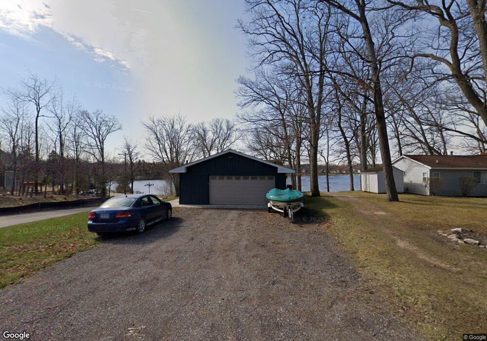
11694 Maxfield Blvd Hartland, MI 48353
Estimated Value: $468,000 - $538,000
4
Beds
3
Baths
2,264
Sq Ft
$226/Sq Ft
Est. Value
About This Home
This home is located at 11694 Maxfield Blvd, Hartland, MI 48353 and is currently estimated at $510,705, approximately $225 per square foot. 11694 Maxfield Blvd is a home located in Livingston County with nearby schools including Hartland High School, Charyl Stockwell Academy, and Our Savior Evangelical Lutheran School.
Ownership History
Date
Name
Owned For
Owner Type
Purchase Details
Closed on
May 2, 2025
Sold by
Rynier Margaret N S
Bought by
Wamble Jason and Wamble Katie
Current Estimated Value
Home Financials for this Owner
Home Financials are based on the most recent Mortgage that was taken out on this home.
Original Mortgage
$389,250
Outstanding Balance
$387,872
Interest Rate
6.65%
Mortgage Type
New Conventional
Estimated Equity
$122,833
Purchase Details
Closed on
Jun 14, 2002
Sold by
Conseco Finance Servicing Corp
Bought by
Rynier Margaret Ns
Purchase Details
Closed on
Apr 18, 2001
Sold by
Lindsey Fredrick V and Lindsey Martha
Bought by
Conseco Finance Servicing Corp and Green Tree Financial Servicing Corp
Create a Home Valuation Report for This Property
The Home Valuation Report is an in-depth analysis detailing your home's value as well as a comparison with similar homes in the area
Home Values in the Area
Average Home Value in this Area
Purchase History
| Date | Buyer | Sale Price | Title Company |
|---|---|---|---|
| Wamble Jason | -- | Select Title | |
| Wamble Jason | $519,000 | Select Title | |
| Rynier Margaret Ns | $215,000 | Select Title | |
| Conseco Finance Servicing Corp | $230,787 | -- |
Source: Public Records
Mortgage History
| Date | Status | Borrower | Loan Amount |
|---|---|---|---|
| Open | Wamble Jason | $389,250 |
Source: Public Records
Tax History Compared to Growth
Tax History
| Year | Tax Paid | Tax Assessment Tax Assessment Total Assessment is a certain percentage of the fair market value that is determined by local assessors to be the total taxable value of land and additions on the property. | Land | Improvement |
|---|---|---|---|---|
| 2025 | $1,580 | $214,500 | $0 | $0 |
| 2024 | $3,771 | $169,800 | $0 | $0 |
| 2023 | $3,430 | $144,900 | $0 | $0 |
| 2022 | $4,994 | $115,500 | $0 | $0 |
| 2021 | $4,816 | $122,900 | $0 | $0 |
| 2020 | $4,780 | $120,900 | $0 | $0 |
| 2019 | $4,563 | $115,500 | $0 | $0 |
| 2018 | $4,459 | $108,500 | $0 | $0 |
| 2017 | $4,377 | $108,500 | $0 | $0 |
| 2016 | $4,594 | $110,400 | $0 | $0 |
| 2014 | $4,181 | $100,000 | $0 | $0 |
| 2012 | $4,181 | $89,100 | $0 | $0 |
Source: Public Records
Map
Nearby Homes
- 11523 Timberlane Trail
- 1291 Courtney Ct
- 2045 Birch St
- 1020 Woods Edge Dr
- 2.03 Acres Highland Rd
- 1491 Division Dr
- 12071 Highland Rd
- V/L Highland Rd
- 2255 Clark Rd
- V/L Parcel D Old Us-23 Hwy
- 000 Highland Rd
- V/L Parcels C & D Old Us-23 Hwy
- V/L Parcel C Old Us-23 Hwy
- Beretta Loft Plan at Hunters Ridge - Condominiums
- Beretta Plan at Hunters Ridge - Condominiums
- Arrow Plan at Hunters Ridge - Condominiums
- Chase Plan at Hunters Ridge - Condominiums
- V/L Old Us 23 Hwy
- 227 W Peterson Dr
- 9901 Crossview Trail Unit 120
- 11686 Maxfield Blvd
- 11670 Maxfield Blvd
- 1670 Maxfield Rd
- 1670 Maxfield Rd
- 1670 Maxfield Rd
- 1670 Maxfield Rd
- 1701 Maxfield Rd
- 11654 Maxfield Blvd
- 11762 Maxfield Blvd
- 1662 Odette
- 1660 Maxfield Rd
- 1707 Maxfield Rd
- 11648 Maxfield Blvd
- 1642 Odette
- 11642 Maxfield Blvd
- 1712 Maxfield Rd
- 1630 Odette
- 1598 Maxfield Rd
- 11770 Maxfield Blvd
- 1655 Odette