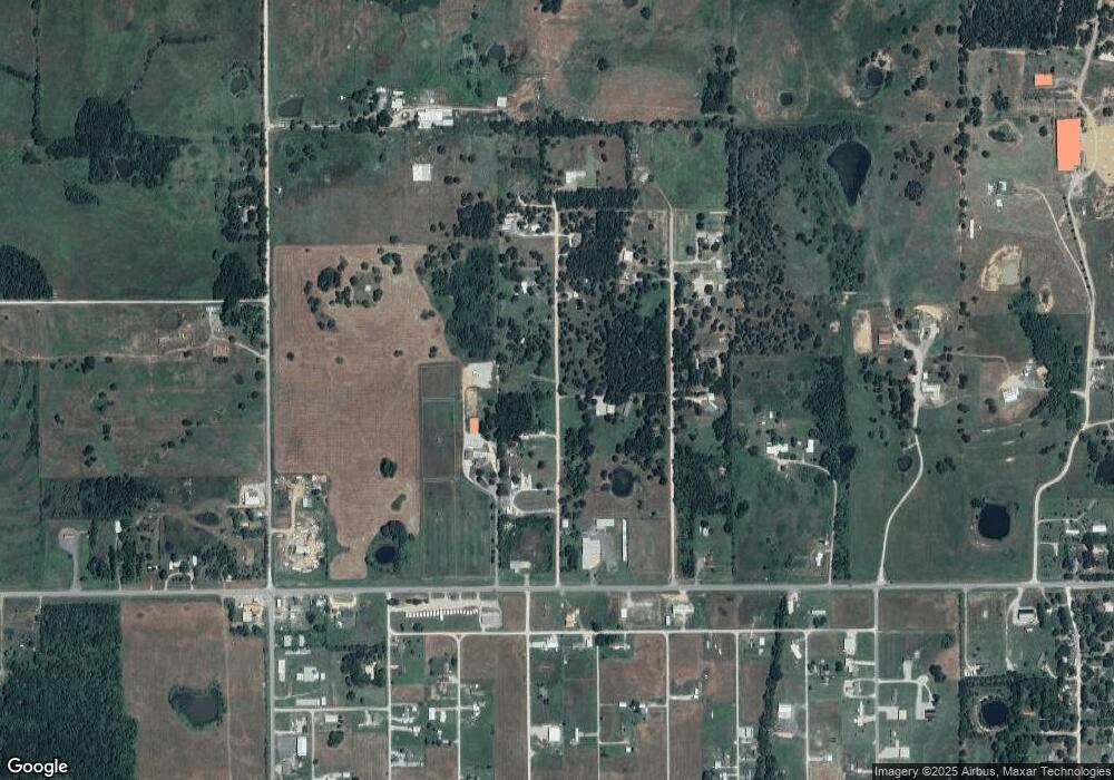
116955 S 4204 Rd Eufaula, OK 74432
Estimated Value: $177,239 - $312,000
2
Beds
1
Bath
1,120
Sq Ft
$213/Sq Ft
Est. Value
About This Home
This home is located at 116955 S 4204 Rd, Eufaula, OK 74432 and is currently estimated at $238,810, approximately $213 per square foot. 116955 S 4204 Rd is a home located in McIntosh County with nearby schools including Eufaula Elementary School, Eufaula Middle School, and Eufaula High School.
Ownership History
Date
Name
Owned For
Owner Type
Purchase Details
Closed on
Jul 30, 2010
Sold by
Mccarty Billy R and Mccarty Vickie L
Bought by
Mccarty Vickie L
Current Estimated Value
Purchase Details
Closed on
Dec 11, 2009
Sold by
Mccarty Vickie L and Mccarty Billy R
Bought by
Mccarty Vickie L and Mccarty Billy R
Purchase Details
Closed on
Aug 21, 2009
Sold by
Mccarty Billy R
Bought by
Mccarty Vickie L
Purchase Details
Closed on
Nov 30, 2007
Sold by
Revocabl Amatucci Patricia Kay
Bought by
Mccarty Billy R and Mccarty Vicki L
Create a Home Valuation Report for This Property
The Home Valuation Report is an in-depth analysis detailing your home's value as well as a comparison with similar homes in the area
Home Values in the Area
Average Home Value in this Area
Purchase History
| Date | Buyer | Sale Price | Title Company |
|---|---|---|---|
| Mccarty Vickie L | -- | None Available | |
| Mccarty Vickie L | -- | None Available | |
| Mccarty Vickie L | -- | None Available | |
| Mccarty Billy R | $12,000 | None Available |
Source: Public Records
Tax History Compared to Growth
Tax History
| Year | Tax Paid | Tax Assessment Tax Assessment Total Assessment is a certain percentage of the fair market value that is determined by local assessors to be the total taxable value of land and additions on the property. | Land | Improvement |
|---|---|---|---|---|
| 2024 | $981 | $12,598 | $687 | $11,911 |
| 2023 | $981 | $11,875 | $443 | $11,432 |
| 2022 | $873 | $11,530 | $412 | $11,118 |
| 2021 | $856 | $11,530 | $277 | $11,253 |
| 2020 | $829 | $11,194 | $269 | $10,925 |
| 2019 | $809 | $10,868 | $261 | $10,607 |
| 2018 | $770 | $10,551 | $253 | $10,298 |
| 2017 | $745 | $9,946 | $239 | $9,707 |
| 2016 | $725 | $9,656 | $217 | $9,439 |
| 2015 | $692 | $9,374 | $238 | $9,136 |
| 2014 | $665 | $9,102 | $232 | $8,870 |
Source: Public Records
Map
Nearby Homes
- 420676 E 1166 Rd
- 00 S 4207
- 116307 S 4209 Rd
- 116965 S 4164
- 115292 S Forsman
- 420502 E 1170 Rd
- 9 Sandy Bass Bay
- 2 E 1167 Rd
- 0 Tract C Siers E 1167 Rd Unit 1157507
- 420492 E 1171 Rd
- 0 Lot 5 Siers E 1167 Rd Unit 1157492
- 0 Lot 4 Fowler E 1168 Rd
- 421171 E 1168 Rd
- 4 Fowler Rd
- 421224 E 1165 Rd
- 118900 S 4213 Rd
- 421355 E 1168 Rd
- 1 Elm St
- 3 Elm St
- 2 Elm St
- 420713 E 1167 Rd
- 420707 E 1166 Rd
- 101 Heathway Rd
- 3124 Pinecrest St
- 2885 Rr 4
- Rt 4 Box 1042 Rr 4
- Rt 4 Box 1214 Rr 4
- 116577 S 4208 Rd
- 420639 E 1166 Rd
- 17860 Creekwood Ln
- 420623 E 1166 Rd NE
- 101 Belle Starr Forest Dr
- 0 None Unit 1009455
- 8306 State Highway 19
- 420848 E 1165 Rd
- 420581 E 1166 Rd
- 116486 S 4208 Rd
- 116476 S 4208 Rd
- 116685 S 4206 Rd
- 420645 E 1168 Rd
