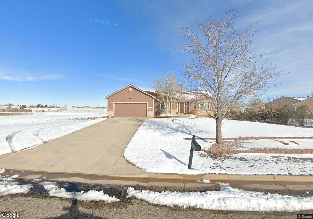
11697 Allendale Dr Peyton, CO 80831
Falcon NeighborhoodEstimated Value: $496,257 - $557,000
3
Beds
2
Baths
1,769
Sq Ft
$300/Sq Ft
Est. Value
About This Home
This home is located at 11697 Allendale Dr, Peyton, CO 80831 and is currently estimated at $530,064, approximately $299 per square foot. 11697 Allendale Dr is a home located in El Paso County with nearby schools including Bennett Ranch Elementary School, Falcon Middle School, and Falcon High School.
Ownership History
Date
Name
Owned For
Owner Type
Purchase Details
Closed on
Jan 31, 2000
Sold by
Cucuzza Construction Inc and Dba Anthony Homes Ltd
Bought by
Young Kenneth C and Beaudette Young Deanna M
Current Estimated Value
Home Financials for this Owner
Home Financials are based on the most recent Mortgage that was taken out on this home.
Original Mortgage
$196,047
Interest Rate
7.95%
Mortgage Type
VA
Purchase Details
Closed on
May 14, 1999
Sold by
Kempton Llc
Bought by
Cucuzza Construction Inc and Anthony Homes Ltd
Create a Home Valuation Report for This Property
The Home Valuation Report is an in-depth analysis detailing your home's value as well as a comparison with similar homes in the area
Home Values in the Area
Average Home Value in this Area
Purchase History
| Date | Buyer | Sale Price | Title Company |
|---|---|---|---|
| Young Kenneth C | $203,340 | North American Title Co | |
| Cucuzza Construction Inc | $27,976 | Unified Title Co Inc |
Source: Public Records
Mortgage History
| Date | Status | Borrower | Loan Amount |
|---|---|---|---|
| Previous Owner | Young Kenneth C | $196,047 |
Source: Public Records
Tax History
| Year | Tax Paid | Tax Assessment Tax Assessment Total Assessment is a certain percentage of the fair market value that is determined by local assessors to be the total taxable value of land and additions on the property. | Land | Improvement |
|---|---|---|---|---|
| 2025 | $2,874 | $35,360 | -- | -- |
| 2024 | $2,704 | $35,900 | $9,000 | $26,900 |
| 2023 | $2,704 | $35,900 | $9,000 | $26,900 |
| 2022 | $2,422 | $26,650 | $7,390 | $19,260 |
| 2021 | $2,464 | $27,410 | $7,600 | $19,810 |
| 2020 | $2,150 | $23,760 | $4,680 | $19,080 |
| 2019 | $2,101 | $23,760 | $4,680 | $19,080 |
| 2018 | $1,892 | $20,790 | $3,280 | $17,510 |
| 2017 | $1,765 | $20,790 | $3,280 | $17,510 |
| 2016 | $1,641 | $19,530 | $3,620 | $15,910 |
| 2015 | $1,721 | $19,530 | $3,620 | $15,910 |
| 2014 | $1,587 | $17,750 | $3,340 | $14,410 |
Source: Public Records
Map
Nearby Homes
- 11674 Allendale Dr
- 11280 Allendale Dr
- 10467 Pictured Rocks Dr
- 11232 Allendale Dr
- 11650 Cranston Dr
- 10488 Cedar Breaks Dr
- 10342 Biscayne Dr
- 10429 Cedar Breaks Dr
- 10489 Cedar Breaks Dr
- 9920 Glenellen Dr
- 12144 Point Reyes Dr
- 10803 Greenbelt Dr
- 12320 Grand Teton Dr
- 12784 Angelina Dr
- 10476 Ross Lake Dr
- 12252 Point Reyes Dr
- 9630 Liberty Grove Dr
- 12272 Isle Royale Dr
- 10603 Ross Lake Dr
- 9614 Waterbury Dr
- 11689 Allendale Dr
- 11681 Allendale Dr
- 11698 Allendale Dr
- 11690 Allendale Dr
- 11706 Allendale Dr
- 11682 Allendale Dr
- 11673 Allendale Dr
- 11714 Allendale Dr
- 11713 Allendale Dr
- 11730 Allendale Dr
- 11668 Allendale Dr
- 11665 Allendale Dr
- 10015 Litchfield St
- 10025 Litchfield St
- 11721 Allendale Dr
- 10035 Litchfield St
- 10005 Litchfield St
- 10045 Litchfield St
- 9995 Litchfield St
- 11746 Allendale Dr
Your Personal Tour Guide
Ask me questions while you tour the home.