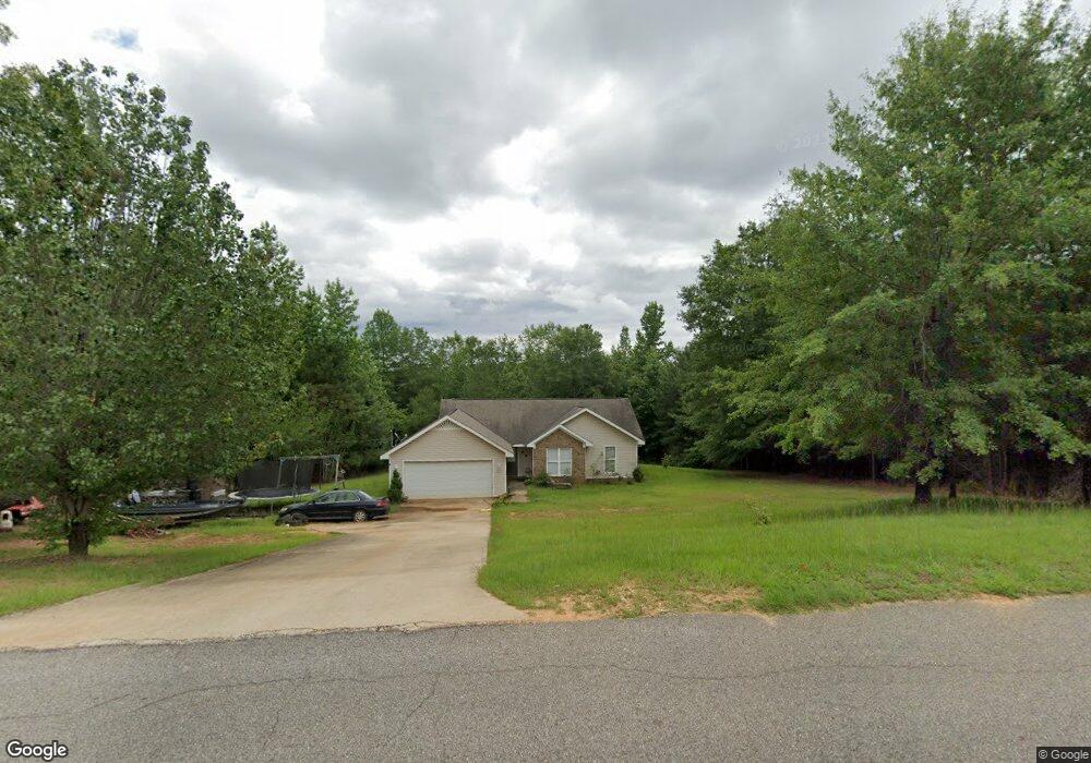
11698 Brant Ward Rd Cottondale, AL 35453
Estimated Value: $193,000 - $216,000
3
Beds
1
Bath
1,236
Sq Ft
$168/Sq Ft
Est. Value
About This Home
This home is located at 11698 Brant Ward Rd, Cottondale, AL 35453 and is currently estimated at $207,460, approximately $167 per square foot. 11698 Brant Ward Rd is a home located in Tuscaloosa County with nearby schools including Vance Elementary School, Brookwood Middle School, and Brookwood High School.
Ownership History
Date
Name
Owned For
Owner Type
Purchase Details
Closed on
Feb 9, 2010
Sold by
Jrc Construction Llc
Bought by
Mitchell Mindi L
Current Estimated Value
Home Financials for this Owner
Home Financials are based on the most recent Mortgage that was taken out on this home.
Original Mortgage
$114,284
Outstanding Balance
$75,599
Interest Rate
5.02%
Estimated Equity
$131,861
Purchase Details
Closed on
Apr 7, 2006
Sold by
Not Provided
Bought by
J R C Construction Llc
Create a Home Valuation Report for This Property
The Home Valuation Report is an in-depth analysis detailing your home's value as well as a comparison with similar homes in the area
Home Values in the Area
Average Home Value in this Area
Purchase History
| Date | Buyer | Sale Price | Title Company |
|---|---|---|---|
| Mitchell Mindi L | $114,284 | -- | |
| J R C Construction Llc | -- | -- |
Source: Public Records
Mortgage History
| Date | Status | Borrower | Loan Amount |
|---|---|---|---|
| Open | Mitchell Mindi L | $114,284 |
Source: Public Records
Tax History Compared to Growth
Tax History
| Year | Tax Paid | Tax Assessment Tax Assessment Total Assessment is a certain percentage of the fair market value that is determined by local assessors to be the total taxable value of land and additions on the property. | Land | Improvement |
|---|---|---|---|---|
| 2024 | $553 | $33,800 | $5,000 | $28,800 |
| 2023 | $553 | $32,280 | $5,000 | $27,280 |
| 2022 | $462 | $28,860 | $5,000 | $23,860 |
| 2021 | $467 | $29,140 | $5,000 | $24,140 |
| 2020 | $427 | $13,470 | $2,500 | $10,970 |
| 2019 | $427 | $13,470 | $2,500 | $10,970 |
| 2018 | $427 | $13,470 | $2,500 | $10,970 |
| 2017 | $390 | $0 | $0 | $0 |
| 2016 | $397 | $0 | $0 | $0 |
| 2015 | $397 | $0 | $0 | $0 |
| 2014 | $397 | $12,670 | $2,500 | $10,170 |
Source: Public Records
Map
Nearby Homes
- 11762 Brant Ward Rd
- 10884 W Manor Dr
- 10463 Beulah Lake Ln
- 0 Unit 21420013
- 0 Station 32 Rd Unit 170891
- 1 Brant Ward Rd
- 10799 Melrose Ln
- 14541 Keenes Mill Rd
- 0 Mallard Trail
- 10802 Mallard Lake Ln
- 10452 N Davis Rd
- 0 N Davis Rd
- 0 Wire Rd
- 13180 Luke Harrington Rd
- 11643 Carter Rd
- 00 Ashborough Dr
- 16414 Highway 11 N
- 14194 Chapel Park Rd
- 14299 Plantation Ridge
- 10464 Nicole St
- 11695 Brant Ward Rd
- 11708 Brant Ward Rd
- 11701 Brant Ward Rd
- 11688 Brant Ward Rd
- 11707 Brant Ward Rd
- 11718 Brant Ward Rd
- 11682 Brant Ward Rd
- 11713 Brant Ward Rd
- 11676 Brant Ward Rd
- 11719 Brant Ward Rd
- 11670 Brant Ward Rd
- 11725 Brant Ward Rd
- 11664 Brant Ward Rd
- 11731 Brant Ward Rd
- 11658 Brant Ward Rd
- 11658 Brant Ward Rd Unit 3
- 11737 Brant Ward Rd
- 11704 Brant Ward Rd
- 11749 Brant Ward Rd
- 11716 Brant Ward Rd