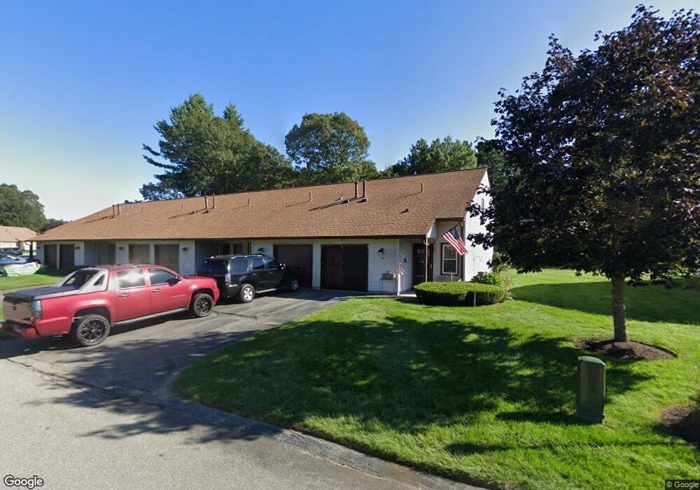
117 10th St Tewksbury, MA 01876
Estimated Value: $680,000 - $802,000
5
Beds
4
Baths
2,200
Sq Ft
$337/Sq Ft
Est. Value
About This Home
This home is located at 117 10th St, Tewksbury, MA 01876 and is currently estimated at $741,760, approximately $337 per square foot. 117 10th St is a home located in Middlesex County with nearby schools including Heath-Brook Elementary School, John W. Wynn Middle School, and John F. Ryan Elementary School.
Ownership History
Date
Name
Owned For
Owner Type
Purchase Details
Closed on
Jun 17, 1994
Sold by
Mckenna Margaret A
Bought by
Anderson Thaddeus and Anderson Linda
Current Estimated Value
Home Financials for this Owner
Home Financials are based on the most recent Mortgage that was taken out on this home.
Original Mortgage
$104,000
Interest Rate
8.5%
Mortgage Type
Purchase Money Mortgage
Create a Home Valuation Report for This Property
The Home Valuation Report is an in-depth analysis detailing your home's value as well as a comparison with similar homes in the area
Home Values in the Area
Average Home Value in this Area
Purchase History
| Date | Buyer | Sale Price | Title Company |
|---|---|---|---|
| Anderson Thaddeus | $134,000 | -- |
Source: Public Records
Mortgage History
| Date | Status | Borrower | Loan Amount |
|---|---|---|---|
| Open | Anderson Thaddeus | $106,000 | |
| Closed | Anderson Thaddeus | $104,000 |
Source: Public Records
Tax History Compared to Growth
Tax History
| Year | Tax Paid | Tax Assessment Tax Assessment Total Assessment is a certain percentage of the fair market value that is determined by local assessors to be the total taxable value of land and additions on the property. | Land | Improvement |
|---|---|---|---|---|
| 2025 | $9,140 | $691,400 | $257,100 | $434,300 |
| 2024 | $8,957 | $668,900 | $244,900 | $424,000 |
| 2023 | $8,659 | $614,100 | $222,600 | $391,500 |
| 2022 | $6,151 | $404,700 | $193,600 | $211,100 |
| 2021 | $9,894 | $341,500 | $166,800 | $174,700 |
| 2020 | $5,146 | $322,200 | $158,800 | $163,400 |
| 2019 | $4,812 | $303,800 | $151,100 | $152,700 |
| 2018 | $7,493 | $273,200 | $151,100 | $122,100 |
| 2017 | $4,169 | $255,600 | $151,100 | $104,500 |
| 2016 | $4,070 | $248,900 | $151,100 | $97,800 |
| 2015 | $3,953 | $241,500 | $157,900 | $83,600 |
| 2014 | $3,887 | $241,300 | $157,900 | $83,400 |
Source: Public Records
Map
Nearby Homes
- 113 10th St
- 116 10th St
- 38 Decarolis Dr
- 37 Decarolis Dr
- 36 Decarolis Dr
- 35 Decarolis Dr
- 55 Decarolis Dr
- 56 Decarolis Dr
- 54 Decarolis Dr
- 53 Decarolis Dr
- 52 Decarolis Dr
- 51 Decarolis Dr
- 53 Decarolis Dr Unit 53
- 106 10th St
- 34 Decarolis Dr
- 33 Decarolis Dr
- 31 Decarolis Dr
- 31 Decarolis Dr Unit 31
- 62 Decarolis Dr
- 61 Decarolis Dr