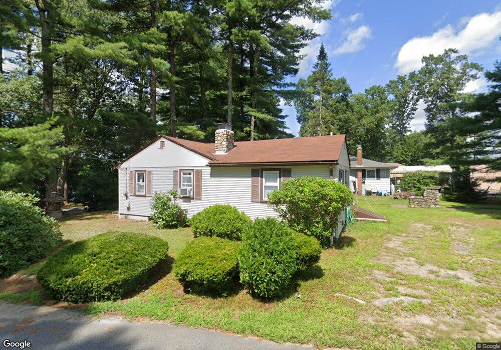
117 Acres of Pine Rd Coventry, RI 02816
Estimated Value: $329,553 - $407,000
3
Beds
1
Bath
972
Sq Ft
$381/Sq Ft
Est. Value
About This Home
This home is located at 117 Acres of Pine Rd, Coventry, RI 02816 and is currently estimated at $370,638, approximately $381 per square foot. 117 Acres of Pine Rd is a home located in Kent County with nearby schools including Alan Shawn Feinstein Ms Of Cov, Coventry High School, and Father John V. Doyle School.
Ownership History
Date
Name
Owned For
Owner Type
Purchase Details
Closed on
Sep 6, 2022
Sold by
Donald R Doucette Ft
Bought by
Leclair Donna D
Current Estimated Value
Purchase Details
Closed on
Oct 16, 2000
Sold by
Brown Janine R
Bought by
Stgermain Louis
Home Financials for this Owner
Home Financials are based on the most recent Mortgage that was taken out on this home.
Original Mortgage
$118,750
Interest Rate
7.89%
Create a Home Valuation Report for This Property
The Home Valuation Report is an in-depth analysis detailing your home's value as well as a comparison with similar homes in the area
Home Values in the Area
Average Home Value in this Area
Purchase History
| Date | Buyer | Sale Price | Title Company |
|---|---|---|---|
| Leclair Donna D | -- | None Available | |
| Stgermain Louis | $125,000 | -- |
Source: Public Records
Mortgage History
| Date | Status | Borrower | Loan Amount |
|---|---|---|---|
| Previous Owner | Stgermain Louis | $118,750 |
Source: Public Records
Tax History Compared to Growth
Tax History
| Year | Tax Paid | Tax Assessment Tax Assessment Total Assessment is a certain percentage of the fair market value that is determined by local assessors to be the total taxable value of land and additions on the property. | Land | Improvement |
|---|---|---|---|---|
| 2024 | $3,778 | $238,500 | $101,100 | $137,400 |
| 2023 | $3,656 | $238,500 | $101,100 | $137,400 |
| 2022 | $3,609 | $184,400 | $90,700 | $93,700 |
| 2021 | $3,577 | $184,400 | $90,700 | $93,700 |
| 2020 | $4,101 | $184,400 | $90,700 | $93,700 |
| 2019 | $3,521 | $158,300 | $76,600 | $81,700 |
| 2018 | $3,421 | $158,300 | $76,600 | $81,700 |
| 2017 | $3,321 | $158,300 | $76,600 | $81,700 |
| 2016 | $3,186 | $148,800 | $72,500 | $76,300 |
| 2015 | $3,100 | $148,800 | $72,500 | $76,300 |
| 2014 | $3,036 | $148,800 | $72,500 | $76,300 |
| 2013 | $3,004 | $161,000 | $72,900 | $88,100 |
Source: Public Records
Map
Nearby Homes
- 170 Acres of Pine Rd
- 0 Poor Farm Lot 68 Rd
- 0 Poor Farm Lot 69 Rd
- 0 Poor Farm Lot 67 Rd
- 207 Shady Valley Rd
- 17 Paige Dr
- 60 Town Farm Rd
- 83 Sunset Lake Cir
- 51 Sunset Lake Cir
- 81 Sunset Lake Cir
- 93 Provident Place
- 870 Hill Farm Rd
- 1 Whitehead Rd
- 2 Whitehead Rd
- 0 Whitehead Rd Unit 1395877
- 33 Sunset Lake Cir
- 35 Provident Place
- 145 Phillips Hill Rd
- 12 Pine Way Blvd
- 6 Boyd Brook Cir
- 115 Acres of Pine Rd
- 113 Acres of Pine Rd
- 154 Acres of Pine Rd
- 155 Acres of Pine Rd
- 114 Acres of Pine Rd
- 160 Acres of Pine Rd
- 120 Acres of Pine Rd
- 162 Acres of Pine Rd
- 181 Acres of Pine Rd
- 109 Acres of Pine Rd
- 159 Acres of Pine Rd
- 112 Acres of Pine Rd
- 179 Acres of Pine Rd
- 164 Acres of Pine Rd
- 108 Acres of Pine Rd
- 105 Acres of Pine Rd
- 125 Acres of Pine Rd
- 175 Acres of Pine Rd
- 166 Acres of Pine Rd
- 106 Acres of Pine Rd