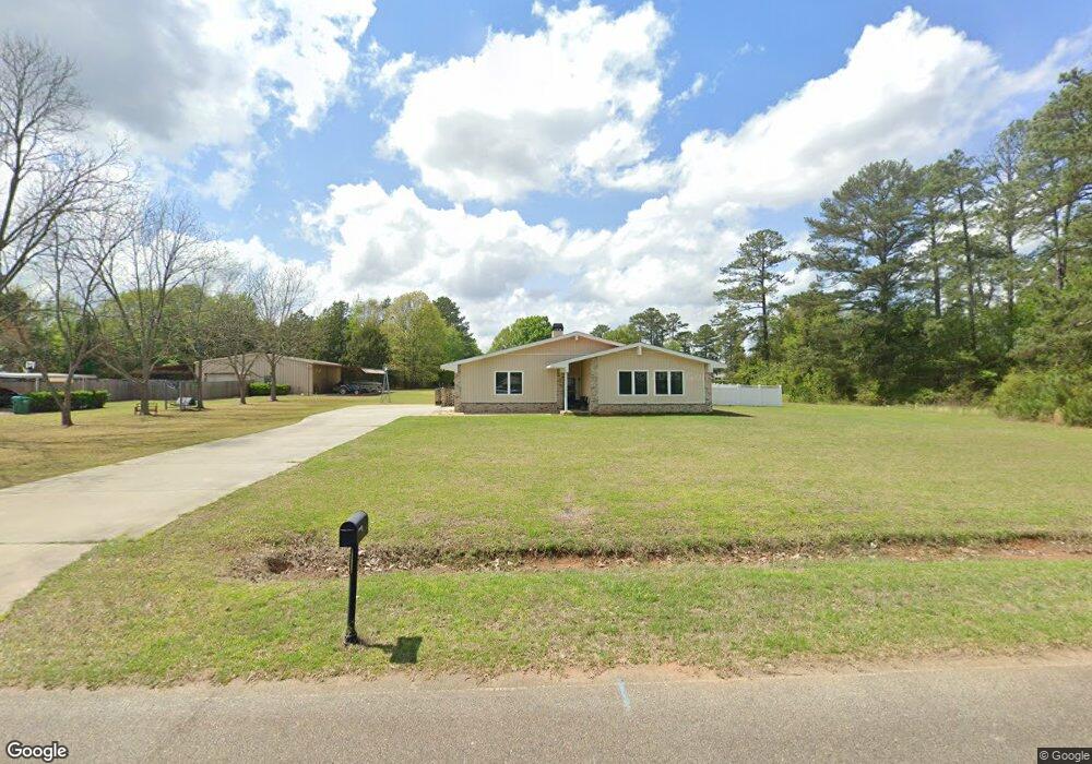
117 Air Park Dr Warner Robins, GA 31088
Estimated Value: $250,000 - $285,000
--
Bed
--
Bath
1,599
Sq Ft
$168/Sq Ft
Est. Value
About This Home
This home is located at 117 Air Park Dr, Warner Robins, GA 31088 and is currently estimated at $269,279, approximately $168 per square foot. 117 Air Park Dr is a home with nearby schools including David A. Perdue Primary School, David A. Perdue Elementary School, and Feagin Mill Middle School.
Ownership History
Date
Name
Owned For
Owner Type
Purchase Details
Closed on
Dec 21, 2015
Sold by
Curington Michael
Bought by
Curington Michael G and Curington Connie J
Current Estimated Value
Home Financials for this Owner
Home Financials are based on the most recent Mortgage that was taken out on this home.
Original Mortgage
$173,250
Outstanding Balance
$138,722
Interest Rate
4.25%
Mortgage Type
New Conventional
Estimated Equity
$130,557
Purchase Details
Closed on
Jul 9, 2015
Sold by
Tischer Carleton B
Bought by
Curington Michael and Curington Connie
Purchase Details
Closed on
Sep 19, 2014
Sold by
Tischer Josephine Estate
Bought by
Tischer Carleton B
Purchase Details
Closed on
Jan 6, 1989
Sold by
Melvin Susan
Bought by
Tischer Carleton B and Josephine J*
Purchase Details
Closed on
Oct 1, 1986
Sold by
Melvin Perry
Bought by
Melvin Susan
Purchase Details
Closed on
Nov 9, 1984
Bought by
Melvin Perry
Create a Home Valuation Report for This Property
The Home Valuation Report is an in-depth analysis detailing your home's value as well as a comparison with similar homes in the area
Home Values in the Area
Average Home Value in this Area
Purchase History
| Date | Buyer | Sale Price | Title Company |
|---|---|---|---|
| Curington Michael G | -- | -- | |
| Curington Michael | $15,000 | -- | |
| Tischer Carleton B | -- | -- | |
| Tischer Carleton B | $10,100 | -- | |
| Melvin Susan | -- | -- | |
| Melvin Perry | $9,000 | -- |
Source: Public Records
Mortgage History
| Date | Status | Borrower | Loan Amount |
|---|---|---|---|
| Open | Curington Michael G | $173,250 |
Source: Public Records
Tax History Compared to Growth
Tax History
| Year | Tax Paid | Tax Assessment Tax Assessment Total Assessment is a certain percentage of the fair market value that is determined by local assessors to be the total taxable value of land and additions on the property. | Land | Improvement |
|---|---|---|---|---|
| 2024 | $2,506 | $104,760 | $7,080 | $97,680 |
| 2023 | $2,195 | $90,800 | $7,080 | $83,720 |
| 2022 | $2,019 | $83,520 | $7,080 | $76,440 |
| 2021 | $1,850 | $76,160 | $6,360 | $69,800 |
| 2020 | $1,659 | $67,960 | $6,360 | $61,600 |
| 2019 | $1,659 | $67,960 | $6,360 | $61,600 |
| 2018 | $1,659 | $67,960 | $6,360 | $61,600 |
| 2017 | $1,660 | $67,960 | $6,360 | $61,600 |
| 2016 | $156 | $6,360 | $6,360 | $0 |
| 2015 | $156 | $6,360 | $6,360 | $0 |
| 2014 | -- | $6,360 | $6,360 | $0 |
| 2013 | -- | $6,360 | $6,360 | $0 |
Source: Public Records
Map
Nearby Homes
- 207 Courthouse Ln
- 110 Mayberry Ln
- 108 Mayberry Ln
- 104 Mayberry Ln
- 102 Mayberry Ln
- 102 Mayberry Ln Unit LOT 1 MB
- 1148 Thornblade Dr
- 404 Minter Dr
- 112 Ballyhara
- 401 Bella Notte Cir Unit 5D
- 401 Bella Notte Cir
- 414 Bella Notte Cir
- 414 Bella Notte Cir Unit 23A
- 416 Bella Notte Cir
- 416 Bella Notte Cir Unit 22A
- 418 Bella Notte Cir Unit 21A
- 409 Bella Notte Cir Unit 1D
- 409 Bella Notte Cir
- 500 Bella Notte Cir Unit 16A
- 500 Bella Notte Cir
- 100 Buchanan Dr
- 115 Air Park Dr
- 102 Buchanan Dr
- 114 Air Park Dr
- 101 Buchanan Dr
- 116 Air Park Dr
- 118 Air Park Dr
- 113 Air Park Dr
- 106 Buchanan Dr
- 103 Buchanan Dr
- 120 Air Park Dr
- 112 Air Park Dr
- 219 Courthouse Ln
- 111 Air Park Dr
- 221 Courthouse Ln
- 217 Courthouse Ln
- 0 Buchanan Dr Unit 8212993
- 215 Courthouse Ln
- 0 Air Park Dr Unit 8084173
- 0 Air Park Dr