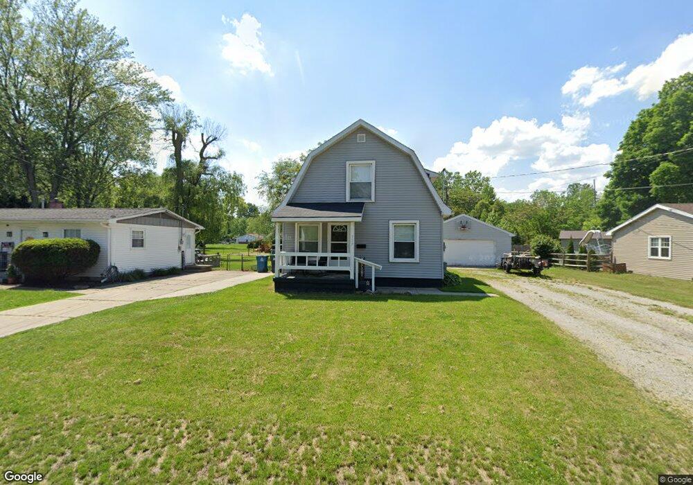
117 Allen Dr Swanton, OH 43558
Estimated Value: $122,502 - $136,000
--
Bed
--
Bath
--
Sq Ft
0.43
Acres
About This Home
This home is located at 117 Allen Dr, Swanton, OH 43558 and is currently estimated at $129,251. 117 Allen Dr is a home located in Fulton County with nearby schools including Swanton High School, Swanton Middle School, and St. Richard School.
Ownership History
Date
Name
Owned For
Owner Type
Purchase Details
Closed on
May 11, 2020
Sold by
Stultz Robert J Trustee
Bought by
Rjs Rough Landscaping Llc
Current Estimated Value
Purchase Details
Closed on
Apr 26, 2006
Sold by
Stultz Jo M and Stultz Robert
Bought by
Stultz Robert J
Purchase Details
Closed on
Feb 14, 2005
Sold by
Deutsche Bank National Trust Co
Bought by
Stultz Robert and Stultz Josie
Purchase Details
Closed on
Nov 10, 2004
Sold by
Wanless Michael L and Wanless Sandra M
Bought by
Deutsche Bank National Trust Co and Long Beach Mortgage Loan Trust 2003-1
Purchase Details
Closed on
Jan 1, 1990
Bought by
Shidler Cecilia L
Create a Home Valuation Report for This Property
The Home Valuation Report is an in-depth analysis detailing your home's value as well as a comparison with similar homes in the area
Home Values in the Area
Average Home Value in this Area
Purchase History
| Date | Buyer | Sale Price | Title Company |
|---|---|---|---|
| Rjs Rough Landscaping Llc | -- | -- | |
| Stultz Robert J | -- | None Available | |
| Stultz Robert | $65,500 | Agg Title | |
| Deutsche Bank National Trust Co | $58,000 | -- | |
| Shidler Cecilia L | -- | -- |
Source: Public Records
Mortgage History
| Date | Status | Borrower | Loan Amount |
|---|---|---|---|
| Closed | Stultz Robert | $0 |
Source: Public Records
Tax History Compared to Growth
Tax History
| Year | Tax Paid | Tax Assessment Tax Assessment Total Assessment is a certain percentage of the fair market value that is determined by local assessors to be the total taxable value of land and additions on the property. | Land | Improvement |
|---|---|---|---|---|
| 2024 | $360 | $8,790 | $1,510 | $7,280 |
| 2023 | $360 | $8,790 | $1,510 | $7,280 |
| 2022 | $300 | $6,650 | $1,260 | $5,390 |
| 2021 | $319 | $6,650 | $1,260 | $5,390 |
| 2020 | $324 | $6,650 | $1,260 | $5,390 |
| 2019 | $282 | $5,640 | $1,260 | $4,380 |
| 2018 | $129 | $5,190 | $810 | $4,380 |
| 2017 | $255 | $5,190 | $810 | $4,380 |
| 2016 | $235 | $4,490 | $810 | $3,680 |
| 2015 | $224 | $4,490 | $810 | $3,680 |
| 2014 | $229 | $4,490 | $810 | $3,680 |
| 2013 | $223 | $4,310 | $700 | $3,610 |
Source: Public Records
Map
Nearby Homes
- 227 Kierra Ln
- 103 Cherry St
- 214 Franklin Ave
- 510 S Main St
- 404 E Garfield Ave
- 407 E Garfield Ave
- 7893 County Road 2
- 433 Church St
- 0 Waterwood Dr
- 204 Hickory St
- 225 Kierra Ln
- 215 Hickory St
- 4303 S Berkey Southern Rd
- 6854 County Road 3
- 13645 Shaffer Rd
- 6042 County Road 1-1
- 1200 County Road F
- 4555 S Fulton Lucas Rd
- 12922 Airport Hwy
- 13560 Old State Line Rd