Estimated Value: $199,624 - $212,000
3
Beds
1
Bath
1,352
Sq Ft
$152/Sq Ft
Est. Value
About This Home
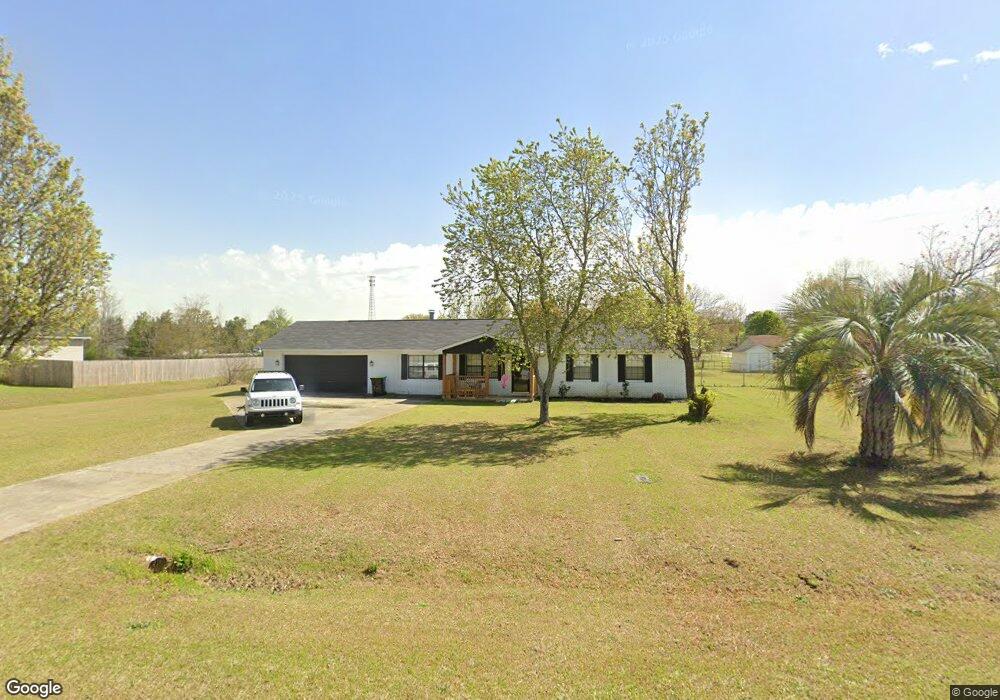
This home is located at 117 Amanda Dr, Byron, GA 31008 and is currently estimated at $205,406, approximately $151 per square foot. 117 Amanda Dr is a home located in Peach County with nearby schools including Kay Road Elementary School, Fort Valley Middle School, and Peach County High School.
Ownership History
Date
Name
Owned For
Owner Type
Purchase Details
Closed on
Jul 15, 2020
Sold by
Carr Jimmie D
Bought by
Pearson Noah A
Current Estimated Value
Home Financials for this Owner
Home Financials are based on the most recent Mortgage that was taken out on this home.
Original Mortgage
$126,262
Outstanding Balance
$111,961
Interest Rate
3.1%
Mortgage Type
New Conventional
Estimated Equity
$93,445
Purchase Details
Closed on
Mar 24, 2004
Sold by
Peters Ricky C and Peters Brenda
Bought by
Carr Jimmie D
Purchase Details
Closed on
Mar 27, 1990
Bought by
Peters Ricky C and Peters Brenda
Purchase Details
Closed on
Jan 30, 1990
Bought by
Dixon J Eddie D/B/A Mid State Homes
Create a Home Valuation Report for This Property
The Home Valuation Report is an in-depth analysis detailing your home's value as well as a comparison with similar homes in the area
Home Values in the Area
Average Home Value in this Area
Purchase History
| Date | Buyer | Sale Price | Title Company |
|---|---|---|---|
| Pearson Noah A | $125,000 | -- | |
| Carr Jimmie D | $91,500 | -- | |
| Peters Ricky C | $45,000 | -- | |
| Dixon J Eddie D/B/A Mid State Homes | $7,500 | -- |
Source: Public Records
Mortgage History
| Date | Status | Borrower | Loan Amount |
|---|---|---|---|
| Open | Pearson Noah A | $126,262 |
Source: Public Records
Tax History Compared to Growth
Tax History
| Year | Tax Paid | Tax Assessment Tax Assessment Total Assessment is a certain percentage of the fair market value that is determined by local assessors to be the total taxable value of land and additions on the property. | Land | Improvement |
|---|---|---|---|---|
| 2024 | $1,900 | $53,240 | $7,040 | $46,200 |
| 2023 | $1,902 | $52,960 | $7,040 | $45,920 |
| 2022 | $1,243 | $46,160 | $7,040 | $39,120 |
| 2021 | $1,274 | $40,800 | $7,040 | $33,760 |
| 2020 | $1,206 | $38,640 | $7,040 | $31,600 |
| 2019 | $1,183 | $37,720 | $7,040 | $30,680 |
| 2018 | $1,190 | $37,720 | $7,040 | $30,680 |
| 2017 | $1,195 | $37,720 | $7,040 | $30,680 |
| 2016 | $1,190 | $37,720 | $7,040 | $30,680 |
| 2015 | $1,192 | $37,720 | $7,040 | $30,680 |
| 2014 | $1,194 | $37,720 | $7,040 | $30,680 |
| 2013 | -- | $37,720 | $7,040 | $30,680 |
Source: Public Records
Map
Nearby Homes
- 167 Erin Ct
- 0 Housers Mill Rd Unit 5515996
- 127 Erin Ct
- 199 Red Tail Cir
- 109 Red Tail Cir
- 107 Red Tail Cir
- 120 Hawks Place
- 152 Hawks Ridge Trace
- 120 Hawks Ridge Trace
- 117 Hawks Ridge Trace
- 127 Hawks Ridge Trace
- 53.91 Acres Anna Marie Circle (Autumn Cove Subdivision)
- 24C Sterling Dr
- 245 Sterling Dr
- 219 Rowland Cir
- 800 John E Sullivan Rd
- 0 Amanda Dr Unit 8797344
- 0 Amanda Dr Unit LOT 3 9026278
- 0 Amanda Dr Unit LOT 2 9026275
- 0 Amanda Dr Unit LOT 1 9026197
- Lot 3 Amanda Dr Unit 3
- Lot 2 Amanda Dr Unit 2
- Lot 1 Amanda Dr Unit 1
- Lot 3 Amanda Dr
- Lot 2 Amanda Dr
- Lot 1 Amanda Dr
- 0 Amanda Dr
- 129 Amanda Dr
- 123 Amanda Dr
- 135 Amanda Dr
- 111 Amanda Dr
- 118 Sarah Dr
- 116 Amanda Dr
- 110 Amanda Dr
- 107 Amanda Dr
- 120 Amanda Dr