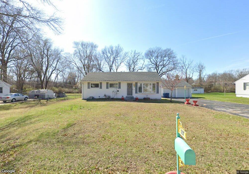
117 Applegate Ln Ballwin, MO 63011
Estimated Value: $274,000 - $302,000
3
Beds
1
Bath
1,216
Sq Ft
$237/Sq Ft
Est. Value
About This Home
This home is located at 117 Applegate Ln, Ballwin, MO 63011 and is currently estimated at $288,243, approximately $237 per square foot. 117 Applegate Ln is a home located in St. Louis County with nearby schools including Westridge Elementary School, Crestview Middle School, and Marquette Sr. High School.
Ownership History
Date
Name
Owned For
Owner Type
Purchase Details
Closed on
Dec 15, 2025
Sold by
Shannon Erik H and Reilly Abigail M
Bought by
Shannon Erik H and Reilly Abigail M
Current Estimated Value
Home Financials for this Owner
Home Financials are based on the most recent Mortgage that was taken out on this home.
Original Mortgage
$241,045
Outstanding Balance
$241,045
Interest Rate
6.22%
Mortgage Type
FHA
Estimated Equity
$47,198
Purchase Details
Closed on
Apr 29, 2024
Sold by
Jpr Properties Llc
Bought by
Shannon Erik H and Reilly Abigail M
Home Financials for this Owner
Home Financials are based on the most recent Mortgage that was taken out on this home.
Original Mortgage
$228,000
Interest Rate
6.74%
Mortgage Type
New Conventional
Purchase Details
Closed on
Mar 17, 2011
Sold by
Hollie Robert and Hollie Donna
Bought by
Jpr Properties Llc
Create a Home Valuation Report for This Property
The Home Valuation Report is an in-depth analysis detailing your home's value as well as a comparison with similar homes in the area
Home Values in the Area
Average Home Value in this Area
Purchase History
| Date | Buyer | Sale Price | Title Company |
|---|---|---|---|
| Shannon Erik H | -- | None Listed On Document | |
| Shannon Erik H | -- | Investors Title Company | |
| Jpr Properties Llc | $130,000 | None Available |
Source: Public Records
Mortgage History
| Date | Status | Borrower | Loan Amount |
|---|---|---|---|
| Open | Shannon Erik H | $241,045 | |
| Previous Owner | Shannon Erik H | $228,000 |
Source: Public Records
Tax History
| Year | Tax Paid | Tax Assessment Tax Assessment Total Assessment is a certain percentage of the fair market value that is determined by local assessors to be the total taxable value of land and additions on the property. | Land | Improvement |
|---|---|---|---|---|
| 2025 | $3,086 | $45,580 | $28,420 | $17,160 |
| 2024 | $3,086 | $43,980 | $20,310 | $23,670 |
| 2023 | $3,084 | $43,980 | $20,310 | $23,670 |
| 2022 | $2,846 | $37,670 | $22,340 | $15,330 |
| 2021 | $2,825 | $37,670 | $22,340 | $15,330 |
| 2020 | $2,622 | $33,310 | $16,970 | $16,340 |
| 2019 | $2,633 | $33,310 | $16,970 | $16,340 |
| 2018 | $2,473 | $29,490 | $13,360 | $16,130 |
| 2017 | $2,415 | $29,490 | $13,360 | $16,130 |
| 2016 | $2,084 | $24,430 | $9,460 | $14,970 |
| 2015 | $2,042 | $24,430 | $9,460 | $14,970 |
| 2014 | $1,840 | $21,430 | $5,050 | $16,380 |
Source: Public Records
Map
Nearby Homes
- 120 Birchwood Dr
- 614 Barton Ln
- 112 Shirley Ln
- 815 Wendevy Ct Unit 16B
- 140 Burtonwood Dr
- 128 Shadalane Walk Unit A
- 832 Wendevy Ct Unit 8B
- 837 Wendevy Ct Unit 11A
- 842 Wendevy Ct
- 845 Wendevy Ct Unit 12B
- 229 Victor Ct
- 816 Crestland Dr
- 107 Falmouth Dr
- 160 Cumberland Park Ct Unit G
- 216 Hillsdale Dr
- 204 Hillsdale Dr
- 260 Monroe Mill Dr
- 330 Sudbury Ln
- 827 Woodruff Dr
- 13 E Meadow Ln
- 119 Applegate Ln
- 115 Applegate Ln
- 121 Applegate Ln
- 113 Applegate Ln
- 118 Applegate Ln
- 120 Applegate Ln
- 116 Applegate Ln
- 123 Applegate Ln
- 111 Applegate Ln
- 122 Applegate Ln
- 114 Applegate Ln
- 124 Applegate Ln
- 112 Applegate Ln
- 125 Applegate Ln
- 114 Ivy Ct
- 116 Ivy Ct
- 109 Applegate Ln
- 118 Ivy Ct
- 120 Ivy Ct
- 112 Ivy Ct
