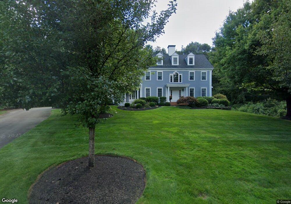
117 Bates Way Hanover, MA 02339
Estimated Value: $1,437,915 - $1,709,000
4
Beds
4
Baths
4,150
Sq Ft
$372/Sq Ft
Est. Value
About This Home
This home is located at 117 Bates Way, Hanover, MA 02339 and is currently estimated at $1,543,979, approximately $372 per square foot. 117 Bates Way is a home located in Plymouth County with nearby schools including Hanover High School and South Shore Charter Public School.
Ownership History
Date
Name
Owned For
Owner Type
Purchase Details
Closed on
Sep 16, 2025
Sold by
Sullivan Kathleen Q
Bought by
Sullivan Richard F and Sullivan Kathleen Q
Current Estimated Value
Purchase Details
Closed on
Dec 20, 2000
Sold by
Stone Meadow Rt and Teuten
Bought by
Sullivan Kathleen Q
Home Financials for this Owner
Home Financials are based on the most recent Mortgage that was taken out on this home.
Original Mortgage
$624,000
Interest Rate
7.71%
Mortgage Type
Purchase Money Mortgage
Create a Home Valuation Report for This Property
The Home Valuation Report is an in-depth analysis detailing your home's value as well as a comparison with similar homes in the area
Home Values in the Area
Average Home Value in this Area
Purchase History
| Date | Buyer | Sale Price | Title Company |
|---|---|---|---|
| Sullivan Richard F | -- | -- | |
| Sullivan Kathleen Q | $195,000 | -- | |
| Sullivan Kathleen Q | $195,000 | -- |
Source: Public Records
Mortgage History
| Date | Status | Borrower | Loan Amount |
|---|---|---|---|
| Previous Owner | Sullivan Kathleen Q | $265,500 | |
| Previous Owner | Sullivan Kathleen Q | $624,000 |
Source: Public Records
Tax History
| Year | Tax Paid | Tax Assessment Tax Assessment Total Assessment is a certain percentage of the fair market value that is determined by local assessors to be the total taxable value of land and additions on the property. | Land | Improvement |
|---|---|---|---|---|
| 2025 | $16,831 | $1,362,800 | $339,900 | $1,022,900 |
| 2024 | $16,212 | $1,262,600 | $339,900 | $922,700 |
| 2023 | $16,622 | $1,232,200 | $308,900 | $923,300 |
| 2022 | $16,842 | $1,104,400 | $271,800 | $832,600 |
| 2021 | $16,849 | $1,031,800 | $247,600 | $784,200 |
| 2020 | $16,618 | $1,018,900 | $270,100 | $748,800 |
| 2019 | $3,477 | $980,800 | $281,400 | $699,400 |
| 2018 | $4,432 | $930,400 | $301,600 | $628,800 |
| 2017 | $14,751 | $892,900 | $276,500 | $616,400 |
| 2016 | $14,388 | $853,400 | $251,200 | $602,200 |
| 2015 | $13,782 | $853,400 | $251,200 | $602,200 |
Source: Public Records
Map
Nearby Homes
- 47 Stone Meadow Ln
- 44 Stone Meadow Ln
- 776 Main St
- 73 Shingle Mill Ln
- 36 Bayberry Ln
- 46 Brookwood Rd
- 535 Webster St
- 506 Main St
- 18 Winterberry Ln
- 53 Chestnut St
- 50 Village Ln
- 62 Larchmont Ln
- 738 Whiting St
- 49 Washington Park Dr
- 823 Market St
- 206-208 Hinghm St
- 436 E Water St
- 5 Blueberry Ct
- 8 Blueberry Ct
- 7 Assinippi Ave Unit 205
- 121 Bates Way
- 114 Bates Way
- 37 Stone Meadow Ln
- 33 Stone Meadow Ln
- 110 Bates Way
- 45 Stone Meadow Ln
- 80 Paul Rd
- 32 Stone Meadow Ln
- 78 Paul Rd
- 36 Stone Meadow Ln
- 29 Stone Meadow Ln
- 42 Stone Meadow Ln
- 51 Stone Meadow Ln
- 76 Paul Rd
- 87 Bates Way
- 131 Setterland Farm Rd
- 24 Rose Hill Rd
- 21 Rose Hill Rd
- 132 Setterland Farm Rd
- 57 Stone Meadow Ln
Your Personal Tour Guide
Ask me questions while you tour the home.